Hiking
I go on a lot of hikes. So it seemed fitting that there would be an entire section of my website dedicated to hiking. The hiking posts have extra data accociated with them designed around tracking my progress through the wilderness. Although that data is displayed on each individual posts, there's still a lot more that can be done with it, so I thought I'd create this place for it.
You can check out my hike list to see all the hikes I have and also hope to acomplish.
Cool Stats:
| Year | Hike Count | Distance (mi)Dist (mi) | Hiking TimeTotal Time | Elevation Gain (ft [mi])Elev. Gain (ft [mi]) |
|---|---|---|---|---|
| 2024 | 9 | 21.38 | 15h 47m 53s | 4,459 [0.84] |
| 2023 | 51 | 273.36 | 166h 24m 26s | 70,071 [13.27] |
| 2022 | 32 | 189.46 | 102h 54m 37s | 42,302 [8.01] |
| 2021 | 46 | 159.26 | 87h 46m 12s | 33,464 [6.34] |
| 2020 | 26 | 151.42 | 70h 08m 14s | 30,463 [5.77] |
| 2019 | 11 | 46.44 | 21h 17m 25s | 10,975 [2.08] |
| 2018 | 11 | 66.59 | 35h 12m 44s | 19,361 [3.67] |
| 2017 | 11 | 54.98 | 32h 21m 00s | 12,582 [2.38] |
| Total | 197 | 962.89 | 531h 52m 31s | 223,677 [42.36] |
Places I Have Hiked
2024
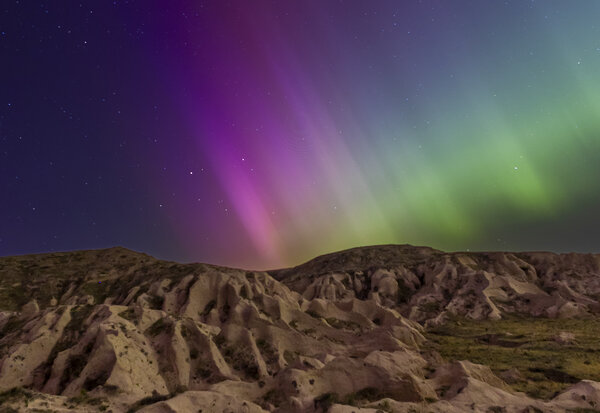
G5 Solar Storm - May 10, 2024
A giant solar storm allowed us to see the Aurora Borealis from Colorado. It was a spectacular event that gave a great showing. The last time a solar storm this powerful happened was in 2003, so I knew I needed to go out to capture it. I had been getting notifications from NOAA all day about how powerful the storm was, and I was hoping that it would hold out through the night for me to peek at such a unique phenomenon that rarely visits Colorado.
At 9:30, I drove an hour and a half to the Pawnee Grasslands to hike a little bit of the Pawnee Buttes trail. When I got to the trailhead around 11 pm I was not the only one who had that same idea. There were several dozen cars along the road car camping and spectating as well as a nearly full parking lot with an additional 20+ cars.
I figured if there were this many cars up here that the showing was good, but before I left the warmth of my car I took a shot from inside using my steering wheel as a tripod. That first photo showed me a beautiful green sky with the silhouette bathroom outlined in the foreground. With just one photo I went from being skeptical of if this long drive would be worth it to being ecstatic and needing to get out there to start taking photos with something a little better in the foreground.
I got out there right as the moon was setting. The moon was just a sliver in the sky about 12% full. With the moon on the horizon, it was a gorgeous addition to the framing. But by the time I got my camera set up, I only got about 5 photos before the moon was gone. All 5 of those photos had the moon overexposed and weren't good enough to share. But I wish I had paid attention to the moon when deciding when to head out for shooting.
The area was busy but not packed. The Pawnee Buttes trail has lots of open space where people could spread out. There were spectators in lawn chairs simply watching, camera-phone photographers with silly phone tripods, amateur photographers (like myself), and serious photographers. Surprisingly, I didn't have to go far to be alone. Where the bulk of the people were was an area with a terrible foreground. The foreground from the meadow by the trailhead was only a few bumps on the horizon from the bluffs in the distance but nothing special or interesting. I knew from previous experiences here (in the daytime) that it was a short half-mile hike to the canyon where the Bluffs were in the direction of the Aurora. I was shocked that no one was in the canyon with me photographing (at least that I know of), but I won't complain about having that area to myself.
I was out shooting for about 2 hours including the hiking and didn't get home until nearly 3 am. The show was the best right before midnight when you could see the solar radiation rippling across the sky. That radiation line was a bright line spanning the entire horizon from East to West that would quickly shoot across the sky starting from the Northern horizon and ending straight up. These ripples lasted about 15 minutes before calming down. I've never seen anything like it.
Read More
| Location: | Pawnee Grasslands |
| Distance: | 1.84mi |
| Hiking Time: | 2 hours, 3 minutes |
| Elevation Gain: | 154ft |
| Max Elevation: | 5,281ft |
View Hiking Stats

Astrophotography at Valley View - May 5, 2024
We skipped going to Valley View for New Year's, and it's a good thing we did since that was only a few weeks after Katie broke her ankle. Instead, we made plans to go in early May when the weather would be a little better and we could go over a weekend when the Eta Aquariids meteor shower was peaking with little to no moon. Along with the meteor shower I planned to do some astrophotography. Of the two nights we were there, only one of them looked good from a cloud coverage standpoint, so at midnight on the night we arrived I woke up and hiked 2 miles to the bat cave. There were other places I could have done astrophotography, but that was the easiest place that I could get up high.
During the day between soaking in the hot springs I went on a nature walk. I explored a new trail and saw some incredible wildlife, everything from squirrels, snakes, insects, and birds.
The evening was mostly cloudy but that didn't stop me from trying to do some more astrophotography. I found an old firetruck that I wanted to make my primary subject and tried to light up with an external light source to make the photos more interesting. The light ended up being too harsh, no matter how quickly I tried to light it up, and the stars in the background weren't that great with the cloud coverage. With rain forecasted all night after midnight, I called it an evening at 10 am and woke up at midnight to a completely overcast sky. I didn't bother setting another alarm to wake up in the morning before sunrise to try again. I woke up in the morning to perfectly clear blue skies and was disappointed I didn't set an alarm in the 3 am hour.
Read More
| Location: | Valley View Hot Springs |
| Distance: | 6.36mi |
| Hiking Time: | 5 hours, 22 minutes |
| Elevation Gain: | 1,296ft |
| Max Elevation: | 9,383ft |
View Hiking Stats

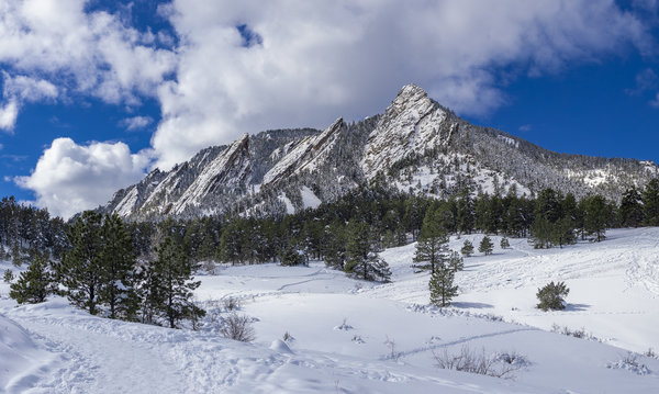
Chautauqua Again - Apr 28, 2024
There's a month left before you have to pay to park in the Chautauqua area, so we decided to go up to Chautauqua again even though we had hiked here a little over a month ago. Even though we were here recently, it was completely different due to the ground conditions. When we were here in March, it was right after a snowstorm, and even though Boulder did get some snow yesterday, it was mostly green with a few speckles of snow on the trees.
We went a little further than we had the last time we were here by doing the loop to the second and third Flatiron. It was a little longer but about the same amount of elevation gain.
Things are starting to bloom. Wildflower season has just barely started at the lower elevations! Although we saw some wildflowers, none of them were photogenic due to the moisture that Boulder got over the past 24 hours. But it still makes me excited for wildflower season.
Read More
| Location: | Boulder |
| Distance: | 2.19mi |
| Hiking Time: | 1 hour, 23 minutes |
| Elevation Gain: | 709ft |
| Max Elevation: | 6,386ft |
View Hiking Stats
Quiet Hike to Zimmerman - Apr 14, 2024
It was a warm weekend in the city, so we wanted to go up high to find cooler temperatures. We got up early to hike on frozen-over snow before the afternoon warmth made it slushy and dangerous. We started early because the early spring warmth created conditions for loose wet and wet slab avalanches because of the afternoon heat combined with a weak overnight freeze. We also picked this hike because it is West-facing which meant keeping the warm sun off of the trail keeping it frozen longer into the morning. After a 2-hour drive, we got to the trailhead a little after 8 am and the temperatures were below freezing. Despite the freezing temperatures, the weather was great with no wind and manageable cold. When we were hiking back, the warmth made a noticeable impact on us sinking in with every step but it was still okay. When we finished the hike around 10 am, the temperature was reading in the mid-50s.
I'm not sure if it was the avalanche conditions or because we started our hike early, but we were completely alone for our hike. We saw 2 groups of people in the parking lot about to start their hike when we were finishing up, but the trail was ours for the entirety of our hike. This was shocking since Zimmerman Lake trailhead is a popular snowshoeing and skiing trail along the Poudre that usually has several dozen cars parked at it each weekend. But I won't complain about being alone since that's part of the reason we go hiking. This is now the 3rd hike we've done that we've had to ourselves.
Katie's ankle did a little better on this hike compared to the hike we did in Rocky a few weeks ago. I think this might be the last snowy hike we do until the next season since the softness of snow is harder on Katie's ankle than solid ground.
Read More
| Location: | Camerons Pass |
| Distance: | 2.81mi |
| Hiking Time: | 1 hour, 38 minutes |
| Elevation Gain: | 528ft |
| Max Elevation: | 10,580ft |
View Hiking Stats
Emerald Lake - Mar 31, 2024
We finally got a sense of normalcy by going on a real hike since Katie's accident. The past couple of hikes haven't been "hikes" because they didn't have much distance or elevation gain and felt more like long walks. But this weekend we went up to the Bear Lake corridor and hiked to Emerald Lake (stopping at Nymph and Dream along the way). The views were gorgeous and it was a refreshing hike. The trail conditions were great with only needing microspikes. The last time we hiked this in 2021, the wind was so strong that snowshoes were necessary to cross Dream Lake, but luckily for us that wasn't required this time. We still brought our snowshoes but left them in the car after talking to one of the rangers at the trailhead about the trail conditions.
The weather was spectacular, and the weather forecast kept people away. We couldn't see the mountains when we woke up, there was a thick cloud between us and the mountains. But Rocky itself wasn't bad. When we got to the parking lot just before 9 am, it was lightly snowing with it forecasted to clear up shortly and be sunny for a few hours before starting to snow again mid-afternoon. That mid-afternoon forecast must have kept the people away because the trail wasn't packed as normally. Instead, it was busy, but a manageable amount. With the temperatures in the upper 30s and little wind, it was a gorgeous day for hiking.
At the trailhead once we finished the hike there was an avalanche information truck from the Friends of the Colorado Avalanche Information Center. We stopped in to see what it was about. We got to ask a few avalanche questions about types of shovels and probes, as well as some things for snowshoers to specifically look out for since a lot of avalanche information is geared towards skiers (and we don't ski). I don't think we'll be in avalanche danger zones anytime this season as Katie heals up, but maybe next season.
Read More
| Location: | Rocky Mountain National Park |
| Distance: | 3.27mi |
| Hiking Time: | 2 hours, 3 minutes |
| Elevation Gain: | 843ft |
| Max Elevation: | 10,180ft |
View Hiking Stats
Well Gulch in Lory State Park - Mar 23, 2024
It was a warm Spring weekend, so we hit the trails. Building off the difficulty (or lack thereof) we had done last weekend, we chose something with a little more distance to see how Katie would do.
Our hike was in Lory State Park where we did the Well Gulch short loop. We were hoping to find some early wildflowers, mainly the Pasque flowers that tend to bloom first. Wildflowers start blooming at lower elevations first (since it's warmer at lower elevations earlier). We didn't have any luck with finding flowers, but there was some other greenery starting to pop up. We also chose this area because we didn't want to drive far to do a short hike and we had some stuff to do in Fort Collins afterward. Driving far is only worth it for full-day hikes (which we won't be doing anytime soon).
We forgot our poles and spikes, but we didn't need the latter. Katie could have benefited from poles, but even without them, she did great with stability in her bad ankle. After the hike, we did some errands in Fort Collins now that we're no longer residents of that city. Based on the significantly fewer amenities we have in our new town, we'll likely be in the Fort Collins area frequently.
Read More
| Location: | Lory State Park |
| Distance: | 2.34mi |
| Hiking Time: | 1 hour, 12 minutes |
| Elevation Gain: | 443ft |
| Max Elevation: | 5,829ft |
View Hiking Stats
Hiking Around Chautauqua - Mar 16, 2024
Between Katie recovering from a broken ankle and moving into a new house, we haven't had time to hit the mountains until this weekend. There's still plenty of stuff we need to do around the house, but for the most part, everything is unpacked. Katie's recovery is going well, and although the doctor told her she wouldn't be hiking until Spring, we squeezed in something that resembles a hike this weekend in Boulder. We weren't quite sure how far we could go and how much Katie could push it without having significant soreness the next day, so we were conservative and just did a short loop. We probably could have done a little more, but it was good to go easy on Katie.
It was a beautiful sunny day in Boulder after a snowstorm that left Boulder with a foot of snow. Since we were hiking in Chautauqua, we knew the trail would be packed down, so we didn't bring our snowshoes, just microspikes. The trail was a little slushy but the microspikes were appropriate. We probably could have used full spikes but neither of us have those and microspikes did just fine for keeping us from slipping too much. As always in this area, there were many people but we were just excited to be out in nature again.
Read More
| Location: | Boulder |
| Distance: | 1.66mi |
| Hiking Time: | 59 minutes |
| Elevation Gain: | 466ft |
| Max Elevation: | 6,156ft |
View Hiking Stats

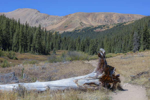
Picnic at Sprague Lake - Feb 11, 2024
It's been 8 weeks since Katie broke her leg while indoor rock climbing on a bouldering wall. That injury in combination with packing to get ready to move into a new house has been the two things keeping me from hiking without her or going on some other photo adventure. Today's "hike" was just a walk around a lake and a picnic, nothing truly spectacular, but we haven't been up to Rocky in a while and wanted to attempt to get back to our normal weekends filled with outdoor adventures. It didn't give us the same sense of enjoyment that a normal hike would have, but we figured that going into it which is why our main objective was to have lunch on the lake.
Being out in nature is just one part of the hiking experience, the other part is being in an area that isn't so easily accessible. Considering slight unevenness in the ground affected her stability, I don't think we'll be doing anything inaccessible for a while, but this hike strengthened those balancing muscles a little so that next time it should be easier. We knew it wouldn't be like other hikes and getting back into hiking post-injury has to start somewhere. We took it slow, had lunch on a bench in the middle of the walk, and enjoyed the cold mountain air.
Katie bought me a new lens for Christmas, the Canon RF 35mm f/1.8. Since I've been busy with packing I haven't used it yet, so this was the perfect thing to try it out on. I've needed a middle-of-the-road lens for a while now since my hiking lenses are a 16mm (way too wide) and a 50mm (too zoomed in for landscapes). The 35mm is perfect and this hike was a great test of it. The 35mm will also double as a macro lens which has a 1/2 reproduction size at minimum focusing distance (which is incredibly short). Although this isn't the right season for macro photography, I found a few things on the trail to give the macro a try and it worked fantastic. I can't wait for wildflower season to really get the most out of this lens.
Read More
| Location: | Rocky Mountain National Park |
| Distance: | 0.91mi |
| Hiking Time: | 1 hour, 3 minutes |
| Elevation Gain: | 20ft |
| Max Elevation: | 8,695ft |
View Hiking Stats
2023
Berthoud Pass Trail - Dec 17, 2023
We ventured into the I-70 Corridor for a hike on the Berthoud Pass Trail. Since it's not quite skiing season but also not summer by any means, we figured the I-70 traffic would be manageable. Luckily, we were correct in that assumption, although I'm sure the traffic will worsen with each weekend after the New Year. Since our hike was right along the route to Winter Park Ski Resort, we were happy to not be stuck in traffic which is a common issue with hiking in this area. But as we venture further South for hikes, we'll have to deal with the traffic.
The traffic was better than it could have been because we got an early start to make sure we were driving home on I-70 in the early afternoon. We got to the trailhead around 9 am and were finished by noon. The hike included having an early 11 am lunch after reaching the summit (once we hiked down a little ways where it was less windy).
The weather was mostly cooperative for us. It was sunny and in the mid 30's. We did end up above the treeline which meant lots of wind. If it wasn't so windy, we would have gone further along the Berthoud Pass Trail, but since the hike plateaued out we decided to turn around once we got the best views. The views were gorgeous and panoramic, especially since we got so high up.
This hike was quite steep, with over 1,500 feet in elevation gain in less than 2 miles. It left us quite tired, especially with being windblown. With how difficult it was, it took us about 3 hours which is slow compared to our average pace of about 2 miles per hour. But we haven't been out hiking in a little bit so we need to get ourselves back into shape to do some harder snowshoe trails.
Read More
| Location: | I-70 Corridor |
| Distance: | 3.68mi |
| Hiking Time: | 2 hours, 55 minutes |
| Elevation Gain: | 1,506ft |
| Max Elevation: | 12,453ft |
View Hiking Stats
Trap Park - Nov 26, 2023
It's been a few weeks since we have gotten to go out and enjoy nature. It's that awkward time of year when it's cold and snowy, but not so snowy that you know for certain if you need snowshoes yet. The day started by driving up the Poudre Canyon and turning before Cameron's Pass onto Long Draw Road. Long Draw Road is seasonally closed during the winter months, so we weren't even sure if it was open. We found out from a sign posted on the gate that it would be closed on December 1st, which meant this was our last opportunity to do this hike for the year. Long Draw Road was a snow-covered dirt road that was a little sketchy, but we only needed to drive 3 miles on it to get to the trailhead.
We started hiking around 11 am with the temperature just below freezing, but with sunny blue skies and practically no wind, the low temperatures weren't a problem at all. It was great. However, by the end of the hike, the temperature was cut in half with the wind blowing and the sun below the nearby peaks. The last couple miles of the hike were quite chilly. But we had our layers so we were uncomfortable but OK with that issue. The main problem we encountered was due to us not bringing our snowshoes since the snow on the ground at the parking lot was only a few inches. For the first mile of the hike, we were correct in our assumption that we didn't need snowshoes, but once we made it to the Northernmost tip of Trap Park there were deeper snowdrifts where snowshoes would have been beneficial. But we were too far from the car at that point so we continued hiking through the fluffy snow that was incredibly hard to hike through. Even though the hike is barely considered moderate for us based on the statistics, the extra effort that each step took trekking through the snow made this hike killer. The best approximation I can make is that each step on this hike took the effort of two steps on a summer hike just based on the resistance of the snow and having to lift our feet higher. So this 6.6 miles and sub-1,000ft elevation gain hike had us feeling similar to a hike that is 10+ miles and 2,000ft elevation gain.
The end of the hike was pretty disappointing because there were no good views at the end of Trap Park. Trap Park itself is a 2-mile long meadow between two mountains that are closed off on the South end where the end of the hike was. Usually when mountains create a bowl it makes for great photos, but the lack of a lake to keep trees out of the immediate foreground meant that the end view wasn't good at all. The best views were between miles 1 and 3 while walking along the Western side of Trap Park. But regardless of the end view, the Trap Park area is gorgeous. I bet in the summer time the area is filled with moose (and other wildlife), wildflowers, and gorgeous sunrises and sunsets. Since it was winter, we got none of these things, except for almost getting a sunset. This would be a fantastic place to do a short backpacking trip.
This hike featured amazing views of Thunder Mountain and Flattop Mountain. Not the same Flattop that we hiked earlier in November, but a different one with a similarly flat top, hence the name... We also got an amazing view of Cameron's Peak and Clark Peak with a few of the Rawaha Mountains in the distance. The mountains looked incredibly stunning with fresh snow on them especially when the sun was getting low on the horizon making them glow. Despite this hike having its technical challenges and terrible views at the end of the trail, this was the best view on the hike. We were treated to an even more spectacular view of those same mountains as we were driving back down Long Draw Road after the hike.
Other than the great views during the hike, one fantastic thing about this hike was that we didn't see a single other person on the trail. This has only happened one other time for us, when we did Trianlge Mountain in 2022. This designation is special to us since one of the reasons that we go out into nature is to get away from other people. I'm surprised with how many remote hikes we've done that we haven't had more people-less hikes, but we've come close a few times this year. Hopefully next year we can get at least another secluded hike all to ourselves.
As of this hike, we've hiked 50 trails this year. Two more and we will be at an average of one hike per week. This is pretty impressive since we often can't get out every weekend. Other than living our typical busy lives that tie us up on some weekends, the weather is also often uncooperative for us in the middle of winter. Getting to 52 hikes in one year is an accomplishment that I've wanted to do for a while, but I have never wanted to push myself for it because I don't particularly appreciate making goals that you can easily get behind which can often make one stop caring about completing the goal altogether. But it would be cool to squeeze in two more hikes this year (which I think we should be able to manage).
Read More
| Location: | Camerons Pass |
| Distance: | 6.51mi |
| Hiking Time: | 4 hours, 53 minutes |
| Elevation Gain: | 902ft |
| Max Elevation: | 10,586ft |
View Hiking Stats
Almost to Flattop Mountain - Nov 5, 2023
We didn't get to hike last weekend because of our first snowstorm in the mountains of the year. So this weekend we knew we wanted to get out and hike something. Since Rocky Mountain National Park isn't requiring timed entry permits anymore, that's where we headed. They haven't required timed entry permits for several weeks now, but we also wanted to wait until November to make the most out of buying a new annual pass into the park since ours expired at the end of September. The pass we bought is good through the end of November of 2024, so by buying at the beginning of the month we essentially get 13 months of use out of it.
When deciding what time to get to the trailhead we were trying to balance out making sure Katie got enough sleep and the parking lot not being packed. So I set my alarm for 6:45 but we did not realize that with daylight savings we would end up sleeping in an hour later than we needed to in order to get a good night's rest before our hike. But that was fine since the parking lot was barely half-full by the time we arrived around 9:30. I was surprised the parking lot wasn't full, but the weather was forecasted to be very windy, so maybe that deterred a few people from coming into the park today.
Despite the forecast for wind, we chose a hike that would put us above the treeline by summiting Flattop Mountain. I'm not sure why we thought it would be a good idea to be above the treeline on a windy day, but we have been wanting to do this hike now for quite a while, and we're now only strong enough to be able to do this hike and this seemed like a good opportunity. Once we got above the treeline after about 2 miles of hiking, it was pure wind on our faces as we struggled to get to a small overlook of Tyndall Glacier and Hallet Peak. The wind was so forceful as we hiked into it that it took extra energy to power up the mountain. After eating lunch in a small naturally created rock shelter, we decided we didn't care to summit Flattop Mountain. Given its name, we knew we wouldn't get better views and the true summit is up for debate since the whole area was flat (ish). We were about 1/4-mile from the true summit, but that's good enough for us.
The wind posed a dangerous threat to us, but we were mostly prepared. We didn't have any hand warmers because it's been too early in the season to consider those. But otherwise, we were adequately prepared with several layers, hats, and gloves. Before starting the hike we were thinking of possibly continuing on to Hallet Peak, which would be a really cool peak to summit. It is the tallest mountain in the local area and would provide excellent views of more lakes. Even without summiting to the top of Hallet Peak (or even Flattop Mountain truly), we saw 8 different lakes on the hike: Bear Lake, Bierstadt Lake, Spraug Lake, Mills Lake, Jewel Lake, Dream Lake, Emerald Lake, and Estes Lake. Another lake in the distance to the East might have been either Lake Loveland or Boyd Lake. But either way, it was an astonishingly great hike for seeing all the lakes in the area. Getting to Hallet Peak would have gotten us at least 1 more view of Lake Haiyaha, and possibly a view of Nymph Lake. We'll save summiting Hallet Peak for a different day with nicer weather.
Read More
| Location: | Rocky Mountain National Park |
| Distance: | 8.33mi |
| Hiking Time: | 5 hours, 4 minutes |
| Elevation Gain: | 3,278ft |
| Max Elevation: | 12,412ft |
View Hiking Stats
Mirror Lake - Oct 21, 2023
Our hike this weekend was to Mirror Lake. The trailhead was accessible via Long Draw Road near Cameron's Pass. Long Draw Road will likely close in the next month due to snow, so since it was still open we wanted to get this one checked off our list before it was too late.
This was a tough hike. It's the most distance than we've ever done before, and we chose it (maybe stupidly) based on the distance. The reason distance was important to us is because we are running out of time to complete our New Year's Resolution. There might be plenty of time left in the year, but it won't be long before the trails are covered in snow and ice making a hike with this much distance even harder.
This hike started off by skirting the 2020 Cameron's Peak burn area. After about a mile, we were completely surrounded by the bur area and continued to hike in the burn area for 4 more miles until we were in an unburned forest for the last mile up to the lake. Hiking in a burn area isn't that great and doesn't really give either of us a positive hiking experience. The views at the lake were terrific, and Mirror Lake truly did live up to its name of being a mirror. But with how far we hiked, the view wasn't worth that much distance. There are shorter hikes with nicer lake views than Mirror Lake. But at least it wasn't a disappointment like some other lakes that we've hiked to.
One really nice thing about this hike was that we were alone for almost all of the hike. We were hoping that this would be a people-less hike, but we saw one other couple also hiking to the lake right before we got to the lake, which meant that we were sharing the lake with them. I don't mind sharing the lake with other people, but we were really hoping for solitude based on how remote of an area this was.
This hike to Mirror Lake beat our previous record for distance by 19%. And as such, we can now say that our 2023 New Year's Resolution is complete! Our New Year's Resolution was to beat our all-time records for mileage, elevation gain, and time hiking by 15%. Prior to this hike, we had already broken our all-time-record for elevation gain and time hiking on our hike to Spectacle Lakes just a month prior. With all 3 of our records broken by 15% or more, our New Year's Resolution is complete.
| Previous Record | 2023 Goal | New Record | |
| Mileage | 11.18 Miles | 12.86 Miles | 13.28 miles |
| Elevation Gain | 2,589 ft | 2,977 ft | 3,458 ft |
| Time Hiking | 5hr, 47min, 42sec | 6hr, 39min, 51sec | 7hr, 37min, 9sec |
Read More
| Location: | Camerons Pass |
| Distance: | 13.28mi |
| Hiking Time: | 6 hours, 20 minutes |
| Elevation Gain: | 2,411ft |
| Max Elevation: | 11,091ft |
View Hiking Stats
Lions Head and Bear Mountain - Oct 8, 2023
With the wedding over, Katie was now free to go hiking with me in Connecticut. We only had one full day left after the wedding before flying back, so this was our last chance. The hike chosen was Lions Head and Bear Mountain. We had this hike planned out before we left for the trip, as opposed to the last two hikes where I figured out where I was going the night before. Since we knew we would have this day to ourselves it was much easier to plan it out in advance.
In the morning we packed up our things and left for the very top corner of Connecticut where New York and Massachusetts border it. This hike has the highest point in all of Connecticut, with an altitude of 2354 Feet high. It's silly to think that our house is at double that elevation, but it was cool to get to the high point in the area to be able to have a great panoramic view. However, since we were bordering two other states, it wasn't the high point in the area. Looking over towards Massachusetts had a mountain that looked just slightly taller than the one we were on. Oh well...
The views were great but not really that impressive since none of the foliage has begun to change here. Although the lighting was better in some ways than the past two days since there was actually sunshine, there were lots of clouds which made for patchy lighting that wasn't ideal. I think I prefer the sun with patchy skies over hiking in the rain, but it made it difficult to capture what we were seeing with our eyes.
It was a good hike with more distance than I did on my other hikes. However, having been up until 1 am from the wedding the night before and having danced a lot, both of us were very exhausted on this hike. I might have liked this hike more if we were both a little less tired, but this was Katie's only day and our only day completely together to go do something fun. So even if the hike wasn't that great and even if we were both completely dead, we still had a good time out exploring a new state with each other.
Read More
| Location: | Connecticut |
| Distance: | 8.59mi |
| Hiking Time: | 4 hours, 7 minutes |
| Elevation Gain: | 1,805ft |
| Max Elevation: | 2,377ft |
View Hiking Stats
Peoples State Forest - Oct 7, 2023
Today was the day of the wedding that we came out to Connecticut for. Since Katie was one of the bridesmaids, she was busy all morning and I was only expected to show up for the ceremony starting at 5. So in the morning, Katie and I went and had breakfast and then I dropped her off at the hotel to get ready with all the other ladies for the wedding while I adventured off to go hike.
I chose Peoples State Forest because it was about the same drive time as the hike yesterday, but it was a little further North. My thought process was that the further North I go the better chance there would be of fall colors, but this whole area is way too early for fall colors. We would need to go a few states North to see anything good right now, but I had low expectations for colors anyway after yesterday's hike.
There was a high probability of rain during this hike. Despite this, I decided to continue going on the hike because I had nothing else to do. I came prepared with my rain jacket, but I wasn't prepared for the amount of rain that came during the hike. The rain was peaceful listening to it hit all of the leaves as it fell and splashed in newly forming puddles. With the amount of rain I got on my hike, I ended up getting soaked completely through my jacket, shorts, pants, and boots. But it wasn't too cold, so other than the uncomfortableness of being wet, the rain wasn't a problem.
When it rains while I'm doing photography I expect to get some water on my lens, which isn't an issue because I can usually find something dry to wipe it off with. But since everything was soaked, I ran into a new issue of how to get the water off my lens. I eventually found a napkin in my bag that was only half-soaked that worked for a little while, but I had to embrace the fact that there was no way to clean my lens.
The wedding was wonderful at the zoo in Stratford. The ceremony was inside the greenhouse which had a hawk as the ring bearer was a uniquely different wedding experience. The reception was in the carousel room afterwards which was a nice place for a venue. I haven't ridden on a carousel since I was quite a bit younger, so it was fun to get to be on one again as an adult.
Read More
| Location: | Connecticut |
| Distance: | 4.97mi |
| Hiking Time: | 2 hours, 18 minutes |
| Elevation Gain: | 1,887ft |
| Max Elevation: | 1,271ft |
View Hiking Stats
Cobble Mountain - Oct 6, 2023
Katie and I had a wedding to go to in Connecticut to go to. It is one of Katie's friends that she is decently close to, and as such, she was part of the bridal party. When we booked the trip, we thought she would only have 1 day of bridesmaid duties plus the rehearsal dinner that we would both attend on top of the wedding itself. We planned a 4-day trip thinking we would get to hike together at least 2 of those days, but as the time grew closer and her bridesmaid duties grew, I was left on my own on the first day to hike by myself.
I decided to drive as far North as I was willing to in order to have the best chance of seeing some fall colors. I knew that all of Connecticut would be a little early for fall colors this time of year, but we didn't set the date of the trip, the people getting married did. I chose a hike in Macedonia State Park somewhat arbitrarily. The two north corners of the state tend to change colors first, so I chose to go on the northwest side of the state since I was already on the West-half of the state where our hotel was. With Macedonia State Park only an hour and a half away, that's where I went. On the way there, I stopped at a deli to get a sandwich for lunch and made it to the park right around noon. The hike I chose was based on getting to the top of something so that I could see rolling hills of colorful trees. Cobble Mountain fit all my criteria including not being a very long or challenging hike. The hike was super foggy and the colors were just starting to change, so the summit wasn't that great.
I haven't hiked on the East Coast since our 2021 fall colors trip and have forgotten how it is hiking around here. It was very humid here. Because of the moisture, there were lots of mushrooms which was a cool sighting for me since I don't see many in Colorado. I also saw a salamander right at the start of the hike which was super cute and cool. The hiking experience was great since I don't hike in this type of forest very often. Everything was so uniquely different, yet familiar at the same time.
Read More
| Location: | Connecticut |
| Distance: | 4.69mi |
| Hiking Time: | 2 hours, 36 minutes |
| Elevation Gain: | 1,486ft |
| Max Elevation: | 1,819ft |
View Hiking Stats

Fall Colors in Colorado - Oct 1, 2023
We don't have a lot of time this year to see the fall colors in Colorado. Next weekend will be good for Colorado fall colors, but we'll be out of town, so we knew we needed to get out today to try and see the colors before they're gone. The best area to go would have been up the I-70 corridor, but that's where all the other leaf peepers are and the popular areas are always so crowded to the point where it's not as fun. Instead, we went to Red Feather where we ended up being just a little late for fall colors. It's hard to get accurate reports of colors in Colorado in the more remote areas, but even though we missed peak colors in this area we still managed to find a few great spots.
We picked an easy hike this week and one that we've done before. We hiked on Molly Moon and Granite Ridge trails to make the same loop that we made in 2021. We knew the hike wasn't anything spectacular from a hiking adventure standpoint, but we knew there were aspens in the area which is the main tree we were hunting for in order to see the fall colors.
Read More
| Location: | Red Feather Lakes |
| Distance: | 6.23mi |
| Hiking Time: | 2 hours, 28 minutes |
| Elevation Gain: | 745ft |
| Max Elevation: | 8,547ft |
View Hiking Stats
Herman Gulch - Sep 24, 2023
We wanted to do a little bit of a longer hike this weekend, but those plans were thrown out when Saturday was a windy day in the mountains. It was so windy that it wouldn't have been nice to hike in. So instead, we decided to hike on Sunday. Katie was meeting with someone for coffee in the morning, so we didn't get started until a little later. After a 2-hour drive, we reached the trailhead at noon where we started our hike up Herman Gulch.
This hike was in the I-70 corridor, an area we haven't hiked much in. It's not any further than the hikes we normally go on, but there's a lot more traffic driving on I-70 compared to the hikes we do in Rocky or up the Poudre Canyon. But with nothing that seemed interesting to us in our normal areas, we decided to brave the traffic and head to a hike that started literally right off I-70. The accessibility of this hike made us skeptical that we would enjoy it or that there would be no parking spots, but neither of those things ruined the hike for us. It was a busy trail, but people were spread out enough that it didn't bother us.
Having gotten a later start, we didn't eat lunch until we made it to the lake. We snacked plenty in the car on the way up, but not hiking with food in our stomachs was a little challenging. This hike was difficult enough on its own, let alone hiking it on empty-ish stomachs. We made it to the lake in under 2 hours, took a few photos, ate our lunch, then headed back down. The hike was less than 4 hours which is impressive for us since a hike of this level we were expecting to take over 4.
The weather was perfect on Sunday for hiking. It was a cool mid 60's with a slight breeze. It was a little chilly at the lake, but we brought some light jackets that were fine for relaxing at the lake. It would have been nice to have done something a little more challenging on Saturday, but the weather was so much better today that our hike today was the right choice.
Read More
| Location: | Silver Plume |
| Distance: | 7.06mi |
| Hiking Time: | 3 hours, 43 minutes |
| Elevation Gain: | 1,713ft |
| Max Elevation: | 11,912ft |
View Hiking Stats
Scramble to Spectacle Lakes - Sep 16, 2023
After recovering from our hiking vacation in Iceland where we hiked 62 miles, we finally made it back out to the mountains. Our mountains. We decided we wanted to get into Rocky because we only have about a month between when the tourists aren't taking over the park and when the roads are still all open. We've been wanting to hike in the Mummy Range for a while, which required parking along Old Fall River Road. This road is closing for the season to vehicles starting in a little under a month, so we don't have much time left in the season to do the handful of hikes in this area.
The hike wasn't that bad up to Ypsilon Lake. We first encountered Chipmunk Lake which we thought at first was Ypsilon Lake. But Chipmunk Lake was way too small to be anything major. However, we did like that Chipmunk Lake was very still and offered fantastic reflective views of Ypsilon Mountain. We continued to Ypsilon Lake which wasn't too much further. Ypsilon was a very nice lake, but you couldn't actually see all of Ypsilon Mountain from the lake. The view of Ypsilon Mountain was blocked by large boulders and trees. After stopping to take a few photos, we continued on the primitive trail to Spectacle Lakes. It was at this point that the hike went from moderate to very difficult.
The distance between Ypsilon and Spectacle Lakes isn't that far. They're right next to each other but on completely different elevation lines, meaning that Spectacle Lakes were straight up 500 feet in elevation gain from Ypsilon Lake. We encountered a few boulder fields that didn't seem too bad to start, and then we came to the crux of the hike. We were faced with climbing a slab wall or scrambling up the cascades coming from Spectacle Lakes. We started by climbing the slab which was quite dangerous. This quickly turned into a class 5 rock climb. I made it maybe 40-50 feet up the slab before turning around. The slab wasn't that steep, but it was slick with very few places to hold or get a good grip with my boots.
After attempting the slab climb, Katie was ready to abandon the idea of making it to Spectacle Lakes due to anxiety - and for good reason, the slab isn't something that should be attempted without ropes. But luckily, there were two other couples just as crazy as us trying to make it to Spectacle Lakes. After us convincing them not to attempt the slab, all 6 of us headed up the river. This ended up being only a class 3 scramble - something that could have broken a bone if you fell, but not so dangerous that it would have been life-threatening (like a class 4 or 5 is). There were a few tricky spots, but both Katie and I made it without getting too many scrapes or bruises. In hindsight, scrambling up the river was the right choice.
Spectacle Lakes was definitely worth the scramble. These lakes are just barely in the alpine tundra with towering mountains around them. Compared with Ypsilon which was only subalpine and surrounded by trees. We weren't above treeline for Spectacle Lakes, but the area was too rocky for almost any trees to grow. Without trees, there are panoramic views. Even looking away from Spectacle Lakes we could see Longs and Meeker in the distance which were a nice treat.
This hike accomplished 2 of our 3 New Year's Resolutions. Our New Year's Resolution was to beat our all-time records for mileage, elevation gain, and time hiking by 15%. This hike to Spectacle Lakes beat our previous record for time hiking by 31% and our previous record for elevation gain by 33%. We still need to do a hike that's more than 12.86 miles to complete our New Year's Resolution.
| Record to Beat | 2023 Goal | Goal Status | ||
| Mileage | 11.18 Miles | Blue Lake | 12.86 Miles | Uncompleted |
| Elevation Gain | 2,589 ft | Mount Ida | 2,977 ft | Completed |
| Time Hiking | 5hr, 47min, 42sec | Mount Ida | 6hr, 39min, 51sec | Completed |
Read More
| Location: | Rocky Mountain National Park |
| Distance: | 11.52mi |
| Hiking Time: | 7 hours, 37 minutes |
| Elevation Gain: | 3,458ft |
| Max Elevation: | 11,516ft |
View Hiking Stats

Last Day in Iceland - Sep 1, 2023
Our day started off with a very touristy thing: taking a guided tour. We took a tour because that was the only way to get to see the glacier up close. Our tour of the Katla Ice Cave started by taking a Super Jeep to a trailhead. The Super Jeep was a fun experience, and hard to judge if we could have made it to that same spot in our own car or not, but probably not.
Once we got out of the Super Jeep, we hiked for a little bit to get to the mouth of the Katla Ice Cave. We were given crampons and started walking on ice until we went through a massive ice tunnel that was maybe 40 feet in diameter and about 60 feet long. Once there, we were in a bowl surrounded by ice mountains when we realized that the "cave" was just the tunnel. So much ice melts from this area that you can't really go underneath the ice safely in the sense that you would be in a cave, so that was the first disappointment on this tour.
The area was super cool but the weather was uncooperating and misting the entire time of the tour which also didn't help. The nice thing was that the tour was somewhat small, with only a dozen people in our group, but our tour guide was pretty new and didn't really know very much when people asked questions. Having done this at the end of the trip seemed a little bit pointless, but it was still neat to get to walk on the ice nonetheless.
Afterwards, we continued driving towards Reykjavik where our plane departed the next day. We stopped in Hulvislodor to see Seljalandsfoss and Gljúfrabúi, which were the waterfalls that we put off seeing a few days ago due to a lack of parking and poor lighting. The lighting today was okay because it was overcast, but it would have been much better if it was sunny. This waterfall was another tourist trap with tons of people there and paid parking, but it was still a good experience because the second smaller waterfall on this short trail was something that we had to hike through a small cave to get to. That experience was different than all the other waterfalls we have seen and made the stop worth it, even if it was touristy and busy.
The evening was the best part of the day. We went to a Viking dining hall, called Ingólfsskáli Viking Restaurant. The food was so-so, but the ambiance was incredible. It was like we were eating in an old Viking hall, even the silverware was hand-crafted (or appeared to be) like in Viking times. The best part was the mead that we had from Öldur meadery. They had a blueberry, a cherry, and an herb mead. We had all 3 to start and then ended up getting two more of the blueberry. The neatest part about this was that it was served in bull horns. This place went out of the way to make you feel like a Viking while providing modern food.
Luckily, the restaurant we ate at for dinner was only 7 minutes from our hotel for the night. A storm was rolling in that had "hurricane-like winds" in our area for the next half-day. There were plenty of delayed and canceled flights because of this storm, but ours wasn't one of them since the storm was long over by the time our plane departed. This was our last real day in Iceland and we had very little planned for the following day. The only things we needed to do was get some of that Öldur mead to take home and drive a little over an hour to the airport for a 4pm flight. We made it to the airport with more than enough time.
Read More
| Location: | Iceland |
| Distance: | 2.79mi |
| Hiking Time: | 2 hours, 13 minutes |
| Elevation Gain: | 266ft |
| Max Elevation: | 778ft |
View Hiking Stats
Múlagljúfur & Fjaðrárgljúfur Canyon - Aug 31, 2023
Since we were staying at the hotel on site we got into the Viking village and Stokksnes for free, so we went in twice. The first time was the evening prior and the second this morning. The day started by going into the Viking village which was cool from a distance, but not great up close. It was still neat to see the Viking Village, even if it's just a poorly done replica anyway. Then we went to Stokksnes and took photos of the Vesturhorn, the same mountain that we had taken last night. The lighting wasn't great, and the lighting was better yesterday anyway, so we didn't spend much time there before heading on our way to the next destination.
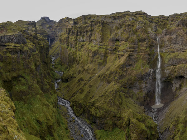
We started driving back down the coast towards Reykjavik since we only had a few nights left in Iceland. We were both completely exhausted, so we decided to start the hike we planned to do and turn around after the first waterfall so that we didn't kill ourselves on the hike. The waterfall was in the Múlagljúfur Canyon and it was a gorgeous area. Even though it was right off the main Ring Road, there were hardly any people there, which was great. In our sneakers and without our packs, it was a manageable hike to the first waterfall, despite us not knowing how far that waterfall actually was. However, because of the hiking adrenaline, we ended up finishing the hike which was a very tough hike that packed a lot of elevation gain (1,500 ft) in a short distance (4 miles round trip). I'm not sure how we managed to do it with how tired we both were, but we're a little crazy like that. The canyon itself was stunning. It was really cool at the summit of the hike seeing a waterfall falling out of the glacier. You could see exactly where that water was coming from. It was such a neat hike and a gorgeous canyon in that we were both delighted we finished the hike, even if it left us dead.
Afterward, we kept driving until we made it to Fjaðrárgljúfur Canyon. This one was much more touristy, and a much shorter hike. The canyon itself was okay, but nothing compared to the Múlagljúfur Canyon that we had just come from. That stop was more or less to break up the long 3 hours of driving that we did today into 1-hour chunks.
We got to our cabin for the evening just outside of Vik, made and ate dinner (where the smoke alarm went off even though there wasn't any smoke in the air), and then crashed hard so that we were well-rested for our ice cave adventure tomorrow.
Read More
| Location: | Iceland |
| Distance: | 5.42mi |
| Hiking Time: | 3 hours, 15 minutes |
| Elevation Gain: | 1,735ft |
| Max Elevation: | 1,453ft |
View Hiking Stats

Skaftafell & Diamond Beach - Aug 30, 2023
Today we drove up the coast to Hofn. On the way, we stopped for a hike to Svartifoss to look at another waterfall and then to an overlook, Sjonanipa, to look at the Skaftafellsjokull Glacier. The hike itself was moderate, but we were both still recovering from our treacherous hikes earlier in the week, even though we had a rest day yesterday. Since we were closer to the coast, this hike was considerably more humid than our other hikes, and we felt that humidity in the form of sweat during this hike. But overall it was a decent hike but not our favorite so far. The overlook of the glacier was very impressive and closer than we got when we went to Thorsmork, but it still wasn't perfect views. This is a touristy spot any way that had a decent amount of people. Not so much that it was annoying, but we weren't alone like we had been in a few other places.
The waterfall itself was framed by basalt columns which were really cool to look at. The way basalt columns form is interesting, and we had fun reading about the science of them forming on a sign near the waterfall.
One cool thing about this hike is that we encountered some new plants. First, Harebells, which we also have in Colorado. Second were Bilberries, which looked like small blueberries. The Icelandic name for these literally translates to blueberries, but they're not the blueberries we can buy in the store. They aren't poisonous, and we were confident in the plant identification since we had internet on the hike, so we both ate one. They weren't as sweet as a blueberry but tasted very much the same. This is now the 3rd plant Katie has foraged and eaten in Iceland, this one is my first.
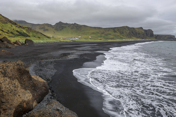
Next, we went to Diamond Beach. Despite it being towards the end of summer here, there were still many "diamonds" on the beach. It's named this because of all the ice that gets deposited on the beach. We had a lot of fun picking up pieces of ice and posing them for photography in this spot. It was very touristy, but the views were well worth the crowds. Besides, the crowds were mostly on the beach and not in the water (which is what we were taking photos of anyway).
We had dinner in Hofn at a very good seafood restaurant, Otto Matur & Drykkur. Hofn is known for its fishing, and the meal did not disappoint. I got the Atlantic char and Katie got the Atlantic shrimp. it was an expensive meal, but very worth it.
We made it the furthest North and East at the end of the day today. tomorrow we start heading back towards Reykjavik, which definitely feels like the end of the vacation is near.
Read More
| Location: | Iceland |
| Distance: | 6.85mi |
| Hiking Time: | 4 hours, 18 minutes |
| Elevation Gain: | 1,135ft |
| Max Elevation: | 1,148ft |
View Hiking Stats
Rest Day - Aug 29, 2023
Today was a rest day for us. Having hiked 3 good hard hikes in a row we were completely exhausted. On this day we also had the longest drive on the whole trip to get to our next hotel, so we decided to take it easy.
The day started by going to the waterfall that we saw the day prior from the bus: Seljalandsfoss. Since we were on a bus, we couldn't stop, even though the evening was perfect lighting on the waterfall. It was morning and it was super washed out, and the parking lot was jammed full of cars, so much that we couldn't even get a parking spot. So we decided to move on and hit this when we drive back which will at least be the right time of day and hopefully have better lighting.
After that, we drove to go hike around the Skógafoss waterfall. This attraction was also right off the ring road but a little bit further away so there were fewer people. It was still packed, but we started by seeing "Iceland's most beautiful waterfall", Skógafoss. It was a gorgeous waterfall, but the lighting wasn't perfect for us to capture the beauty. We had seen more beautiful waterfalls while in Iceland so far, so I'm not sure where this title comes from. It started raining on this hike, and we weren't prepared for it, so we turned around and went back to the car to get jackets since we weren't too far anyway. By the time we restarted the hike, the rain had stopped. This hike starts by climbing a million steps to the top of Skógafoss, and then continued along a gradual incline up the canyon for as far as you want to make it. Since we were tired, we turned around after a little over a mile where we had a snack, saw a few more waterfalls, and then we headed back down. Like many touristy places, the amount of people made this a meh experience, but the further we hiked the fewer people there were so it was nice to be able to get out from the people a little bit.
From there, we kept driving along the coast to get to Vik, where we stopped at the Black Beach overlook on the West side. This area was neat and great viewing, but the lighting was less than ideal so we didn't get that great of photos. We then drove to the Eastern side of the beach where we could actually get on the beach. The lighting was better here and we spent a little more time at this spot.
Next, we stopped at a really cool coffee shop, Skool Beans. It was inside of a bus where you order at the back. It was a really neat experience and the owners put a lot of thought into it. The main reason we went was because the name of it is "Skool Beans Micro Roaster... and Sometimes a Cat!", and Katie wanted to see the cat. Unfortunately, Jeffrey (the cat) was out wandering around and not on the bus while we were there. Since it was late in the day, we got hot chocolate so we didn't have a caffeine rush in the evening. I got white chocolate and fennel hot chocolate, which is unusual to see on a menu, but it tasted delicious.
We made it to our guest house for the evening and cooked dinner. Our room was in Kalfafell, a small little town that is literally just a few farms. it was a nice small place to stay, but we were only there for one night. Unfortunately, it was cloudy, so no chance of Northern Lights.
Read More
| Location: | Iceland |
| Distance: | 2.77mi |
| Hiking Time: | 1 hour, 40 minutes |
| Elevation Gain: | 522ft |
| Max Elevation: | 591ft |
View Hiking Stats
Þórsmörk - Aug 28, 2023
Today we took the bus to Thorsmork. The morning weather was rough, raining, and chilly, and we didn't know what we were in for. Since we were taking the bus, we didn't have many options for what to bring or when we could come back, so it was a little risky going out there with the potential for both of us to be wet, tired, and wanting to be back (but not having means to get back). Our bus ticket to get back was for 7:15 pm, which would get us back to Hella where we would stay the night at 10:15. We knew this was pretty late, but I don't think we fully thought it through when we booked it. The only other time the bus left was at 4 which didn't feel like enough time.
We have a car, but to get to Thorsmork requires multiple water crossings, at least one of which we absolutely could not do in our rental car. The bus left Hella at 8:30 am and got to Thorsmork at 10:30 am. By the time we got to Thorsmork, the weather was clearing up with almost no rain anymore. We think a lot of people must have canceled their bus bookings because of the weather since there were only a handful of people on the bus.
Our planned hike was about a 4.5 mile loop around some of the trails that start at the volcano huts. This area has many trails that all interconnect, so we were constantly checking the map to make sure we were on the right trail. About halfway through, we decided to make our loop about twice as long to go around Tindfjoll Mountain. Before making this fork the views were pretty good but nothing spectacular. Once we decided to extend our loop, the views got incredibly better. We got fantastic views of Rjupnafell Mountain which had incredibly steep switchbacks leading up to it. We joked that we would hike up it but we both knew we wouldn't since we were tired from a killer hike the day before. But as we reached the furthest point of the hike we got amazing views of the glacier. Truly incredible. We were both completely exhausted but we were so grateful that we did this loop because without it, this area wouldn't have been that cool.
We didn't encounter a ton of people on this hike. Not encountering many people makes any hike nicer, even when compared to the beautiful landscape we hiked yesterday in the Landmannalaugar area which was busy (but not packed) with people. There were just a handful of other like-minded people who went out of their way to hike the cool inaccessible stuff. We met 2 groups of Icelandic people who were all very nice, one of whom offered us some cashews and Brazilian nuts. These were the first nice native people we encountered here, not that everyone else was mean or rude, but a lot of who we’ve been interacting with were in touristy areas. But when you're out in the middle of nowhere having a shared experience with like-minded people it brings out the niceness in everyone.
Our hike ended at 3:50 pm, and we went to the bathroom very quickly and went over to the bus, even though we didn't have tickets for the 4:00 pm departure. Once everyone was on the bus, the bus driver confirmed that they would switch our tickets for us, which was very nice of them. If we couldn't have done that, we would have had to wait 3 hours at the small restaurant at the volcano huts before having a 3-hour bus ride back in the middle of the night. That was our original plan, but we're glad they were able to fit us in on the 4 o'clock departure. The 4 o'clock departure was an hour shorter because the route was more direct. All of those things made the day a little bit nicer.
The weather on this hike was nearly perfect. It was about 50-60 degrees the entire time, and not really that windy. There was one point a few hours into the hike when we got some misting and strong winds that were very cold and made the views hazy, but that only lasted for about 15 minutes. Otherwise, we had mostly cloudy skies which made for the best lighting conditions for the time of day we were there. Conditions towards Landmannalaugar where we were the past two days looked very rainy the entire time, which meant we didn't have good views looking in that direction, but we were grateful to have been there the day before with sunny weather instead of being there today with bad weather. We really lucked out with the weather today. It was forecasted to be raining all day but it hardly rained at all.
One of the unexpected things on this hike was that we came across a tröllkirkja which translates to troll church. It was in a cave on a particularly outcropping rock that I was photographing quite a bit, unknowing that there was a "church" up there. It was cute to find some troll stuff while at Thorsmork.
Read More
| Location: | Iceland |
| Distance: | 8.4mi |
| Hiking Time: | 4 hours, 53 minutes |
| Elevation Gain: | 1,759ft |
| Max Elevation: | 1,780ft |
View Hiking Stats

Landmannalaugar - Aug 27, 2023
We went into the Highlands again for our last day this far North. It was the same area as the day before but went a little bit further to Landmannalaugar, the main place to camp in the Fjallaback Nature Preserve. We started early in the morning and after a 2-hour drive, we got to the trailhead around 9 am. The hike we had planned was to summit both Brennisteinsalda and Blahnukur, but we started with Brennisteinsalda first. It's recommended that you summit just one of three peaks in this area in a day, but we are crazy enough to have done two of them. The views were unbelievable. We had much sunnier weather today compared to yesterday, which is good because you need the sun and the clarity to get good photos of this area. The mountains were such interesting colors, everything from typical brown and green, but also oranges, reds, and blues. It felt like we were hiking in another world.
We summited Brennisteinsalda without any issues and decided we wanted to continue on to the summit of Blahnukur, which translates to Blue Mountain. It's named that because, well, it's blue. Not bright blue, but a blue-green-gray that's really funky. That one was a little more difficult to summit since we practically descended all the way down Brennisteinsalda before hiking back up to Blahnukur. But we had good adrenaline going which helped us through the entirety of the hike.
Between these mountains is a giant lava field from an eruption in 1477 which framed the valley between the two mountains. The perimeter of the lava field was much clearer from Blahnukur than Brennisteinsalda.
Blahnukur was directly behind the sun for most of the hike so even from Brennisteinsalda we didn’t get a great photo of it, but it was the tallest peak in the immediate area which made me happy to have summited it.
We returned to our hotel at the Panorama Glass Lodge for the last night. I was happy to have driven on road 26 between F26 and F225 for the last time. That section is 12km of the worst washboard road I've ever driven on. The first time we drove into the Panorama Glass Lodge we took this road and only went about 40km/hr on it and it was so incredibly bumpy that I was afraid an airbag would go off. The following day we took the road at 80km/hr and the bumps were manageable, but keeping traction was difficult. But the trick with the washboard roads is to go really fast on them. Every now and then, I would need to swerve to avoid large tire-popping rocks in the road which resulted in us nearly sliding off the road a few times because of the speeds we were going. But driving slowly just wasn’t an option because of the bumpy road.
Driving into the preserve was fun today with all the rain from the night before. There were large puddles in the road that I intentionally splashed through getting the whole car soaked a few times. At one point on the way back, we had the windows cracked and another car passing us splashed up water into our car, a dirty lesson that we need to keep the windows shut... Luckily it wasn't that bad since the window was only down about an inch.
Read More
| Location: | Iceland |
| Distance: | 7.67mi |
| Hiking Time: | 4 hours, 50 minutes |
| Elevation Gain: | 2,316ft |
| Max Elevation: | 3,041ft |
View Hiking Stats
Rainy Day in the Highlands - Aug 26, 2023
The weather was forecasted to be rainy all day which is typical weather for summer in Iceland, but we were lucky the past few days with having sunny skies. The rain wasn't all that bad, but it was the wind combined with the rain that made a few parts of today unbearable.
Our day started late with relaxing and sleeping in. We finally got up and went to our first attraction: Sigoldufoss. This was a waterfall with gorgeous views that we could park right at and walk up to. Since it was in the highlands, it was quite a drive from the touristy centers, so there was almost no one there which was fantastic. We took a few photos and headed to our first "hike" of the day, Sigöldugljúfur, which is on the same river just a few minutes from there. We turned off the main dirt road onto a smaller dirt road and continued on until we saw a few other cars where we parked and got ready for our 1-mile hike. We quickly realized the road we drove in on was the hike. But we had a 4x4, and it was a road, so it was fine for us to drive up to. But it was funny we just drove there even though you could hike it from the main road.
Sigolduglufur was incredible. It was like a dozen waterfalls that were falling from the canyon into a river. Purely picturesque for sure. The thing I loved about it was that I was able to hike down a little bit to get to the top of the major waterfall. That area, wet with moisture from the river, made that place a really neat oasis. I was fascinated with seeing the water channels which were deep grooves in the ground that you hardly knew you were walking over. Some of the waterfalls in this area were seemingly coming out of nothing.
We entered the Fjallaback Nature Preserve where a ranger handed us a card that told us the exact same thing in about 15 different graphics: don't drive off the road under any circumstances. It was weird because the ranger was just standing on the side of the road at the entrance - no booth or anything - just on the side of the road.
On our way to our hike, we made one spontaneous quick detour to Hnausapollur (Bláhylur) View Point. This area was so windy. The rain had also started for the day and that combined with how windy it was made us laugh the whole time in the sense that we knew we had to laugh about it or we would be in bad spirits because of it. We hadn't experienced anything like that before, but it was an unforgettable moment. We got out of the car in all our rain gear, took a few photos, and got back in the car before we were blown away by the wind.
Our main hike started by hiking to Ljótipollur Crater, then around Nordurnamur mountain, and finally around Stútur Crater. The hike started out super windy and rainy, but we powered through because it was such a beautiful place and we weren't really cold, just slightly uncomfortable. Both Katie and I had decent (although not completely waterproof) jackets on and overall we did fine. After hiking up to the Crater and back down, the weather was a lot nicer to us with almost no wind and just some rain. So it got a lot better after the first mile or about 30 minutes.
The hike was incredible. We hadn't hiked on anything like that yet and we were really glad we braved the weather and went out there. We even saw some sheep on the hike which was cool to photograph them in a very Icelandic scene. The best part about it all was that we passed no one on the trail that we were on. There were people at the top of Stutur Crater, and a few people in the parking lot for Stutur Crater, but no one on our trail, even though this is one of the major natural preserves in Iceland. That aloneness is the reason we hike and we loved every minute of it.
At the end of the day, we drove all the way to Hella for 2 things: gas and groceries. We needed groceries for the next few days since tomorrow we are heading back to the same area for a longer hike, and the day after we have an early start getting on a bus to Thorsmork. So today felt like the appropriate day to drive out of the way to go get some supplies to make sure the next few days would go smoothly.
Read More
| Location: | Iceland |
| Distance: | 4.74mi |
| Hiking Time: | 1 hour, 53 minutes |
| Elevation Gain: | 699ft |
| Max Elevation: | 2,315ft |
View Hiking Stats
Hikes along the Fossá River - Aug 25, 2023
My morning started at midnight trying to capture some astrophotography. I had an alarm set for 3 am, but I woke up on my own at midnight and went outside. It was cold. I was hoping to see some Northern Lights but it was a low chance, only a KP index of about 2. I didn't see anything with my eyes, so I took a few shots and was out there for about 20 minutes, then went back to bed (and turned my 3 am alarm off). Upon looking at the photos through my phone the morning after, there was a faint green streak through the sky. So that was cool to have captured the Northern Lights. Unfortunately, there was a much more spectacular light show that occurred right around 3 am, but since I already went out there and took photos at midnight, I was fast asleep when it happened and didn’t capture it. Even though it was still early in the trip, this was the last night that had clear night skies for any chance at seeing the Northern Lights. Of course I didn’t know that at the time, but it was a bummer to have gotten a tease of them and for them to be out of reach due to cloud coverage for the rest of the trip.
After waking up to start the day, the morning started off with going to Hjálparfoss which was the first of 3 activities along the Fossá River. It was a stop along the way to our other activities and it was a quick stop off the road, so we went there first, even though the lighting on this waterfall would be better in the afternoon. We got there around 9 and the lighting was terrible, so we left and went on to our main attraction of the day: Haifoss. This one was a decent hike and had the amazing waterfall view right at the beginning, which we then descended down to and spent a great deal of time at. The lighting wasn't perfect when we got there, but by the time we left Haifoss, the lighting down in the canyon was near perfect. We were happy to have had sunny skies for this hike because the moisture getting kicked up from the waterfall created a perfect rainbow around the waterfall. Iceland isn’t known for sunny weather, but we got it on this hike for some truly spectacular photos.
Next to Haifoss is Granni, which is another waterfall visible from the parking lot. This one didn't really have a trail to it but we scrambled our way to it anyway. The views and pictures at Granni were not nearly as good as Haifoss, but the adventure was a lot of fun. It included a short rock traverse and a steep muddy scramble. After getting there we took a few photos and turned around to go back to Haifoss for a quick lunch of peanut butter and jelly sandwiches. Peanut butter was hard to find here, as well as gluten-free bread, but we managed to find both a few days prior which will be our lunches for the next few days while we hike in the highlands.
After that hike, we continued on the dirt road to go to Gjáin, which is an area where they shot a scene from Game of Thrones. That area was a gorgeous hidden gem that we parked at and walked right up to. The lighting was a little harsh, but the area was beautiful. The thing that amazed us was that we were driving through what seemed like a desolate, dry, desert, and then all of a sudden happened upon a river where everything was green and the plants were flourishing. But Gjáin was a really cool place, just off a dirt road requiring a 4x4 vehicle that we were glad to see.
After Gjáin, we continued on the dirt road to head to our lodging for the next few days. But before that, we stopped at the first attraction again, Hjálparfoss. The dirt road we were on literally spat us out right at that waterfall, and being later in the day (around 3), we knew the lighting would be about perfect. The lighting was great, although harsh, so we snapped a few photos and went on to the Panorama Glass Lodge.
The road to get there was rough. Like really rough. The road wasn't technical at all, just very washboard. We drove about 12km on extremely bumpy roads that we were concerned would make the car explode. But we made it. We later found out that the trick to driving on this road is to drive at dangerously high speeds. The faster you go, the less you feel the washboard bumps in the road.
The Panorama Glass Lodge itself is pretty cool and very modern. This was our one expensive hotel to treat ourselves for our honeymoon. The hope was to see some good stars and maybe the Northern Lights, but all 3 nights we were there it was completely overcast.
Read More
| Location: | Iceland |
| Distance: | 4.91mi |
| Hiking Time: | 4 hours, 4 minutes |
| Elevation Gain: | 1,096ft |
| Max Elevation: | 1,358ft |
View Hiking Stats
Waterfalls and Volcanic Craters - Aug 24, 2023
The day started off quite early, not on purpose but because we finally got over the jet lag. We woke up in the 5 o'clock hour and started our day slowly by making it to the Brúarfoss trailhead. When we were planning our trip, there was only one trailhead for this hike, but just this summer a parking lot opened up right next to Brúarfoss. We decided to do the original hike which led us along the river which showcased a total of 3 different waterfalls. The trail was, according to AllTrails, a 4.2-mile hike with 1,500 ft of elevation gain. That elevation gain had us both worried because of how tired we felt after hiking Glymur Waterfall while being jet-lagged a few days prior. But AllTrails lied to us and this hike only had 250 feet of elevation gain (but still 4.2 miles). Having seen the 2 other waterfalls along the way, Hlauptungufoss and Miðfoss, we were glad we didn't just drive to the Brúarfoss parking lot. Since we started early, we hardly saw anyone and had Hlauptungufoss all to ourselves, and that waterfall was incredible. Miðfoss was a decent waterfall but not as far of a drop or as fast-moving. Brúarfoss was gorgeous and spread out, but I think I liked Hlauptungfoss the best, which is ranked based on beauty and lack of other people. Brúarfoss didn't have many people there, but it's not as special when you see someone drive up and walk over with almost no effort and take the same photo as you. The coolest part about this hike was how blue the water was. It was a crazy pretty blue color.
In the afternoon, we decided to go to the Kerid Crater, which is something we had planned to do later in our trip. We decided to stop there because we didn't have anything else planned for the day except a long 45-minute drive (one way) to Selfoss to go to the larger grocery chain store to get some cheaper food for the next few days where we were in a much more remote area. Kerid Crater wasn't anything special, but it was cool to learn about that kind of geology - where a volcanic eruption happened and then the crater collapsed in on itself sealing it back up and then filling with water creating a lake. The pictures were mediocre because of the lighting and because it wasn't all that exciting. But we hiked around that area and went a little north of the crater to find a bunch of lava rock. All sorts of different colors, sizes, and materials. Again, not something super exciting, but this wasn't anything like what we were used to, so we probably looked like over-enthusiastic tourists touching and holding the volcanic rock. But one other reason why we liked doing this was because we were mostly alone - just a few other people, despite being only a few hundred feet from the popular crater itself. It's crazy how many people come to do just one thing (like see the crater) and don't actually stop to appreciate the beauty of the surrounding area.
We're glad we did the Kerid Crater on this day instead of when we had it planned for later in the week. The day we had this planned out ended up being horrible “hurricane-force” winds and rain, so it wouldn’t have happened anyway. Additionally, we had a lot going on the day we were going to do it, so I feel like this makes it a little bit easier to do. I think flexibility in shifting around hikes really made this trip more enjoyable. Going grocery shopping on this day also wasn't planned out, but it was good to go to a large grocery store. We found more gluten-free food for Katie and it was a lot less expensive (although still very expensive by US standards) than any of the smaller grocery stores we have stopped at along the way. For just a few meals worth of food, we spent 12,000 ISK ($90).
Read More
| Location: | Iceland |
| Distance: | 5.87mi |
| Hiking Time: | 2 hours, 53 minutes |
| Elevation Gain: | 558ft |
| Max Elevation: | 385ft |
View Hiking Stats
Touristy Day in the Golden Circle - Aug 23, 2023
Still a little jet lagged, we woke up at about 9 am and had a slow start to the day. Today was marked as a rest day, although any of the days in the golden circle could have been switched around to be our rest day. We decided to spread out the rest of what we were doing in the golden circle over the next few days in this day so we weren't doing quite as much all at once, so today was the touristy day. We did two things, both right off the side of the road, but we still managed to make them both a decent walk. Neither were really hikes (even though they’re tagged as such on my blog).
The first thing we did was go to Strokkur Geyser. Just a 10-minute drive from our cottage, we got there pretty quickly around 10 am after eating some Skyr yogurt and granola for breakfast in the cottage. Everyone said that Skyr yogurt was something not to be missed, but it's just a creamier Greek yogurt which isn't that special. A gluten-free breakfast is difficult enough, but yogurt and granola are usually a safe bet. However, most granola in Iceland had barley and/or rolled wheat in it. Despite this, Katie ate it anyway and did fine. Maybe because it was small amounts or maybe because it wasn’t formed into actual gluten yet (like it is in bread). But by the end of the trip, Katie was tired of eating Skyr and granola every day for breakfast.
Strokkur Geyser was interesting. We'd never been to a Geyser before, so we didn't know what to expect. Before getting to the geyser itself, it was interesting learning about how they work and why they do what they do from signs posted around the area, but even then we were under-prepared for what to expect. We got the geyser and everyone had their phones out waiting. We figured the geyser eruption would be something we would have time to grab our cameras and take a few photos of, but we were wrong. The eruptions were just a few seconds long, and you had to have your camera up to your face ready to take the shot. Luckily, this geyser erupts every 5-10 minutes, so we didn't have to wait long between eruptions, but holding the camera still and waiting for that long was a little bit treacherous. But dispute that, we managed to get a good couple of eruptions in at the geyser itself before hiking up to a spot where you could see it from above. But we're not here for geysers anyway and although they're neat, this was a touristy thing that was worth stopping for, but not super exciting for us.
We had lunch at the Strokkur Geyser area which was jam-packed with tourists. Since this was a touristy spot to eat, the food wasn’t very good, but it was better than some other touristy food spots I've eaten before. If we had been a little more prepared, we could have packed a lunch, but that wasn’t something we figured out how to do until a little later in the trip.
Next, we went on to Gullfoss waterfall. This is also right off the side of the road, so we parked and walked along the walkway with 50 million other people. The Gullfoss waterfall was significantly better than the Strokkur Geyser in terms of what we came out here to see. This one was absolutely worth stopping at and we were happy we did, even if it was busy. We just don't ever see that much water from where we're from, so seeing unquantifiable about of water like that is incredibly interesting to us both.
We then went out of our way to go to a Samkaup Strax grocery store in Flúðir to pick up just a few extra supplies for the next couple of days. To our surprise, they actually had a (small) gluten-free selection at this store, so we got some gluten-free bread and some peanut butter and jelly for us to be able to pack a lunch for some of our upcoming hikes where we need a more substantial lunch. This was a great win for us since even finding granola bars without gluten in them had been incredibly difficult to find. We also picked up some ice cream from that place since we have a freezer at the cottages.
Went back to our cottage and got there around 4 in the afternoon. We did some laundry by hand and hung it up on a clothesline, drank some wine, and grilled some potatoes and hotdogs with ice cream for dessert. Even though it doesn’t sound like a fancy dinner, having a grill for food prep made this the best (away from) home-cooked meal we had on the trip.
Read More
| Location: | Iceland |
| Distance: | 3.16mi |
| Hiking Time: | 2 hours, 27 minutes |
| Elevation Gain: | 531ft |
| Max Elevation: | 729ft |
View Hiking Stats
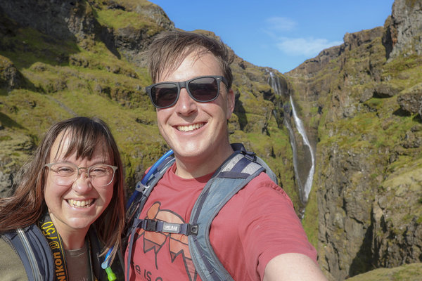
First Day on the Golden Circle - Aug 22, 2023
We woke up at 8 after sleeping nearly 12 hours. It felt good to sleep and that helped a lot with resetting our internal clocks from the jet lag, although it ended up taking another 2 days for the jet lag to finally wear off. We wasted no time and packed up to head to the Golden Circle.
We left Reykjavik and our first stop was a quick 2-mile hike in the Þingvellir National Park to see our first Icelandic waterfall: Oxrafoss. We picked this one first because it was facing Northwest so it would be lit up in the morning. We got to the parking lot, which was right off the Golden Circle to find it was jam-packed with tourists. That's because this "hike" wasn't really a hike and the waterfall was less than a quarter mile from where we parked. This turned out to be an incredibly touristy activity because of how accessible it was. Although Oxrafoss was beautiful, the amount of people and the lack of it being an actual hike didn't really give us as much joy as a true hike to a waterfall would have given us. But that’s okay, we were still a little but jet-lagged and needed something easy to start our first real full day in Iceland. Hiking around this area resulted in a 2.5 mile hike with a couple hundred feet of elevation gain.
We left Þingvellir and headed 45 minutes to Laugarvatn for some lunch because that was the closest town that had food. We didn't plan out the day very well in that respect - we should have brought food with us. After that, we backtracked again towards Þingvellir to go hike to Glymur waterfalls. This is a little longer of a hike coming in at 4.5miles and 1300 feet of elevation gain. That combined with the fact that it's a little further away from the Golden Circle made us hopeful that it would be less busy. And it was, although there were still maybe 50 cars in the parking lot. But the trail was big enough that it wasn't too bad with all the people.
The hike started off with us putting on real hiking attire. The first cool thing in the hike that made us happy to be on a real hike was passing through a keyhole. It would have been easy for the trail makers to have us go around but I appreciated that we went through it. After crossing the river shortly after the keyhole we started steeply ascending where we got absolutely stunning views of Glymur the entire way up. We kept stopping at all of the outcroppings to get photos and catch our breath.
Both Katie and I were happy to have done the hikes today in this order for two reasons: first because we did the crappy hike first and the real hike second so the disappointment of Oxrafoss wasn't as bad. Second, the lighting was perfect for both hikes, which is something I planned out that morning. The only bad thing was the backtracking and wasting so much gas. It would have been at least an hour less of driving to have done these hikes the opposite way, but to have perfect lighting was worth it.
We went back up towards Laugarvatn to get to our hotel for the next 3 days, a cute cottage called Úthlíd Cottages that had a full kitchen and a grill on the patio. Before getting there we stopped and got groceries so we could relax at the cottage after a long hike and also to save a little bit of money since Iceland is so expensive. With Katie's gluten intolerance, we wish that we had stopped at a larger grocery store in Reykjavik to get some gluten-free foods, but we'll be able to make do with the food at the smaller grocery stores in the towns along the way. So far, the hardest thing to figure out is what to pack for lunches on hikes. The grocery stores sell a lot of sandwiches for this, but that doesn't work for Katie. Luckily we found a great gluten-free brand that’s sold in larger grocery stores that worked well for peanut butter and jelly sandwiches, but it took us a few more days to find that as an option.
The lighting here is weird, the sun stays so low on the horizon all day. It rises in the East, swoops to the South, then sets in the Southwest. And then even in the middle of the night, you can see the glow from the sun that’s just below the Northern horizon. It's weird looking at the sun at noon and seeing it so low, but it created for unique lighting that was never too harsh.
Read More
| Location: | Iceland |
| Distance: | 7.14mi |
| Hiking Time: | 3 hours, 58 minutes |
| Elevation Gain: | 1,660ft |
| Max Elevation: | 1,144ft |
View Hiking Stats

Perseid Meteor Shower - Aug 12, 2023
We haven't been getting out to do nature stuff in a little while. Knowing we wouldn't get out on Sunday, we decided to drive up to Rocky to watch the Perseid Meteor Shower. Katie proposed the idea to me, and I was surprised since she likes to be asleep by 9 pm on most days. But we hopped in the car a little after 7, got to the top of Trail Ridge Road around 9, and hiked on the Tundra World Nature Trail a half-mile to the top of the Roger Toll Memorial before sitting and watching the stars for an hour. We didn't get back home until midnight. Being out that late isn't something either of us could recall having done together.
Even though it was a very short hike, it was still nice to have gotten out and done something in nature. Rocky Mountain National Park was a great spot to watch the stars, although you could still make out quite a bit of light pollution from Loveland. The light pollution helped with getting my focus set right and wasn't in the direction that we were looking for the best meteors, so the light pollution didn't both us.
We were seeing one shooting star about every other minute. Upon looking at the images, there were meteors in almost every 10-second photo that I took which seemed crazy to me that we didn't see that many. But most of them were quite faint, and my camera was picking up on stuff that we couldn't see with our eyes. But since I had my camera on a tripod with a remote trigger taking photos one after another, it makes for a cool time-lapse. This photo shoot makes me want to do more astrophotography in even darker areas.
Read More
| Location: | Rocky Mountain National Park |
| Distance: | 1.38mi |
| Hiking Time: | 1 hour, 33 minutes |
| Elevation Gain: | 148ft |
| Max Elevation: | 12,356ft |
View Hiking Stats
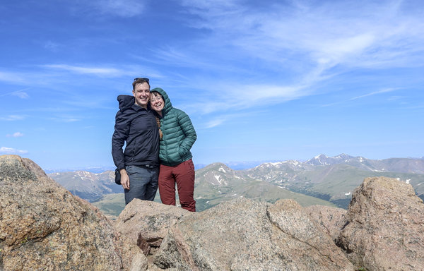
First Day of Marital Torture - Jul 25, 2023
I jokingly got it into Katie's head that the first hike we do together as a married couple should be a 14er. I'm always down to do hard hikes but I meant this as nothing more than a joke since the focus of this trip was a wedding day hike. But she took it to heart and we did it despite being exhausted from the wedding hike the day before. We went to bed at a modest 7 pm both because we were unbelievably tired from waking up at 2 am that morning and also so we could get up at 5 am the following morning to climb Mount Bierstadt.
Often referred to as the easiest of Colorado's 14'ers, Mount Bierstadt is not an easy hike. None of Coloradon's 56 peaks above 14,000 feet in elevation gain are. But this distance and elevation gain isn't anything harder than hikes we've done in the past so we gave it a shot. The difficulty came from the fact that we had hiked the day prior and didn't get much sleep.
We arrived at the parking lot around 6:30 am and the parking lot was already full. We were able to park alongside the road without adding too much extra distance to our hike. We got going and started the torture. The weather was fantastic and we summited Mount Bierstadt after 3 hours. Surprisingly, the summit had calm winds on the East-facing slope, which made for a fantastic place to sit and eat a peanut butter and jelly wrap to refuel before heading back down.
Even though this hike was right in the same area as our wedding day hike, Mount Bierstadt had lots more wildflowers on it. We got plenty for our wedding but it was incredibly breathtaking how many wildflowers were covering the Mount Bierstadt area. We spent a lot of time photographing the wildflowers.
Mount Bierstadt, unlike our wedding hike, was busy. We started the hike early, but there were already several dozens of people on the trail when we arrived. Katie and I don't like this kind of hiking, and the crowds on this trail are a symptom of it being Coloradon's easiest 14'er. People climb this to say they've done a 14'er but we're not interested in achieving those bragging rights - we hike to enjoy nature, get good views, and have the area mean something special to us knowing that not many people witness the same beauty. But we did it anyway because as Coloradoans, climbing a 14'er is a right of passage and something we needed to get marked off Katie's bucket list. But after being reminded of how busy 14'ers are, I think we'll stick to the more secluded 13'er hikes which have similarly incredible views but without the people.
This hike had 2 moose sightings on it. The first moose was on the side of the road as we drove up. We think, although have no way of knowing for sure, that this was the same moose we saw while driving up to our wedding day hike since it looked similar and was in (we think) the exact same spot. The second moose sighting came in the last half-mile of the hike at the lake near the parking lot. I have carried my big and heavy telephoto lens with me on every hike since I got it and this is the first time that we've seen wildlife cool enough for me to use it. The moose was in the middle of the lake dipping its head down to eat off the bottom of the lake. It was quite far from us, but the telephoto lens did a great job of capturing this magnificent creature.
Summiting a 14er is our 2024 New Year's Resolution, despite it being 2023 and us still needing to complete our 2023 goal. We wanted to make hiking a 14er our goal for 2023, but with the wedding and our Icelandic honeymoon, we had a lot going on during the prime 14er hiking season that we didn't want to give ourselves an unrealistic goal. There's a pretty small window of time that 14ers can safely be hiked; it can't be too early in the summer when thunderstorms are too unpredictable, and it can't be too late because the first snow on a 14er could be mid-August. Now we just need to keep working towards our 2023 goal of beating our highest 2022 statistics by 15%. More on that goal is in this blog post.
Read More
| Location: | Georgetown |
| Distance: | 7.97mi |
| Hiking Time: | 5 hours, 32 minutes |
| Elevation Gain: | 2,805ft |
| Max Elevation: | 14,065ft |
View Hiking Stats
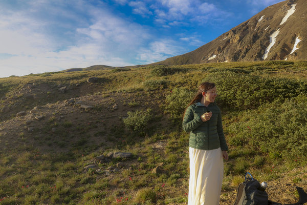
Alone in the Mountains - Jul 24, 2023
Today, Katie and I got married in the most "us" way that we could think of - at a secluded alpine lake. We hired Bailee from Alpine Vows as our wedding photographer to accompany us. Bailee specializes in Colorado hiking elopments so I didn't need to focus on photography on this hike allowing us to be more focused on each other. And my photos show that this wasn't about my photography - I took just a few photos, very quickly. I decided to bring my camera on the hike dispite us hiring a photographer for two reasons. First, this whole thing was about staying true to ourselves, and since taking photos on hikes is what I do, I wanted to take some photos to post so I can count this on my blog as a hike we've done. Secondly, my wedding ring has Longs and Meeker engraved in it. I plan to redesign the ring and have it remade with the ridgeline of the mountains where we got married at, which requires a very specific panorama. I certainly could have asked Bailee for that particular photo to be taken, and we completely trust her with all the photos, but the mountainscape I have engraved on my ring needs to be my artwork for it to mean what it does to me.
The morning started at 2 am when we woke up in a bed and breakfast in Georgetown, Colorado that we had arrived at the day before. As we were getting ready in the early morning hours, we had just a few things to get done: get dressed, do Katie's Hair, and do Katie's makeup. all of that took about an hour before we were out the door heading to the trailhead. The trailhead was a little under 30 minutes away through the winding roads of Gunealla Pass. Along the way, we encountered a young male moose licking the guide railing on the side of the road. This was our first moose sighting of the year and even more of a sign that we were ready to be married.
We started our hike at 3:45 where we meet up with our photographer and made it to Murray Lake in about an hour. The lake was a little over 2 miles with 1,000 feet of elevation which is a fast pace for us, especially since it was pitch black other than our headlamps. But we were excited and had our adrenaline pumping so we got there incredibly quick. We got to the lake well before sunrise which was the plan from the beginning so we could get the alpenglow on the mountains. While waiting for the sun to rise, I helped Katie into her dress and we waited for the sun to start peaking above the horizon.
The sunrise and alpenglow on the mountains were absolutely stunning. After spending about an hour taking portrait photos, Katie and I had our private ceremony around 7 am where we exchanged vows and rings before heading back down to the lower lake - Silver Dollar Lake. There, we had a cheese charcuterie picnic followed by signing the marriage certificate and then some more portrait photos. The hike ended around 10 am after 6 hours of a lot of excitement. We can't wait to see the professional photos and get them printed.
When deciding on a hike for our wedding, we had a few requirements that are listed below. All of these criteria were met and we have our photographer Bailee to thank - she did such a great job at finding this perfect hidden gem of a spot for us to get married.
Wedding Hike Criteria:
- The hike needed to be to an alpine or sub-alpine lake. Katie and my favorite type of hike is to a lake. Summiting tall mountains is great, but doesn't have the same view that a lake has. Not only was this hike to an alpine lake but there were 3 lakes on this hike.
- The ceremony needed to be private with a hike that didn't have many people on it. We had Murry Lake all to ourselves and didn't see a single person until an hour after we were married - this hike perfectly met this need.
- It needed to be a true hike. Not something where we drove to a lake and took some photos. No one would know the difference in the photos if we did this, but adventuring is what we do, and you can't adventure without doing a little bit of work. Katie and I have always defined a true hike to be at least 1,000 feet in elevation gain, but we didn't want it to be a torturously long hike that resulted in us being drained of energy at the summit. This hike came in at just over 2 miles to the summit and about 1,200 feet of elevation gain making it an easy, but true hike.
- Wildflowers - we chose a late July wedding date specifically for the wildflowers, which this hike was packed with. So many different varieties. It was magical as the sun came up and we could see just how many there were.
Read More
| Location: | Georgetown |
| Distance: | 6.21mi |
| Hiking Time: | 6 hours, 8 minutes |
| Elevation Gain: | 1,224ft |
| Max Elevation: | 12,050ft |
View Hiking Stats
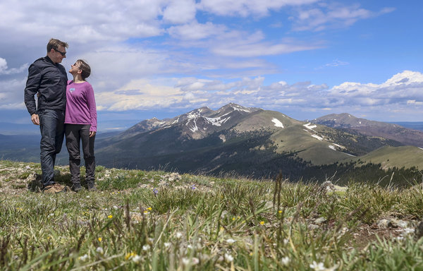
North Diamond Peak - Jul 4, 2023
For the 4th of July this year we did the same hike that we did last year: Montgomery Pass. Having been in absolute awe of all the flowers at Montgomery Pass in 2022 we wanted to do it again in the same season. The cool thing about this area is that at Montgomery Pass you can head North or South and continue along the ridge as far as you want and every step has amazing panoramic views. We decided to go South toward North Diamond Peak - the tallest south-most peak in that range.
The wildflowers became even more incredible after climbing up from Montgomery Pass. We spent so much time taking photos of wildflowers because there was an unbelievable amount of them. Rolling mountains of wildflowers as far as you could see. The number of wildflowers wasn't too different from last year, but we didn't see the variety last year that we saw this year.
There were thunderstorms forecasted in the Cameron's Pass area, mostly after about 2 pm. We got to the trailhead just before 9 and started our hike, thinking we would be below treeline before 1 pm - giving us plenty of buffer before the storms. We aren't too worried about getting wet, just concerned about lightning above treeline. That went to plan - we were back in the cover of the trees around 1, with sunny blue skies. What we didn't expect were the 3 quick storms that rolled over us while we were exposed above the treeline. The first one just barely hit us with a little more than some sprinkles of rain. There was a 30-minute intermission of sunny blue skies before we got hit with the second storm. The second storm was a lot worse and we were directly in its path. Being on an exposed ridgeline we headed off the ridgeline to at least get out of some of the wind where we stood waiting for the storm to pass. After about 5 minutes of downpouring sideways rain, we were able to continue on our hike in again,m sunny blue skies. The third storm barely produced any rain and happened on the summit of North Diamond Peak. We waited for this storm to roll over to get different lighting conditions before heading back down.
During the entire hike exposed above treeline we were looking for lightning and thunder. We did hear some thunder, but only from storms that had already passed us and were picking up steam heading East. As each storm approached we made a plan and watched the storm clouds for any chance of danger. Luckily, we didn't encounter anything too dangerous.
The summit of North Diamond Peak had a geological survey marker in very poor condition. Marker LL1389. It looked like it had been melted over the rock it was affixed to which made me wonder if maybe it had been struck with lightning. This marker was placed in 1937 by the Forest Service and was last reported in good condition in 1959. What's cool is that anyone can submit a report that they found one of these, so I reported it as found in poor condition. Katie and I have been starting to research these markers and report them as we find them. The markers have their own reports to them, which has a really funny passage for how to find it from when it was set in 1937:
Turn right on a graveled road, State Highway 14, and follow it for 21.0 miles to the Gould post office.
What's funny about this is that state Highway 14 is no longer a gravel road and hasn't been for quite some time. These reports have some interesting tidbits of history embedded in them that make them somewhat fascinating to read. The report for this marker can be found here. Soon this report will read that it was found in poor condition on July 4, 2023 (by me).
Read More
| Location: | Camerons Pass |
| Distance: | 7.58mi |
| Hiking Time: | 4 hours, 51 minutes |
| Elevation Gain: | 2,352ft |
| Max Elevation: | 11,798ft |
View Hiking Stats
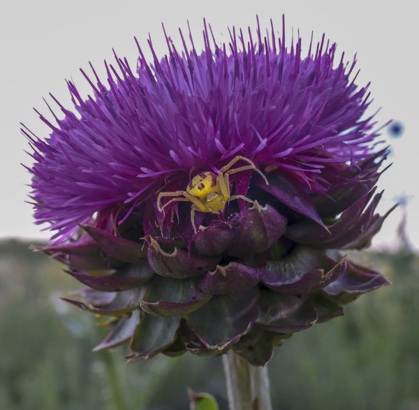
Wildflowers at Coyote Ridge - Jul 3, 2023
Two years ago in June we went to Coyote Ridge to photograph the wildflowers. We were busy at the beginning of June so we never went, and by the time we thought of going it was likely too late. As it so happened, I went bike riding at Coyote Ridge last weekend and the wildflowers were still absolutely gorgeous, so Katie and I went with our cameras after work one day.
Considering it's July, we weren't sure if we would go out to take photos because the weather in July can be atrocious in the evenings. But with just a little bit of light rain and temperatures in the mid to upper 70s, it ended up being an absolutely gorgeous walk with fantastic cloudy-day lighting for our wildflower photography.
Read More
| Location: | Fort Collins |
| Distance: | 2.31mi |
| Hiking Time: | 1 hour, 7 minutes |
| Elevation Gain: | 200ft |
| Max Elevation: | 5,269ft |
View Hiking Stats
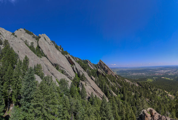
Free Soloing My First Crag - Jun 25, 2023
This weekend we picked a hike in Boulder because it was a short drive to our lunch plans in Erie. Having lunch plans meant we couldn't do anything too long, so we picked Royal Arch since that's still a tough hike with over 1,500 feet in elevation gain but it's packed in a short hike that's less than 4 miles long. The hike was something we knew we could do in under 3 hours, so we got to the trailhead 3 hours before we needed to leave for lunch and got hiking.
Like all the other hikes we've done recently, the spring rain has made the area ripe with green grass and lots of wildflowers. Since we were hiking considerably lower in elevation than our previous hikes, most of the wildflowers were wilted and dying, but we managed to find several that were still in peak bloom. We're ready to start getting up higher where it's not as hot now that the wildflowers are blooming up high.
We got to the summit in a little over an hour which gave us about 30 minutes to relax before heading back down. Since it was a nice Sunday morning, the summit was packed with people, but that didn't stop us from getting a good spot to rest. I decided to wander around a little and give Katie some anxiety by climbing up high. I did two sketchy climbs, the first one up to the Westernmost tip in that area behind Royal Arch, and the second climb was up the East face of Royal Arch itself which I summited to the top of the arch. I didn't have any climbing equipment with me and had my camera shoved into my pocket so I could use both hands. While I was climbing, Katie looked it up and found out what I was doing is a class 5 climbing route. It's at the low end of the class 5 scale coming in at a 5.0, but it's still class 5 and is the first outdoor climb that I've done outdoors that's more than just a scramble without any rope protection.
Climbing classes are as follows:
Class 1: Hiking
Class 2: Scrambling using hands
Class 3: Scrambling, fall could result in a broken bone
Class 4: Simple Climbing, fall could be fatal
Class 5: Technical climbing
Since this ranked a 5.0 climbing I should have had a rope and protection like a helmet. But it gave Katie (and may other people at the summit) some much-needed anxiety that was only worth it because I didn't die.
Read More
| Location: | Boulder |
| Distance: | 3.8mi |
| Hiking Time: | 2 hours, 33 minutes |
| Elevation Gain: | 1,545ft |
| Max Elevation: | 6,905ft |
View Hiking Stats
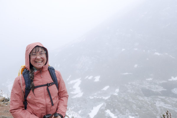
Blizzard Adventure in June - Jun 17, 2023
Okay, maybe "blizzard" is an exaggeration, but not by much. It was snowing hard with poor visibility for the majority of the hike. It felt like a mid-winter hike which included busting out gloves and hot hands to try and keep my fingers from freezing - that's not something that should need to happen 4 days from the summer solstice!
Conditions weren't forecasted to be dangerous, just some chance of rain between 10-12, something we could easily prepare for. And good thing we did since that rain ended up being snow at that high elevation. The weather was forecasted to be perfect for hiking the other day of the weekend, but we had other plans. Normally if the weather is bad we would just skip the weekend and go the next, but we had (non-hiking) plans for the next 2 weekends that will make it hard to get outside. All of that combined made us decide to brave the weather and hike up to Chasm Lake. We loaded up the car and got an early start since this hike shares parking with the only 14'er in Northern Colorado, meaning the parking lot would fill up quickly. We got to the trailhead at 8:30 and took a spot from (presumably) someone who had already gone up and come back down. Not questioning our luck in getting a parking spot, we hopped on the trail and started our adventure.
The hike started dry, but it started snowing quickly early on, much sooner than the 10 am forecast. But we were prepared and hiked through the blizzard. Getting that much snow just a few days in the middle of June was strange, but since it is nearly summer it wasn't as cold as some of the other snowy hikes we have done in Rocky Mountain National Park. We were hoping that the weather would clear up by the time we got to Chasm Lake, but we hiked too fast getting there around 11 and it was still snowy with low visibility.
After summiting, we took a few photos at the lake and headed down to find a place that was less exposed for lunch. We quickly ate our lunch and kept descending. About a mile from the lake the snow abruptly stopped and we had partially blue skies in a matter of a few minutes. There was no indication that this sudden change of weather was going to happen when we were at the lake, otherwise, we would have waited. But having already hiked back so far we decided to just keep hiking back to the car. It was a shame, too, since all the beauty in this hike is in the last mile.
Having seen a glimpse of how great the views can be on this hike we've decided to leave it on our hike list to do again hopefully when the weather is better.
Read More
| Location: | Rocky Mountain National Park |
| Distance: | 8.98mi |
| Hiking Time: | 5 hours, 20 minutes |
| Elevation Gain: | 2,457ft |
| Max Elevation: | 11,663ft |
View Hiking Stats
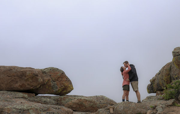
Foggy Hike - Jun 11, 2023
The weather hasn't been cooperative with all the rain, and this weekend was no different. But Sunday morning and early afternoon had a low probability of rain so we decided to take a chance and go hiking. Because of the forecast, we decided to do something lower in elevation in case it rained so that we wouldn't be as exposed. We chose Button Rock Mountain because we both had good memories of hiking it back in 2020 and knew it would give a great panoramic view at the summit.
We did get a panoramic view at the summit, but because of the fog, we couldn't see very much. The whole hike was setting up for a summit disappointment (from a view perspective), because of the thick fog that we were hiking in and out of. By the time we summited, we weren't too surprised that we couldn't see anything. The weather has ruined hikes for us in the past, but this time was different in a positive way. Not only did the fog keep it much cooler than a typical sunny June day, but the fog also added a cool layer of depth to the hike that we're not used to. It might have been different if this was our first time hiking Button Rock Mountain, but we weren't upset with the lack of visibility or sun. The fog ended up adding peacefulness during the hike, especially at the summit. There's something quieting about standing on top of a summit where you should be able to see the tall peaks in the distance but all you see is fog.
Read More
| Location: | Lyons |
| Distance: | 8.52mi |
| Hiking Time: | 3 hours, 57 minutes |
| Elevation Gain: | 1,509ft |
| Max Elevation: | 8,439ft |
View Hiking Stats

Wildflowers at 6,000ft - May 21, 2023
We've been holding off on hiking Grey Rock because we wanted to wait for it to be green and filled with wildflowers. It's starting to get hot in the lower elevations, but after having some great rain the past few weeks to encourage the wildflowers to grow we knew it was time to check this one off the list. We've done Grey Rock before, almost exactly 3 years ago, but it doesn't appear that there were nearly as many wildflowers that time. I think we hit the jackpot of wildflowers on this hike with the beginning of the hike being peak bloom and the top a little early. But the start and the summit are drastically different elevations by over 2,000ft, so there's no way to time the entire hike for perfect blooms. Nonetheless, we timed this hike great and we were both happy to see so many and so many different varieties of wildflowers on this hike.
The warmer weather is getting us excited about our July hiking elopement. Up until now, none of the hikes this year have felt very summery. But with the weather in the mid-70s and the sweat pouring down our backs the entire hike, it's finally summer. It's just a matter of time before we're hiking for more of a purpose than just seeking out a summit. We just need to stay in shape and make sure we don't break any bones.
This is the first hike I've taken my new camera on. I'm happy with the results, but I thought the differences between the new camera and my old one would be a lot more noticeable. I'm certainly still learning this camera, so I'm sure as I learn all the features I'll be able to compare to my older photos and see a more stark difference in quality. I guess I'll just have to keep shooting with it and make sure I really know how to make the best out of it.
Read More
| Location: | Cache La Poudre |
| Distance: | 7.99mi |
| Hiking Time: | 4 hours, 53 minutes |
| Elevation Gain: | 2,553ft |
| Max Elevation: | 7,597ft |
View Hiking Stats

Storm Mountain - May 6, 2023
We made it to Storm Mountain as we do every year in the springtime. Maybe not every year, we've done it 3 times - 2020, 2022, and now 2023 (we couldn't go in 2021 due to the damage from the fire). This hike is such a good hike because it's so accessible. It's less than an hour from our house, has gorgeous views of the tall peaks to the West, and isn't incredibly popular. I'm not sure why this trail isn't more popular, but I won't complain since it's one of my favorites for all the reasons previously mentioned. The hike itself was nicer before the fire, but the fire cleared out a lot of trees making the visibility at the summit wide open.
This is the first time that we've hiked this that it wasn't stormy. There were storms to the West, but with no threat to us, we could take our time. Of course, since we had time we didn't need it - we made it up to the top in what I would consider record time. Our normal pace is about 1.5 miles per hour on the ascent, but we were cruising around 2 miles an hour. I think we were able to hike this faster because Storm Mountain is at a lower elevation than the hikes we've been doing recently.
The summit was incredibly windy. We both had our windbreakers, which was good, but windbreakers weren't enough at the very top. We found a sheltered place to sit and eat an early lunch that still had fantastic views, although they were looking East and not toward the tall Western Mountains. But it was still a great enough view for us to stay at the summit for almost a half-hour until we headed back to the car. On the descent, we realize that it wasn't just windy at the summit, but instead, the wind had picked up everywhere. We made it back to the car without freezing too much, but that made us were glad we started the hike on the earlier side rather than leisurely getting to the trailhead this morning.
Read More
| Location: | Glen Haven |
| Distance: | 5.09mi |
| Hiking Time: | 2 hours, 35 minutes |
| Elevation Gain: | 1,549ft |
| Max Elevation: | 9,906ft |
View Hiking Stats

Twin Sisters - Apr 30, 2023
Hiking Twin Sistes in Rocky Mountain National Park has been on our hike list for a while now. Since our hike last weekend was easy, we wanted to do something a little more challenging to get us back into and keep us in shape. Twin Sisters was the perfect hike for that with 7.5 miles in distance and a whopping 2,500 feet of elevation gain. We knew going into this that it wouldn't be easy, but with its proximity to Longs Peak and Meeker and being above Treeline, we knew it would give fantastic views. And it did. Longs and Meeker are such impressive mountains, and summiting Twin Sisters gave us an unobstructed panoramic view of that pair of mountains
The hike started out at 9:30 in the morning when we got to a nearly-filled parking lot. It was clear to us when we started the hike that this was an early-riser type of hike with many people descending as we ascended, which wasn't what we were expecting. Since it's not summer temperatures yet, most people wait until later morning to start a hike to take advantage of warmer hiking temperatures. But with the temperatures forecasted to hit the mid-60s in Estes Park, I guess enough people wanted to summit early. But not us, our summit ended up being right around noon. It was too windy at the summit for us to eat lunch up there, but we only had to hike back a couple of hundred feet to find a nice calm spot to eat.
Read More
| Location: | Rocky Mountain National Park |
| Distance: | 7.43mi |
| Hiking Time: | 4 hours, 22 minutes |
| Elevation Gain: | 2,497ft |
| Max Elevation: | 11,329ft |
View Hiking Stats

The Start of Wildflower Season - Apr 23, 2023
This weekend we didn't venture too far from home. With Katie recovering from COVID we decided to take it easy by hiking Arthur's Rock. It was a bonus that we got in without having to pay because of the Keep Colorado Wild pass that's tied to Katie's car registration. We got to the trailhead around 11 thinking parking might be tricky and hoping to snag an early-riser parking spot that was finishing their morning activity. But we didn't need to worry, there were plenty of parking spots left when we got there. In fact, the parking lot was full when we finished our hike so we ended up being the "early risers" taking up all the parking spots for the afternoon hikers.
The weather was great considering that the past few days it was raining and there's rain in the forecast for the foreseeable future. 50 degrees and just a slight breeze that we could have done without, but other than that it was a completely perfect hike. There was a light dusting of snow on the ground covering some wildflowers that we didn't see until our hike back after the snow melted. We're both excited for wildflower season, and it's just around the corner!
Read More
| Location: | Lory State Park |
| Distance: | 3.48mi |
| Hiking Time: | 1 hour, 58 minutes |
| Elevation Gain: | 1,132ft |
| Max Elevation: | 6,549ft |
View Hiking Stats

Lake Agnes - Apr 9, 2023
We've been up to Lake Agnes once before while camping in State Forest State Park. During that visit, it was in the middle of summer and it was packed with people because of how easy it is (if you start from the summer parking lot). Since we haven't been up to the Cameron's Peak area in a while, let alone State Forest State Park, we decided that would be the destination for this week's hike. Since this is early spring, the views were the same but completely different.
This weekend's weather turned out to be perfect for hiking - mid 40's and sunny with little wind (only a gust here and there). That might not sound that warm, but it is, and we haven't had a hike where the weather cooperates that well in a while. We started the hike from the winter lot - which was literally just a pull-off from Highway 14. We thought we would be able to drive into State Forest State Park a little to get to the actual winter lot but the entire road was closed. Even starting from further back, the hike only ended up being a little over 5 miles. The worst part was the 200 feet of ascent on the way back up to the parking lot, which by the time we were doing that we were completely exhausted.
Once we made it off the road and onto the start of the trail we lost the trail quickly. We aren't quite sure how it happened, but the error resulted in us going up an incredibly steep ascent to find the trail. That steepness wasn't too dangerous because it was West-facing, but there was some level of avalanche risk in trying to get back on the trail. We were surprised that there wasn't an obvious trail made. Since this is a popular summer hike, we figured there would have been a few more people on the trail and a well-defined trail. But we didn't see anyone else on our hike, except for some skiers in the distance at the lake itself. Besides having to break trail for some steep sections, I prefer it this way and it was a fun adventure trying to find the real trail.
One of the cooler things about this hike is that Lake Agnes has an island in the middle. When we were there over the summer we thought about swimming across - but even in the July heat, this is still a freezing cold alpine lake. But in April, the lake is completely frozen, so I decided to simply walk to the island. I tried to get up to the top but quickly abandoned that idea after I made a few steps where I sank down to my waist and had a difficult time recovering. The island was unfortunately not stable enough to summit with several feet of loosely packed snow on it - one misstep could have had me buried. But I can now say I've made it to the island on Lake Agnes, something that I'm sure many people can't say they've done.
Read More
| Location: | State Forest State Park |
| Distance: | 5.27mi |
| Hiking Time: | 3 hours, 38 minutes |
| Elevation Gain: | 1,355ft |
| Max Elevation: | 10,755ft |
View Hiking Stats

Bear Peak - Apr 2, 2023
Surprise, surprise - we went hiking this weekend. But that's not actually a surprise if you know anything about us. With crazy winds in the high mountains (like last weekend), we opted to stay lower so we wouldn't freeze from the windchill. We ended up hiking in Boulder, which was still windy, but with mid-60s temperatures where the wind was refreshing.
The hike we chose, Bear Peak, was a tough hike that packed almost 3,000 feet of elevation gain in just a couple of miles. The steep section of the trail was facing North, which meant incredibly icy scrambling adding to the challenge. But we came prepared with our microspikes, unlike many hikers that we saw along the way. Considering the difficulty, the trail was fairly busy with many people on the trail. Typically we hike to get away from people, and usually, a difficult hike guarantees it, but not in Boulder with how accessible this trail is.
We haven't done a lot of hiking in Boulder because parking is always terrible. It's a city where everyone hikes, which means that parking lots fill up very quickly. Additionally, Boulder has a lot of paid parking lots for hiking which I'm not against, but they're doing it wrong. Some parking lots are a set fee, but most of them don't accept electronic forms of payment which neither Katie nor I carry (get with the times, Boulder...). Other parking lots are by the hour, which is not helpful for hiking since we never know how long a hike will last... But that's why we picked a hike that starts at NCAR which has a massive parking lot that's free for hikers. I've never seen that parking lot more than half-full, making it a stress-free choice to start a hike from.
This hike earned us a new achievement - the most elevation gain we've done together. We made our New Year's Resolution based on beating our all-time hiking stats for distance, time, and elevation gain by 15%. Our goal for elevation gain is set at 2,997ft for the year, but this hike fell short by just 103 feet, with an elevation gain of 2,874 feet. Of the 3 stats we have to beat, elevation gain will be the easiest, so I'm not too bummed about nearly beating that goal on this hike.
Read More
| Location: | Boulder |
| Distance: | 6.51mi |
| Hiking Time: | 4 hours, 47 minutes |
| Elevation Gain: | 2,874ft |
| Max Elevation: | 8,352ft |
View Hiking Stats

Windy Hike to Stone Mountain - Mar 25, 2023
It's been too long since we hiked last. But we haven't had many opportunities to go hiking this month due to the weather, Katie getting a cold, and work schedules. This is only our second hike this month, but that's twice the number that we did in this month last year, so I guess it's not that bad.
But even though the weather was forecasted to be horrible this weekend we knew we had to get out since it had been 3 weeks since our last hike. So this week's hike was to Stone Mountain, which is just outside of Loveland. By staying closer to the city (and lower in altitude), the hike was considerably warmer than if we went all the way into Rocky. By "considerably warmer", I mean that the temperatures were above freezing when you don't account for the wind chill. With the wind chill, there were a couple of areas along the hike that were miserable, including the summit with gusting winds that almost knocked me over a few times. But the views were decent (considering our low altitude) and worth the hike.
Other than the views, the lack of people made this a good hike for both of us. There were two other cars in the parking lot when we started. One person went on a different trail and we never encountered them. The other car was a couple around the same age as us that started hiking at the same time. We leap-frogged a few times on the trail with this other couple during the hike, but we were in front of them for the majority of the hike and we stayed out of each other's way. We were breaking the trail from the snowfall from the night before which meant that we were the first ones to the summit for the day which is a special accomplishment having the first view of the day. But since we hike to be out in nature away from people, the lack of people on this trail was fantastic.
This is the second time that we've done this hike, but Katie didn't finish it the first time we hiked it in 2020. But we were both determined this time since we haven't hiked in a while. The hike itself is a moderate hike, but the majority of the elevation gain is in the first half of the hike which makes this a killer hike. By the time we were 2 miles from the trailhead on the way back we were both ready to be done, but to be fair, that's pretty typical for most of our hikes.
Read More
| Location: | Loveland |
| Distance: | 8.06mi |
| Hiking Time: | 4 hours, 42 minutes |
| Elevation Gain: | 2,812ft |
| Max Elevation: | 7,720ft |
View Hiking Stats

Long Lake - Mar 4, 2023
The weather wasn't great either day this weekend, however, the weather on Sunday was forecasted to be blizzard conditions in the mountains, so we figured Saturday was the day to go hike. We haven't been to the Brainard area in over a year, so that was our choice. The weather wasn't bad, but it was overcast during the entire hike and windy at Long Lake. Surprisingly, it wasn't windy at Brainard Lake, which is something that Brainard is known for. This was the season's first hike that felt cold and required us to bundle up; It's been so unseasonably warm on all our other hikes this year that we haven't had to worry about that yet.
Before going, I read my blog entry from the first time we snowshoed at Brainard Lake and it was comical to us both because I said that "this is one of the hardest hikes we've done in a long time". This isn't an easy hike, but with less than 1,000 feet in elevation gain, this hike shouldn't be (and wasn't) something that should be a hard hike. But it puts into perspective how much more snowshoeing we've done this year, and shows that we've kept some of our summer hiking endurance.
That being said, this was a moderately difficult hike. We decided to take a different trail than the one we took last year and made it all the way to Long Lake before stopping at Brainard Lake on the way back down. The most difficult part of the hike was when we were breaking trail between two trails which made that section brutal. Since this trail isn't hiking up to a summit and back down, the way back was a little torturous since we had some elevation gain heading back to the car. Since we already got the views we just wanted to be back to the parking lot without having to do any more ascent.
Read More
| Location: | Brainard Lake |
| Distance: | 7.72mi |
| Hiking Time: | 4 hours, 10 minutes |
| Elevation Gain: | 974ft |
| Max Elevation: | 10,540ft |
View Hiking Stats

Forest Lake - Feb 25, 2023
This week's hike was to Forest Lake in the James Peak Wilderness area. The hike started in the same spot as the one 3 weeks ago to Crater Lakes, at the East Moffat Portal. The East Moffat Portal is this cool train tunnel that goes through the Continental Divide. When a train enters or exits the tunnel it makes a tremendous amount of sound. The first time we were here, we neglected avalanche safety, but this time we stopped ignoring the danger because we were equipped with new BCA Tracker S avalanche tracker transceivers. The trackers were a gift from me to Katie for Valentine's day because what says love more than showing concern for your loved one's safety?
But just having the avalanche tracker transceivers isn't enough to be safe, you also have to know how to use them and have the accompanying gear to go with them; an avalanche probe and a shovel. However, just having the avalanche tracker transceivers isn't enough to be safe. You also have to know how to use them and have the accompanying gear, an avalanche probe, and a shovel. We practiced using the transceivers to make sure we at least knew how to use them roughly, and we'll continue to practice using them in the event that we need to find one another buried in the snow.
The avalanche tracker transceivers weren't the only new piece of gear that I brought on this snowshoeing adventure.We were in Sierra Trading Post last weekend and I found a pair of snowshoes on clearance for $29! Usually, a good pair of snowshoes cost well over $100, but I got extremely lucky to snag a pair for so cheap. To be fair, these weren't all that high quality and were probably only $80 snowshoes to begin with, but they were very similar to the snowshoes that I already owned, so I knew they would work for what we were doing. My current pair of snowshoes weren't in dire need of replacement yet, but they were getting close. I was planning on getting a new pair after this season anyway so this was maybe a little premature, but I couldn't pass up a deal like that.
Since we've been to this area now twice in a month the second time wasn't nearly as exciting as the first. I think we got better views the first time (at Crater Lakes), but the views at Forest Lake were still worth the hike. I think we'll save the other hikes in this area that we want to do for a different season.
Read More
| Location: | James Peak Wilderness |
| Distance: | 7.02mi |
| Hiking Time: | 4 hours, 20 minutes |
| Elevation Gain: | 1,585ft |
| Max Elevation: | 10,730ft |
View Hiking Stats

Caribou Hill - Feb 11, 2023
After doing a difficult hike last weekend, we decided to do something a little easier. The hike to Caribou Hill (and onto Klondike Mountain) has been on our hike list for a few years. But we've never attempted it before today because of the relatively easy distance (less than 4 miles) and barely 1,000 feet of elevation gain.
We didn't know what to expect starting this hike. No one had reviewed this hike in several months, so we didn't know how busy it would be or how packed the trail would be. When we got to the trailhead, we quickly realized this is a popular cross-country skiing area with dozens of people skiing around us. However, the Caribou Hill area has rolling hills where people can spread out which may be the reason it's popular for that activity. Because of this, we didn't encounter many people despite barely finding parking.
The one annoying thing about this hike was the amount of snow. There were some spots that were completely dry dirt and other areas where the snow would come up to your thighs if you weren't wearing snowshoes. That meant that we were constantly putting on or taking off our snowshoes to cross a section of either dirt or deep snow.
There really was no defined trail since everyone skied wherever. That made this hike a little more fun because we were making our own path and hiking wherever we wanted to. In certain parts of the forest, I hate this, but Caribou Hill didn't have many trees or large boulders so it was easy to follow elevation lines without running into something you couldn't pass.
All things considered, this was a really short hike that gave us some gorgeous views with a fun wandering make-it-up-as-you-go hike.
Read More
| Location: | Nederland |
| Distance: | 3.67mi |
| Hiking Time: | 2 hours, 43 minutes |
| Elevation Gain: | 1,093ft |
| Max Elevation: | 10,761ft |
View Hiking Stats

Practicing Neglecting Avalanche Safety - Feb 5, 2023
One of the biggest determining factors for hiking this weekend was the weather. Last weekend the mountains all had single-digit or negative temperature forecasts (not including the windchill) so we decided to stay inside. This weekend, however, all our typical hiking destinations had 40-degree weather. Considering this is typically the coldest month of the year, we're starting off February quite warm. No complaints about this other than the fact that we were drastically overdressed for the weather. But I would rather be overdressed than underdressed for any winter hiking.
We haven't been on a hike in a few weeks, and even then, the last hike we went on was in Arizona which barely counted because it wasn't that difficult of a hike. So this week we decided to challenge ourselves by picking a moderately difficult hike. The hike to the lower Crater Lakes was not too difficult, but the hike from the lower to the upper Crater Lakes was treacherous. Not only was it challenging because we were breaking trail in our snowshoes, but the risk of causing an Avalanche was probably a little higher than what we should have been hiking on. The avalanche danger was only a level 2 - Moderate (out of a scale of 1-5), but there were several features where the angle of ascent was much greater than the 30 degrees where an avalanche could occur on an East-facing slope. By taking it slowly and planning our route to stay close to the trees and avoid open areas where large avalanches could occur, we made it safely to the Upper Crater Lake and back down. We don't normally put ourselves in these types of situations, but it's already happened twice this year that we were breaking trail with our snowshoes, so maybe it's time for us to start taking avalanches a little more seriously since I'm positive we'll be snowshoeing in similar situations in the future.
Despite the difficulty getting to the top of Upper Crater Lake, the views were absolutely stunning. The Upper Crater Lake has mountains surrounding it that are mostly West to North facing, which with the sun low in the SouthWest made the whole mountain range lit up for me to photograph. I took more panoramas than I've ever taken in a single trip - 26. That took an immense amount of time to post-process, but it was worth it considering how the photos turned out. The last thing I'll mention that made this hike spectacular is that since we were breaking trail, we got to experience these mountains that no one else had seen in at least a week. This alpine lake was all ours and I doubt anyone else will be hiking up there anytime soon.
Read More
| Location: | James Peak Wilderness |
| Distance: | 8.35mi |
| Hiking Time: | 5 hours, 48 minutes |
| Elevation Gain: | 2,142ft |
| Max Elevation: | 11,186ft |
View Hiking Stats
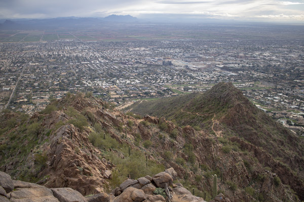
Camelback Mountain - Jan 23, 2023
While visiting Katie's family in Arizona, we decided to take some time to enjoy the outdoors since this is the only time of the year that you can be outside in Arizona without melting. With the temperatures in the mid 40's it could have been a little warmer, but that's still more than double the temperature that we're used to hiking in this time of year.
Katie picked the hike and it was a lot of fun. This hike packed A LOT of elevation gain in a very short distance, and that's apparent from the big caution sign at the beginning of the hike with two black diamonds on it with big bold letters saying that this is an "extremely difficult hike". But since we were hiking at a much lower elevation than we're used to, the hike seemed fairly easy considering what it was. We haven't done a lot of hiking near sea level, but it amazes me how much easier it is to catch your breath after doing a strenuous section. But the main reason that this hike was a lot of fun was because of the amount of rock scrambling that was required. The last half-mile to the summit we were using our hands in order to make it to the top. There aren't typically a lot of hikes in Colorado like that which made this hike extra fun. The worst part about this hike was the proximity to the city. We never really got far enough from the city where we couldn't hear city noises, but to be fair, this hike is right in the middle of Phoenix. But because of this, we got fantastic views of the city from the summit, which is a lot different than the views that we're used to getting at the summit. So I appreciated the different views than what I'm used to (let alone the cactus instead of the trees, which was cool too).
This hike has two different trailheads that one can start from. We started from the East side of the Cholla Trailhead because it was a little less elevation gain than starting on the West end. The hike to Camelback mountain from the Cholla Trailhead was also a little bit longer than the other trailhead, but that extra distance was probably better to spread out the elevation gain anyway.
Read More
| Location: | Arizona |
| Distance: | 3.08mi |
| Hiking Time: | 1 hour, 57 minutes |
| Elevation Gain: | 1,312ft |
| Max Elevation: | 2,618ft |
View Hiking Stats

Lake Haiyaha - Jan 14, 2023
Since last weekend's hike was a little bit of a bummer, we planned to go into Rocky Mountain National Park this weekend since hikes in Rocky never disappoint. But the only problem is that we've done just about all of them, well at least the ones that we can physically get to in the winter. I've wanted to hike to Lake Haiyaha again since the June 2022 rockslide that changed the color of the lake. Of course, since it's winter, I wasn't expecting to see much of the color since it's all frozen over, but the colors were still spectacular and well worth the grueling 6-mile hike. We didn't get very much of the green color that the lake had in the summer, but it was a gorgeous crisp blue that was more brilliant than ice we've seen at other alpine lakes.
We decided to make the hike longer than the 4-mile out and back as we did in early 2022. Instead, we made it a loop starting from the Bear Lake parking lot to Glacier Gorge, turning before branching off to the Loch to get up to Lake Haiyaha, then back down to Dream Lake, followed by Numph Lake, and finally ending our loop back at the Bear Lake parking lot. The hike started out on easy terrain with well-packed down snow since the Glacier Gorge trail is quite popular. But it was apparent that this particular loop isn't popular since the trail was nonexistent between The fork to the Loch and Lake Haiyaha. For that mile of the trail, we were completely on our own breaking trail. Equipped with COTrex on Katie's phone, we made it without wandering too far from the trail (but the map is quite funny to look at because of us squiggling back and forth around the trail in a few spots). Breaking trail isn't something I ever expected to do in Rocky Mountain National Park since it's such a popular place. But it was great to be on our own and away from all the people during that mile, even if it was extremely strenuous. By the time we were hiking back from Dream Lake, there were people everywhere you looked since that's the number one most popular trail in Rocky. That amount of people ruin the hiking experience, but we didn't care since we were physically and mentally done with the hike by that point and just trying to make it back to the car.
Read More
| Location: | Rocky Mountain National Park |
| Distance: | 5.97mi |
| Hiking Time: | 4 hours, 20 minutes |
| Elevation Gain: | 1,847ft |
| Max Elevation: | 10,379ft |
View Hiking Stats

Timberline Falls - Jan 8, 2023
We opted to do a more leisurely hike this weekend a hike with only 1,000 feet of elevation gain and almost 7 miles long. The length was a little more than what we would normally do for a leisurely hike, but wouldn't be something too difficult for us to do. Even though we've done much harder hikes than this, the hike to Timberline Falls from Camp Dick took a lot out of both of us and left us both completely exhausted, and neither of us knows why. Our best bet is because there weren't any good views along the way which usually fuels our excitement to push ourselves further. Sadly, though, the best view was near the parking lot since that was the only spot where we were far enough away to see the towering mountains in the distance.
Even though this hike didn't have any good sights and isn't one we'll be doing again anytime soon, it was good to get out and wander through the mountains for a few hours.
Read More
| Location: | |
| Distance: | 6.82mi |
| Hiking Time: | 2 hours, 42 minutes |
| Elevation Gain: | 958ft |
| Max Elevation: | 9,232ft |
View Hiking Stats

New Year's Day Hike - Jan 1, 2023
We started the new year doing what we do best, hiking. We've made it somewhat of a tradition to spend the New Year holiday up at Valley View Hot Springs, which we've done 3 times now. On one of the days that we were there, we drove an hour North to Buena Vista to hike in the Collegiate Peaks. The Collegiate Peaks have always been a place we've both wanted to hike but it's a long drive (over 3 hours) to any of the hikes from our house. The mountains we have in the Northern part of the state gradually build up to taller mountain ranges, but the Collegiate Peaks jump up high from the flat valleys between mountain ranges, which makes them a stunning mountain range.
We woke up at the hot springs, ate breakfast, and went on our way. Since it wasn't a normal morning getting ready for a hike (most of our gear was already pre-loaded in the car), I forgot one critical item; my camera. I realized it only a couple of minutes after we left, but it was too late since we had already left the hot springs premises, which are marked by a one-way gate during their closed hours. They wouldn't be open for another two hours for us to get back in. As the saying goes, the best camera is the one you have on you, so I used my camera phone on this hike. I haven't had to use my camera phone on a hike in nearly two years, and just like the last time, my phone camera doesn't even compare to what my DSLR can do.
The hike itself was a good hike to ring in the New Year. It was on the moderate side of our hiking level - so not too easy but also not too difficult. It started off with a small dusting of snow where we hardly even needed our microspikes. About a mile in, we threw on our snowshoes for traction, and by the time we made it to the second lake, we were trekking through 2 foot deep fresh powder making our own trail. There were only 2 other groups in front of us that broke the trail for us, but neither decided to make it all the way around the second lake. Feeling adventurous, we used up a great amount of energy hiking around the second lake which was absolutely worth the views. We found a spot on the lake to eat lunch and have a cup of tea (using a new hiking thermos Katie got for Christmas) in front of Mount Columbia and then made our way back to the trail.
Since it's the new year, we decided to make some New Year's resolutions, and just like last year, one of ours is hiking-related. We crushed our 2022 New Year's resolution of beating one of our hiking stats from 2021 in November, and for most of the last few months we've talked about making hiking a 14'er our 2023 New Year's resolution, but that's not what we landed on. With our wedding in late July, wedding reception in mid-August, and our Icelandic honeymoon in late August, there aren't that many weekends that we could hike a 14'er that would be in good 14'er hiking season. In order to not set ourselves up for failure, that will likely be our 2024 goal, but this year in 2023, here's our New Year's resolution:
2023 goal: Beat our all-time records for mileage, elevation gain, and time hiking by 15%.
| Current Record | Hike Achieved | Date Achieved | 2023 Goal | |
| Mileage | 11.18 Miles | Blue Lake | Sept. 4, 2022 | 12.86 Miles |
| Elevation Gain | 2,589 ft | Mount Ida | Oct. 17, 2022 | 2,977 ft |
| Time Hiking | 5hr, 47min, 42sec | Mount Ida | Oct. 17, 2022 | 6hr, 39min, 51sec |
Elevation gain sounds the easiest of all 3 of those goals. The hike we did today is about half of what we need to do to complete our new years resolution. I don't expect to beat all 3 of these records in one hike, and that's not part of our 2023 goal. In terms of my personal all time records, what's shown above are my personal records except for elevation gain which is a record of 3,973 ft back in 2018. I will absolutely not be beating that record by 15% this year.
Update:
This New Year's Resolution was completed on October 21, 20203 on our hike to Mirror Lake (completing the distance and time hiking portion of the 2023 goal) in conjunction with our hike to Spectical Lakes on September 16th, 2023 (completing the elevation gain portion of the 2023 goal).
Read More
| Location: | Collegiate Peaks |
| Distance: | 5.57mi |
| Hiking Time: | 3 hours, 43 minutes |
| Elevation Gain: | 1,680ft |
| Max Elevation: | 10,304ft |
View Hiking Stats
2022

Black Lake - Dec 18, 2022
We haven't had any snow over the past week but that didn't stop us from finding some snow that required snowshoes. With horrible winds during the week, I thought that there would be pent-up demand, so we got to the Glacier Gorge parking lot around 9 am to find it was only half-filled. Oh well, it was good to get this hike started early since it took us over 5 and a half hours to complete.
Looking at the stats for this hike you might think we're crazy for doing something like this, and I would agree with you. Neither Katie nor I thought this would be a double-digit hike (This is now the 3rd hike we've done over 10 miles), and we didn't think this would be as much elevation as it ended up being (multiple online resources suggested this would be around 1,600 feet of elevation gain, not 2,200). But the views were absolutely stunning at Black Lake and made the pain of hiking there and back worth it. We didn't see very many people during the hike, but the best part was that we had Black Lake all to ourselves.
It was windy during most of the hike, but neither of the lakes we visited were that breezy. That was great luck since most of the time the lakes are windier than the trails themselves, but I wasn't going to question what black magic sorcery made the lakes absent of wind.
We've done a couple of hard hikes in a row now, so I think next week we'll take it easy. There aren't many more hiking days between now and the end of the year, but that doesn't matter since we accomplished our hiking New Year's resolution last month.
Read More
| Location: | Rocky Mountain National Park |
| Distance: | 10.08mi |
| Hiking Time: | 5 hours, 31 minutes |
| Elevation Gain: | 2,156ft |
| Max Elevation: | 10,679ft |
View Hiking Stats
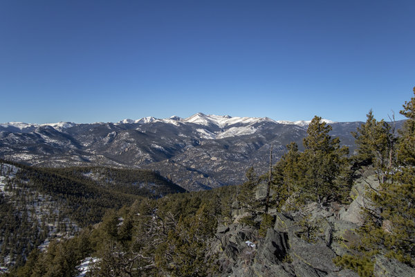
Crosier Mountain - Dec 11, 2022
We stayed a little closer to home this week for our hike. It was refreshing being able to only have to drive 45 minutes to get to the trailhead, but since we weren't in the high country the views were not nearly as great as if we had driven a few hours to get somewhere. But that's okay since being a little lower had two other advantages. First, we were hiking at a lower elevation which meant we could go a little longer between breaks because we didn't get winded nearly as quickly. Secondly, it was considerably warmer than the other hikes we have been doing. So warm that we were both hiking in just our t-shirts most of the way up.
This is the second time we've done Crosier Mountain. We first did this hike in 2020 starting from Glen Haven, so this time we started from the Gravel Pit trailhead which starts a little further East than the trailhead from Glen Haven. Looking back on the photos from the previous hike I think I liked the other trailhead better, but there are 3 trailheads to summit Crosier Mountain, so the next time we hike this in a few years we'll be doing it from the last trailhead. That trailhead is considerably harder than the other two, so that's why we saved that one for last...
The views were great at the top but it was incredibly windy. So windy that the gusts were causing us to lose our balance, which was quite dangerous with the dropoffs all around us. Because of this, we didn't stay very long at the summit before heading back down the trail and finding a different overlook that wasn't as gusty to eat our lunch.
Read More
| Location: | Glen Haven |
| Distance: | 7.53mi |
| Hiking Time: | 3 hours, 50 minutes |
| Elevation Gain: | 2,546ft |
| Max Elevation: | 9,260ft |
View Hiking Stats

Snowshoeing Montgomery Pass - Dec 4, 2022
This is the second time we've done this hike this year. Usually, we don't hike something twice a year unless it's one of the convenient trails near our house. This trail was not convenient to get to since it took almost 2 hours to get all the way up the Poudre Canyon and nearly all the way to Cameron's Pass, but it's a fantastic hike which is why we decided to do it again. This time we did the hike in the snow.
We first hiked to Montgomery Pass in early July when the weather was significantly different. In July, Montgomery Pass was peak wildflower season and that was the start of us becoming obsessed with finding alpine meadows filled with wildflowers. The top of the pass was still reminiscent of the wildflowers with dead flower seed pods sticking up over the snow on fragile dried-out stems. Montgomery Pass is our first snowshoe of the season, and we needed every bit of our snowshoes on this hike. With only one other group in front of us past the fork for the skiing bowl, we were taking steps and sinking a few feet with nearly every step (well I was, Katie had better luck). Because of this, our muscles fatigued quite quickly, something we weren't expecting on such an "easy" hike. This is an easy hike in the summertime, but it was difficult to snowshoe. But having to nearly break the trail made this snowshoe all that more exciting and truer to the reason we go out and adventure in the forest in the winter.
Other than the snow and lack of wildflowers, there were two more noticeable things that were different on this hike now versus in July. First, the State Park service had changed out the summit sign at the top of Montgomery pass. The old one was extremely weathered, but it was really cool. Now it's just a boring metal sign. Secondly, we saw Smoky the Bear at the Arrowhead Lodge Visitor Center. That visitor center has been closed as long as Katie and I can remember, so it was weird to see it finally open back up and to have such an honored guest waving at the cars driving by. We didn't stop to say hi, but they definitely got our attention, and was a completely unexpected sight to see.
We safely hiked this without any problems, just in time since an avalanche warning was posted after we got home for this area for the next few days. There definitely wasn't enough snow at the top of Montgomery Pass to be concerned, but with snow in the forecast (and a storm rolling in as we were finishing up the hike) I can see how this could be dangerous in the coming days. Maybe we should stick to hiking below the treeline for the remainder of the snowshoeing season.
Read More
| Location: | Camerons Pass |
| Distance: | 4.23mi |
| Hiking Time: | 2 hours, 47 minutes |
| Elevation Gain: | 1,198ft |
| Max Elevation: | 11,154ft |
View Hiking Stats

All the Sights Along the Way to Sky Pond - Nov 20, 2022
Our hike this week consisted of going to the Loch, a large sub-alpine lake in Rocky Mountain National Park. The Loch is a pretty easy (for us) hike that's only about 5.5 miles and 1,000 feet of elevation gain. But the trail doesn't end at the Loch, it continues on to Timberline Falls, then onto the Lake of Glass, and ends at Sky Pond. We made it to the Loch pretty quickly which is a gorgeous lake, but it was mostly in shade which wasn't as photogenic as I would have liked. After getting to the Loch and both of us feeling pretty good, we decided to continue on to Timberline Falls, which this time of year was completely frozen over. There were several groups of people ice climbing on the frozen waterfall which was cool to take a break while watching them. The next section of the tail was an incredibly dangerous ice scramble. We had to climb up the side of Timberline Falls which is a difficult rock scramble in the summertime, so it was nearly ice-climbing this time of year. With only having our microspikes, we were ill-prepared for what came next. We made it up with a bit of caution but the way back was quite trickier and it only added to the adventure when Katie slid down the 30-40ft "ice slide" at an alarming speed. But neither of us got hurt. This got us talking about wether or not they make mini ice axes (pocket-knife style) that could have helped in this kind of situation. But so far I haven't found such a product...
From the ice scramble we continued on to the Lake of Glass, which was by far the best lake of the hike. The sun was just in the right spot and the surrounding mountains were facing the right direction for the sun. The lake itself was completely frozen over, and as its name suggests, it was like walking on top of glass. The ice was crystal clear in some spots which was quite nerve-wracking to walk on top of. There were several places (on all of the lakes) where there were large cracks going through the ice from the ice moving around. It was in the cracked areas that you could see just how thick the sheet of ice was because there was a deep ribbon of white ice where the crack occurred. The ice on Lake of glass, as well as at the Loch and Sky Pond, were all well over a foot deep, but we still exercised some caution after Katie's mishap stepping through the ice at Lake Helene about a month earlier.
Leaving the Lake of Glass we continued on about a quarter-mile to Sky Pond. The trail to Sky Pond was less packed down which left us post-holing almost the entire way there. We definitely could have benefited from having snowshoes while getting to Sky Pond, but we didn't bring them with us since we weren't sure that we would make it that far (and definitely didn't need snowshoes for the rest of the hike). There was a group in front of us who had snowshoes tied to their backpacks and one of them made the comment to me that it's not worth it to put them on, which made us feel better that we didn't bring ours at all.
Sky Pond was quite windy (more so than the Loch and just barely more than at Lake of Glass). This is expected with winter hiking, which is why we didn't stop at Sky Pond for very long before heading back. We finally found a spot at the Lake of Glass to eat our lunch - burritos that we kept warm in a thermos in my pack. From there we scrambled down Timberline falls (nearly dying) and make it back to the Loch which was now completely in sun, but with the sun in the completely wrong spot to photograph... Oh well, it's still a gorgeous lake even if I can't photograph it well.
Overall, the hike was a little over 9 miles and 2,200 feet of elevation gain. This would have been a difficult hike in the summertime, but we decided to do it in the winter, which made it even harder. Despite the difficulty, we made it to the end of the hike with enthusiasm while seeing some fantastic sights along the way.
Read More
| Location: | Rocky Mountain National Park |
| Distance: | 9.21mi |
| Hiking Time: | 4 hours, 52 minutes |
| Elevation Gain: | 2,228ft |
| Max Elevation: | 10,749ft |
View Hiking Stats

Finch Lake - Nov 13, 2022
It's almost snowshoeing season! Well not really, but we've had some great snowfall here recently that makes it seems like it's snowshoeing season. We didn't need snowshoes for this hike to Finch Lake, but there were some areas where the snow was almost a foot deep and soft enough that we would fall right through it. The hike started from an unusual trailhead in a neighborhood rather than from the traditional Wild Basin trailhead area in Allenspark. We choose this trailhead because it made the hike about a mile shorter, which was great for me since I was tired from being on my feet all day on the previous day. Even with that shortcut, this hike was still pretty killer for me and probably a little more than I should have done, but I made it all the way there and back (with lots of complaining - just ask Katie).
But before we started the hike, we had to find a parking spot. Several hiking apps warned us that there were a lot of strict no parking signs around the trailhead, so we carefully looked around when we got there and decided on a parking spot. We drove onto the shoulder of the dirt road and onto untouched snow when the car quickly fell into a ditch. We spent about 20 minutes using a small shovel Katie had in her car and her slipping with her wheels on the ground before we finally got out of the ditch and parked somewhere flatter.
I like photographing summer hikes a lot better than winter hikes. The snow coverage often makes the photos look a less detailed and overly bright, so that's the main reason why there aren't many photos in this blog post. That combined with me being generally low on energy meant that I didn't take my camera out very many times. But the snow is my reality for hikes (or snowshoeing) for the next 5-ish months, so I need to start switching my mindset to be able to capture the beauty of snowy hikes.
Read More
| Location: | Allenspark |
| Distance: | 7.82mi |
| Hiking Time: | 4 hours, 30 minutes |
| Elevation Gain: | 1,644ft |
| Max Elevation: | 10,073ft |
View Hiking Stats

Estes Cone - Nov 6, 2022
Finally, some snow has hit the ground and it feels like winter. Winter hiking is pretty great, mostly because you sweat way less and there are fewer crowds. There were so few people on this hike to Estes Cone that we had to break the trail in the snow for the last half-mile to the summit after passing some out-of-towners that were doing it before we passed them. We unintentionally made them feel bad and slow when they asked us what time we started - Don't worry Washingtonians, this is a hard hike for even Coloradans. The snow was pretty light in some areas and knee-high in others, and combined with the rocky terrain, each step forward was a gamble on how far down you'd step. Maybe you would sink in 2 feet deep, or possibly land on a rock and twist your ankle, or hopefully the ground was flat and right under a thin layer of snow. The latter didn't happen very frequently. Because of those gambles, the stats for this hike are as follows:
| Fall Count (Katie): | 5 (which averages out to less than once per mile!) |
| Fall Count (Noah): | 1 (butt didn't touch the ground, so I'm not sure it counts) |
| Bruised Knees (Katie): | 2/2 (Both of them! Ouch!!) |
| Bruised Knees (Noah): | 0/2 |
The day started with us driving into Rocky to try and park at Glacier Gorge to hike to Sky Pond. We got about half-way up the Bear Lake road when we saw the road was unexpectedly closed. RMNP is usually pretty good about posting road closures on their Twitter, which we checked when we had reception in Estes some 20 minutes prior and hadn't seen any notice of this particular closure yet. The ranger's best guess for when the road would reopen was going to be about 3 hours, so we quickly changed our plans and headed out of the park to get to the Longs Peak parking lot to do the hike to Estes Cone. On our way out, I got the Tweet notification that the road was closed - thanks for the late notice, RMNP... Then some 10 minutes later, I got another Tweet notification that the road was back open (so not the 3 hours that the ranger thought). I know the rangers and staff at RMNP are doing the best they can and isn't their fault, but this started our hiking adventure on a little bit of a sour note.
It's probably good we didn't do Sky Pond anyway since it's above treeline. There was a winter storm rolling over the mountains while we were hiking, and we hiked while it was snowing for most of the trip. Doing any hiking above treeline would have been absolutely miserable with the snow and wind. There were decent views up at the top of Estes Cone, but again, because of the storms, there wasn't that great of visibility and the wind didn't make for a good place to stop to eat lunch. The one good thing that I can say about this hike (other than the lack of people) is that it pushed our stats over the threshold for us to say that we've completed our New Years' Resolution. At the end of this hike, we have done 32,530 feet of elevation gain year-to-date, surpassing last year's 32,312 feet. We're only about 4 miles and 5 hours short of beating our mileage and hiking time stats from last year as well. We will definitely exceed those this year as well, but our New Years' resolution was to beat just one of our hiking stats from last year. Mission accomplished, now we can relax on our weekends instead and not have to hike at all the rest of the year, right?
Read More
| Location: | Rocky Mountain National Park |
| Distance: | 6.38mi |
| Hiking Time: | 4 hours, 16 minutes |
| Elevation Gain: | 2,116ft |
| Max Elevation: | 10,910ft |
View Hiking Stats

Hiking Through Rocky - Oct 30, 2022
The weather this weekend was forecasted to be gorgeous in the mountains. And it was. The shuttles in Rocky Mountain National Park still run during the weekends in October (weather permitting), so we used that to our advantage which takes a lot of pressure off knowing if you'll get a parking spot at the exact trailhead that you want to do. We started our adventures by being the first car to park at the park-and-ride and hitching a ride on the shuttle up to Bear Lake. A ranger at the park-and-ride told us that there was still parking at Bear Lake trailhead, but we were planning a different kind of hike where we actually didn't want to park at Bear Lake, despite starting our hike there.
We parked at the park-and-ride because we ended our hike in Moraine Park. There is no shuttle that goes from Moraine park to Bear Lake, but both shuttles do go to the park-and-ride, so that's why we parked there. Because of the shuttle service, we were able to hike 10 miles across Rocky Mountain National Park without having to track back on the trails we hiked up, and we ended our hike in a completely different area than where we started. The hike started with slick ice, fresh snow, and cold weather. The hike ended with no snow in sight and us not wearing any of our layers other than our base clothing. We were well prepared for all of those conditions, which was good, but it was neat to have that varying degree (pun intended) of nature during our hike. We were also able to shave off strenuous elevation gain by making this a one-way trip instead of an out-and-back, only having to do 1,200 feet of elevation gain but almost 3,000 feet of decent. All of those things combined made this a pretty spectacular hike.
Our hike started at the Bear Lake trailhead where we went counter-clockwise around the lake. Bear Lake is always busy, but most people start their hike by going clockwise, so almost immediately we were hiking in what felt like a secluded area with few people which was great since we go into the mountains to be away from people anyway. From Bear Lake, we hiked up 1,200 feet in elevation to Lake Helene, which marked the high point of the hike. From there, we hiked down to Odessa Lake. This is where most people turn around and hike back up to Lake Helene and back to Bear Lake. But we continued on descending to Fern Lake, then down to Fern Falls, and concluded through Moraine Park where we hitched a ride from the Fern Lake Shuttle stop back to the park-and-ride.
The only downside to the shuttle service is that if you are planning to use them, you better make it back on at least the last bus. This added a little pressure to the hike, even though we still had plenty of time when we finished the hike to catch a ride. But because of this time constraint, we were constantly looking at the time to make sure we were on track to not get stranded in Rocky. Not only that, but the busses leave Fern Lake Trailhead (where we finished) once every hour, so at the end of the hike we pushed ourselves a little harder than we should have to make sure we didn't miss the bus and have to wait around for an hour. Our hustling got us to the bus stop 5 minutes before its scheduled departure (and 2-hours and five minutes before the final departure). I am still glad we hiked the end quickly to make sure we got on that bus rather than taking it easy and having to wait an hour for the next one.
Only because it turned out OK I have to point out that Katie went for an accidental swim in Lake Helene. We had no idea that we were walking on thin ice when her foot went right through the ice into the lake. Her foot got soaking wet. She trekked onward with squishy socks for the remaining 6+ miles even though it would have been quicker to turn around. This marks an important lesson in carrying some spare socks, particularly as the weather gets colder and hiking (or snowshoeing) turns from something you can get by being relatively ill-prepared to something that could be life-threatening in the wrong environment.
Read More
| Location: | Rocky Mountain National Park |
| Distance: | 10.11mi |
| Hiking Time: | 4 hours, 45 minutes |
| Elevation Gain: | 1,365ft |
| Max Elevation: | 10,614ft |
View Hiking Stats

Perfect Weather on Mount Ida - Oct 17, 2022
We got fortunate with the weather hiking to the top of Mount Ida. There wasn't a single cloud in the sky and considering this hike is mostly above treeline, the wind was minimal. The last time I hiked Mount Ida I remember it being so incredibly windy at the top with nasty storms rolling in (which is the last thing you want when you're on one of the highest peaks around and above treeline). So we were pleasantly surprised when we reached the summit and the sun was out without a single cloud in the sky and almost nonexistent wind. We came prepared for colder weather than this, with both of us bringing two jackets. Both jackets ended up being taken off quickly in the hike and were a little annoying to have to carry around, but it's better to be prepared than to be underprepared.
The hike started a little later in the day than we were hoping. We didn't leave the house until almost 10 am, and it took almost 2 hours to get up to Estes Park, into Rocky, and over the continental divide to the trailhead. The Trailhead for this hike is closer to the West-side of Rocky, which was apparent since we could see Lake Grandby from the summit. Because we got to the trailhead around noon, there wasn't very much parking. We had to park about a quarter-mile down the road from the trailhead which pushed this hike to be over 10-miles long, the second double-digit hike I've ever done. Even though we got started later than we wanted to, this almost 6 hour hike was completed before the sun went down and since we weren't fighting the weather, getting started that late didn't matter.
This was a very challenging hike. Although it's not the longest hike we've done together, it is the most elevation gain we've done. Combining the elevation gain of 2,600ft with the 10.5 miles of hiking and we were both completely exhausted by the end of the hike. The altitude also didn't help, since we hiked to almost 13,000 feet where there isn't very much oxygen. But we made it and the absolutely stunning summit was worth the pain.
Read More
| Location: | Rocky Mountain National Park |
| Distance: | 10.45mi |
| Hiking Time: | 5 hours, 47 minutes |
| Elevation Gain: | 2,589ft |
| Max Elevation: | 12,830ft |
View Hiking Stats

Leaf Peeping in Nederland - Oct 2, 2022
It's the first weekend in October, which means that this might be the last weekend to see fall colors in the mountains. There will still be plenty of colors down in the foothills, but not the same kinds of colors that we get in the mountains. Primarily I'm talking about the Aspen trees which can grow in thick groves in the mountains and turn a vibrant yellow color. Fall colors seemed to be a little late this year, so there's a chance that the colors could be good next weekend, but we have plants that will keep us out of the mountains next weekend, and the colors will surely be gone the weekend after.
This is our second "hike" this weekend, which is rare. I put hike in quotes since neither of the trails we were on this weekend were very difficult. Our barometer for if something should be considered a hike is usually that it needs to be over 1,000 feet in elevation gain, but that isn't fair for snowshoeing where a moderately difficult hike might only be 800 feet in elevation gain. But I digress - with fall colors not lasting very long, we knew we had to go out to try and find some rich Aspen groves. Yesterday we found fall colors past their peak; today, we found fall colors not quite at their peak. It's so odd that the colors change in different areas (even though yesterday and today we were at similar elevations), but not knowing what the aspens will be like helps in the adventure of trying to find the perfect colors.
This hike started off with someone telling us there was a bull nose not too far from the start of the trail. This got us quite excited, but we never saw it. The temperature was about right for a moose sighting, but we figured it was probably too busy to see one. Then just a few minutes from our car at the end of the hike another group warned us that the moose was still roaming around. We extended our hike a little bit to try and find it, but the moose didn't want to be seen by us. We've seen plenty of moose this season, but it would have been really cool to capture one in the aspens. Maybe next year...
Read More
| Location: | Nederland |
| Distance: | 3.69mi |
| Hiking Time: | 1 hour, 57 minutes |
| Elevation Gain: | 331ft |
| Max Elevation: | 8,826ft |
View Hiking Stats

Twin Lake Reservoir - Oct 1, 2022
Fall Colors have finally hit Colorado. We were a little early for fall colors in Rocky Mountain National Park last weekend and just a little too late this weekend in Pingree Park. Since fall colors tend to change first in the North, it's no surprise that Pingree Park was already past its peak, but it gave us some rich and deep oranges that you don't get until the trees are starting to die. But since the colors in Northern Colorado were starting to fade we'll try for somewhere South in central Colorado tomorrow. There is still plenty of color out there, we just have to find it.
Pingree Park is a lesser-known gem that's filled with Aspen trees. Since the area was burned in the High Park Fire in 2012 the area has had a little bit of time to recover. The first trees that sprout up from a burned area are usually aspens, and since it's been a decade since the fire there are a lot of new aspens growing everywhere.
Both times (July 2021 & June 2022) that we've hiked in this area I've noted the amount of aspens. Ever since doing those hikes, I've wanted to come back to this area for fall colors. We didn't do much for fall colors in Colorado last year because we had our East coast fall colors trip planned, so this was the first year since I've noticed those aspens that I wanted to take photos of the changing aspens. The area definitely didn't disappoint and this is absolutely on my list for years to come for fall colors.
Read More
| Location: | Pingree Park |
| Distance: | 3.13mi |
| Hiking Time: | 2 hours, 21 minutes |
| Elevation Gain: | 518ft |
| Max Elevation: | 9,427ft |
View Hiking Stats

A Little Bit of Fall - Sep 25, 2022
We had a busy weekend, but that didn't stop us from getting into the mountains, particularly since it's getting that time of year when the colors are changing. The colors change fast in Colorado, so we knew we needed to take any opportunity we had to get into the mountains to try and enjoy it while it lasts. With Katie working Saturday and us attending a birthday party in the early afternoon on Sunday, our only option was to get up into the mountains before sunset, which at this time of year is starting to be early.
Timed entry is still required in Rocky Mountain National Park for a couple more weeks, but it had been a while since we last made it into the park. We try and avoid the busy summer with all the tourists, but now that people aren't taking summer vacations, the park should be a little less crowded. We didn't quite know where we were going to hike when we were driving up to Estes Park. We had a reservation to get into Rocky at 4, but because of the time constraints before the sun went down we knew we weren't going to do anything serious. We ended up picking Bierstadt Lake based on the views that we got earlier in the year when we snowshoed this same trail. Bierstadt lake is a quick 2.5 mile trail with very minimal elevation gain, but the hike is along an exposed mountain face that gives great views of the Bear Lake corridor. The hike didn't disappoint, the first half-mile we were hiking through thick aspen groves, and the remaining half mile to the lake we had unobstructed views of the surrounding mountains. The sun was setting towards the direction that we wanted to shoot, so this hike may have been better as an early morning hike instead, but we made due and ended up with some pretty good sun flare photos. One thing I always forget about in the mountains is that there really isn't golden hour because the sun doesn't get low enough. By the time the sun sets behind a tall peak next to you, the sun is still pretty high in the sky. But that's okay since all of these plans were somewhat last minute anyway.
We were a little early for fall colors this year, but we knew that heading up to Rocky. The colors were predicted to be early this year because of the massive amounts of rain that we got in the late summer, but I think peak colors in Rocky Mountain National Park will actually be next weekend, which aligns better with when peak colors usually hit the Colorado mountains (which is the last weekend in September or the first weekend in October). Despite most of the aspens still being green, we did find several golden aspen trees that made for some great fall colors hunting. Next weekend will be even better.
Read More
| Location: | Rocky Mountain National Park |
| Distance: | 2.51mi |
| Hiking Time: | 1 hour, 53 minutes |
| Elevation Gain: | 610ft |
| Max Elevation: | 9,430ft |
View Hiking Stats

Browns Lake - Sep 18, 2022
We did a moderately difficult hike today in the Pingree Park area. Unknown to us, there was a marathon happening that went on the road we take to get up the Poudre Canyon, but even with that delay, we made it to the trailhead in under 2 hours. We had a lazy start to our morning and didn't leave the house until around 9:30, but we didn't need to rush out of the house because the weather was forecasted to be pretty nice during the hike. The weather was forecasted to barely hit the 70's, but we neglected to realize that the forecast was for a few thousand feet lower in elevation than where we were starting. When we got to the trailhead it was a breezy 56 degrees which was a little too chilly for the start of the hike. Once we started hiking, the cooler temperatures and the breeze were wonderful.
This area was recently burned in the 2020 Cameron's Peak fire, and there were several times when we walked right through a post-apocalyptic burnet forest with even black soot covering parts of the trail. Every time we hike through a burn area it's a little different in scenery, and this one looked pretty spooky. Halloween is right around the corner, so I guess this hike was helping us get into the Fall spirit!
Luckily we weren't walking through the burned area the entire time, we walked in and out of it for the first half of the hike. Then we got above treeline and there wasn't any indication of any burn scars up there, mostly because there isn't a lot to burn. But above the tree line we were very exposed and the wind was blowing hard. Luckily there wasn't a single could in the sky, so we didn't have to worry about the weather while being so exposed, but it didn't make for a very pleasant hike. This area was probably absolutely stunning during wildflower season. Typically above tree line, there are rocky mountains in every direction, but near Crown Point it was mostly open meadows. I would love to do this hike again in mid-summer to see what the wildflowers are like.
This hike is a little different than what we're used to doing in the fact that we first hiked up to Crown Point, then hiked down to Brown's Lake. It was nice to spread out all 2,000ft of elevation gain between getting to the lake and getting back to the car, but the way back was pretty brutal because we're not used to having to do ascent on the way back to the car. When you're hiking to a destination you have some adrenaline that helps you with the ascent. There wasn't that kind of adrenaline on the way back, so having to do an additional 1,000 feet of elevation gain on the way back took all of our energy. Because of this, coupled with the sub-par views during the hike makes me rate this as below-average views for the effort.
Read More
| Location: | Pingree Park |
| Distance: | 8.79mi |
| Hiking Time: | 4 hours, 38 minutes |
| Elevation Gain: | 2,037ft |
| Max Elevation: | 11,316ft |
View Hiking Stats

Roosevelt Ridge - Sep 11, 2022
We opted for an easier hike this weekend because the new COVID booster was messing with Katie's energy level. She was pretty weak the day after the shot (Saturday) but seemed to have most of her energy by Sunday morning. Saturday was pretty rainy and cold anyway, so Sunday was the better day to hike. I get my shot next weekend, we'll see if we hike something hard next Sunday or not.
Roosevelt Ridge was a pretty easy hike that started just outside of Estes Park. We only had to drive 45 minutes to the trailhead which was a nice change of pace from the 1.5 hour dives we've been doing in past weekends. The hike started at a pretty low elevation, which usually means a warmer hike, but because of the cool weather the day before, the weather remained pretty cool throughout the short hike. It was in the mid-50s when we started hiking around 11 am and barely got into the 70s by the end of the hike around noon.
The trail ends about 3/4 of a mile into the hike, but there was a primitive trail that took us to the top of Roosevelt Ridge. There were many times that we weren't sure where we were going, but there were lots of cairn rock sculptures that guided us when we got lost. It wasn't that hard to figure it out if we did get off the trail since we could see where we were headed the majority of the way.
Read More
| Location: | Rosevelt National Forest |
| Distance: | 2.6mi |
| Hiking Time: | 1 hour, 31 minutes |
| Elevation Gain: | 830ft |
| Max Elevation: | 7,917ft |
View Hiking Stats

Double-Digit Mileage Hike - Sep 4, 2022
We finally did it. We hiked double-digit mileage, something neither of us has ever done. We tried to do this hike a few weekends ago but the weather didn't hold out of us, so we put off this hike until Labor Day weekend instead. The day started out with us realizing that our hiking clothes weren't clean because we hadn't done laundry this weekend yet. I'm not sure how this isn't more of a problem since we often hike on the first day of the weekend, but we quickly remedied this problem by washing the clothes by hand and throwing them into the dryer while we got ready. A little while later we loaded up Katie's car and hopped in, already leaving later than we wanted while we waited for the clothes to mostly dry. After Katie put her key in the ignition, we realized our hike would be delayed even further since her car didn't start... 30 minutes later and some quick diagnostics with a multimeter and repairs using baking soda, water, and a toothbrush, we got the battery terminal cleaned off and the car started right up. Although frustrating since we had somewhere to go, having this happen on a weekend when I could actually fix it is preferred over her trying to start her car on a workday since I always leave for work before her. We planned to leave the house around 8:30 for this hike but actually ended up leaving more than an hour late and got to the trailhead at 11. But at least our hiking plans weren't completely thwarted.
Today was an odd day for weather over the Cameron's Peak area - zero chance of rain. Usually, this is a good thing, particularly since we were doing such a lengthy hike, but the weather was also forecasted to hit the mid 70's right in the middle of our hike. We hiked directly through the Cameron's Peak burn scar area so we knew we were in for sunny trails with no shade, and we wouldn't get any help from the clouds with that zero percent chance for rain in the forecast. The burn scar area wasn't all that nice to hike through because of the lack of shade and because there isn't a lot of interest in that type of scenery. We did see some cool mushrooms and some neat patterns on burnt trees that we'd never seen before, but overall it was just hot and uncomfortable almost the whole way to the lake. About a mile from the lake we left the burn scar and that's when we really started enjoying the hike.
We were a few hundred feet above the lake when the lake came into view on the hike which gave us a fantastic aerial view of the lake before descending to it. This view made hiking through the burn scar and the heat worth it. The 5+ mile hike to the lake took us about two and a half hours and about two hours to get back. We were at the lake for about an hour for a total hiking time of almost five and a half hours for this 11-mile hike. Overall the views were good enough that we weren't disappointed, but we've had much better experiences hiking in other areas and we feel like a hike with this much effort (distance) should have better views during the majority of the hike. Because of this, I don't think we will come back to hike anytime soon.
One of our New Year resolutions was to beat one of our hiking stats that we did last year. Since we're now back on track, I don't feel quite as bad restating how we're doing, and I really felt like I owed posting an update since the last time I posted about these goals was February. Below is our hiking stats from last year, which can be found on the hiking page.
| Hike Count | Distance | Hiking Time | Elevation Gain |
|---|---|---|---|
| 45 | 154.8 miles | 85hr 56min | 32,312 feet |
| Last years hiking stats (2021) | |||
Here's our current year to date statistics:
| Hike Count | Distance | Hiking Time | Elevation Gain |
|---|---|---|---|
| 19 | 102.93 miles | 54hr 8min | 22,134 feet |
| Year to date hiking stats (Through Labor Day) | |||
We just started the month of September which as of September 4th is 68% of the way through 2022. If I compare 2021 to 2022, you can see (below) that we're above 68% only for elevation gain - but that's all that matters since our New Year resolution is to just beat one of our statistics from last year (although this year is far from over).
| Hike Count | Distance | Hiking Time | Elevation Gain |
|---|---|---|---|
| 42.2% | 66.5% | 63.0% | 68.5% |
| 2022 progress benchmarked against 2021 as the goal. | |||
To no surprise, we're far behind in the number of hikes, but we knew we wouldn't come anywhere close to surpassing our 45 hikes from last year since last year we had two hiking trips planned. We're not that far off from being on track for total distance which we're only 1.8 miles behind where we should be at this point in the year comparing ourselves to our 2021 selves. We're 4 hours behind on hiking time, but I would consider us being behind where we were at last year a good thing as long as we meet or exceed what we did in distance last year (because that means we hiked at a faster pace).
Read More
| Location: | Cameron's Peak |
| Distance: | 11.18mi |
| Hiking Time: | 5 hours, 19 minutes |
| Elevation Gain: | 1,850ft |
| Max Elevation: | 10,747ft |
View Hiking Stats

Mestaa'ehehe Mountain - Aug 28, 2022
We had a pretty busy weekend between going to yoga on Saturday morning, Participating in breaking a world record, Cirque Du Soleil on Saturday afternoon, this hike on Sunday morning/afternoon, and then engagement photos on Sunday evening. However, we still wanted to get out of the house to enjoy the mountains. Because we had lots of things going on, we picked a pretty quick hike that was supposed to be a little over 4 miles but ended up being just over 3. Mestaa'ehehe Mountain is in the I-70 corridor, a place we haven't hiked before. Just outside of Idaho Springs in the Mount Evans Wilderness area, Mestaa'ehehe Mountain has a fire tower at the top that people can rent out. No one was in the fire tower when we summited, but we were able to get up on the observation deck which was pretty neat. A little bit to the North from the fire tower there are some large cellphone towers and another area that we hiked to in order to get panoramic views looking North towards the Indian Peaks mountain range.
The hike was different than the typical hikes we've been doing. We usually don't venture this far South for hiking, and because of that, the mountain range was a little different than what we're used to. The most notable difference is that the Mount Evans area has much denser and taller trees. I'm guessing that area is a little bit older and hasn't been burned by a forest fire in quite some time (maybe because of people on watch at the Mestaa'ehehe fire tower), but it was interesting to hike in a different area of Colorado.
Read More
| Location: | Mount Evans Wilderness |
| Distance: | 3.13mi |
| Hiking Time: | 1 hour, 33 minutes |
| Elevation Gain: | 771ft |
| Max Elevation: | 11,470ft |
View Hiking Stats

Triangle Mountain - Aug 21, 2022
We have been on a roll for doing challenging hikes, and our plans for this weekend were no different. We had our first double-digit mileage hike planned up near Camerons Peak, but after doing a quick weather check before heading out we realized that there were life-threatening flood warnings issued in that area for the early afternoon. Deciding that was a little too risky, we decided to pivot and hike Triangle Mountain which has always been daunting for us. Triangle Mountain is a daunting hike because of how steep it is. It's only 3 miles round trip, but in the 1.5 miles to the summit, there is almost 1,300 feet of elevation gain. Even though the area that this hike was in was also supposed to get some afternoon thunderstorms, it was a lot less risky because we would have never been too far from the car and because it's less than an hour drive to get to the hike. Because the hike was so short and it was quick to drive to, we were back home before noon - something that's never happened before.
Looking back on it, this isn't the steepest hike that we've done, so I'm not sure why it's been so daunting to us. This hike has almost the exact same steepness as Green mountain, around 400 vertical feet per mile, which we hiked in the winter (which is more difficult to hike because of the danger of slipping). I've also done 3 other hikes that were steeper than this, Lilly Mountain with 443 vertical feet per mile, and then of course the two 14'ers that I've done are at the top of the list with averages of 840 vertical feet per mile for Mt. Sherman, and 550 vertical feet per mile for Democrat, Cameron, Lincoln, and Bross
This still proved to be a really challenging hike, despite it only taking a little over two hours to complete. We're not used to such steepness in our hikes and that made it a little bit unpleasant. We also weren't very high up (around 9,000 feet) so it was a little warmer than I would have liked it to be. There were some great views of the surrounding mountains, but with the sun pretty high in the sky most of the mountains were washed out. We've been hiking in such nice alpine areas lately that these views just didn't do it for us. But overall it was nice to get out and get some exercise, even if it's not a hike that we would probably do again.
The best part of this hike was that we were completely alone. Every other hike I've done there has been at least one other group of people on the trail at some point, but today we had Triangle Mountain all to ourselves. It's not a very popular hike because of the steepness and short distance, but I would have thought we would see at least one other group at some point because of how close it is to Loveland. But I won't complain about that, having a trail all to yourself is a pretty special treat, one I've been chasing for quite some time that I'm now glad to have accomplished.
Read More
| Location: | Glen Haven |
| Distance: | 3.16mi |
| Hiking Time: | 2 hours, 19 minutes |
| Elevation Gain: | 1,263ft |
| Max Elevation: | 8,348ft |
View Hiking Stats

Hiking into Rocky Mountain National Park - Aug 6, 2022
I guess we didn't endure enough pain from pushing ourselves to the limits on our last hike since this weekend we decided to set a record for the longest distance that we've ever done together. We were in a much better mindset for this hike since we went into it knowing that it would be around 9 miles and 1,800 feet of elevation gain, and I think that made the hike easier in some ways, but we were still completely exhausted and dead by the end of the 4-and-a-half hour hike. Considering this hike was just a little bit longer in distance but just a little bit less elevation gain (1,800ft versus 2,000 feet), I'm pretty proud that we shaved off an hour of hiking from the hike to Diamond Lake.
On the hike up, the highlight was definitely seeing several moose. I saw 3 moose on this hike, first a cow and a baby, and then later a bull moose. Katie saw a fourth moose, a cow, but it ran behind some trees before I could see it. This brings my year-to-date moose sighting to 7 (up 350% from last year!) with plenty of time for us to spot some more before the end of the year. We came around a corner with a bull moose dangerously a few hundred feet up the mountain from us, and Katie didn't even see it. I managed to tell her to stop while I got a few shots of the bull moose's head before it started wandering off. That bull moose definitely didn't like that we were there, but it's lucky for us that he wasn't feeling aggressive and instead wandered into a denser area of trees. I wasn't sure we would see any moose on this hike since the hike started so late in the morning, around 10 am, and moose tend to be out early during the times of cooler weather. But luckily for us, since this hike started at 10,000 feet, it was a cool 60 degrees when we started the hike and it only rose about 10 degrees during the entire hike. That 10 degree differential was enough for no moose to be out on our return back from our summit, but we got to see some which is more than I could have asked for.
Once we got above the treeline - about half way up to the summit - the chance of seeing moose drastically decreased. Shortly after hiking above the tree line, we made it to the first small lake, Michigan Lake (not to be confused with Lake Michigan which is easily 10,000 times larger than the Michigan Lake we came across). At the lake, we forked towards Thunder Pass with the alternative route to continue on to Snow Lake. With the sun pretty high in the sky, the views at Snow Lake would have been washed out, and the reviews of Thunder Pass included panoramic views that we wanted to see. Thunder Pass is the border between State Forest State Park and Rocky Mountain National Park, so once we got to the pass the views opened up and we could see a great deal more looking South into Rocky Mountain National Park. There was a sign marking the boundary, and we crossed over to the Rocky Mountain National Park side to be able to say that we were in Rocky Mountain National Park without paying any fees or having a timed entry permit (although that's not 100% true since it was a $9 fee to get into State Forest State Park). The panoramic views were exceptional and we knew we made the right choice by going to Thunder Pass instead of Snow Lake.
On the way back we humored ourselves that we could do the quick hike to Snow Lake. That idea was quickly squashed when we had to go up a very slight incline that wasn't more than 20 feet of ascent. With our muscles protesting, we knew we should head back. Maybe someday we'll get a double-digit (10+ miles) hike in. We were only 3/4 mile from achieving that today, but we'll save that record for another hike.
Read More
| Location: | State Forest State Park |
| Distance: | 9.28mi |
| Hiking Time: | 4 hours, 27 minutes |
| Elevation Gain: | 1,880ft |
| Max Elevation: | 11,383ft |
View Hiking Stats

Pushed to Our Limits - Jul 17, 2022
We set out to do a pretty moderate hike for our level: a 5 miles, 1,200-foot elevation gain hike to Diamond Lake. We made it to our destination but decided to keep hiking to the upper Diamond Lake based on a recommendation from some other hikers at the (lower) Diamond Lake. They told us that it was worth at least hiking up to see the wildflowers halfway to the next lake, so we continued on the hike. What was planned to be an extra mile to see the flowers turned into us hiking all the way to the Upper Diamond Lake which nearly doubled the mileage and elevation gain from the (lower) Diamond Lake.
Our day started out like any other hiking day - waking up somewhat early and heading to the trailhead. We left by 8:30 and started on the 2-hour trip to the 4th of July Trailhead just outside of Eldora. We had no idea to expect the road to be closed at Nederland Highschool, and we were told the parking lot was full. However, we were told we could wait in line for parking spots that become available as hikers left. Thinking that there would be a wave of early-morning hikers finishing up around now, we decided to get in line. It was around 10 am, and we waited about a half-hour for the 5 cars in front of us to be allowed up to the trailhead before we were allowed to drive up as well. We got to the trailhead much later than we expected - around 11:30 - but I can't complain since we got a parking spot. Overall, that was one of the best parking experiences I've ever had when parking at an incredibly busy trailhead.
It's not often that our hikes take up the entire day. We typically have some time in the evening to do some chores or relax a little bit. And because of this, we had many other plans for our afternoon and evening other than just this hike, but since this hike was a 2 hours drive each way (plus waiting for a parking spot) and hiking for nearly 6 hours, this took up the entire day with us not getting home until 7:30.
So far, I've only complained about this hike. Obviously, if this hike wasn't that great we wouldn't have continued on from the first lake. The weather was a little warm in the 70s but overall that's pretty acceptable for a hike in mid-July. Besides seeing 4 alpine lakes on this hike, we also saw quite a variety of wildflowers flourishing everywhere. It's not really wildflower season anymore so it was nice to see this many wildflowers on a hike. In addition, we saw many cascades and waterfalls much larger than anything we've ever seen in Colorado before. There aren't many waterfalls in Colorado, so to have gotten to see so many - including hiking across one - made this hike pretty special. Additionally, the hike wasn't all that bust considering that we had to wait for parking. We same a few other groups of people from the trailhead to the first lake, but then we saw almost no one beyond that. This is important to how much we like a hike because we hike to get away from people. So this hike checked all of our boxes and then some. There are other hikes in this area that we definitely want to come back and do, but there's a pretty large barrier with the parking situation that we might wait a little bit before attempting another in this area.
Because of how difficult this hike felt, I decided to pull some statistics about our hiking, as well as, my all-time statistics. Comparing this hike to other hikes, I found the following:
- Katie and I have only done 2 other hikes with more elevation gain than this one (Gray Rock: 2,421ft and Crosier Mountain: 2,162ft).
- This is the second longest mileage that Katie and I have ever done during a single hike, only second by a mere 100 feet (0.02mi) to Button Rock Mountain.
- This is the longest time we've spent hiking before.
I'm not quite sure that this being our longest hike is a good thing. That mostly shows that we were slower today than some of the other similar distance and elevation gain hikes. But even If I look at my all-time records, this hike still fairs pretty well as one of the hardest hikes I've ever done:
- 12th for elevation gain.
- 4th for distance.
- 2nd for time.
Although apparently, I've done quite a few more hikes with lots more elevation gain in my life than this one. But it's still impressive based on distance and time.
Read More
| Location: | Nederland |
| Distance: | 9.15mi |
| Hiking Time: | 5 hours, 41 minutes |
| Elevation Gain: | 1,955ft |
| Max Elevation: | 11,397ft |
View Hiking Stats

Montgomery Pass - Jul 4, 2022
We tried to go camping this weekend but were thwarted twice. Both Katie and I had a 3-day weekend with the 4th of July on a Monday this year so it was a great opportunity to get out and camp. Trying to take advantage of the 3-day weekend, we booked a small yurt outside of Georgetown to do some glamping. We haven't done too much hiking in the I-70 corridor, so we thought this would be a good home base to get out and explore the area. This would have been our first time going glamping, but due to too many guests prior to our arrival lighting illegal campfires, the fire marshal shut down their Airbnb operation a week before our stay.
We got a refund for the Airbnb and started planning where we would go camp instead. We really wanted to camp in that same area, but since we live in Fort Collins, it would take us longer to get to that area than people coming from Denver, and we didn't want to risk getting to that area and having no place to camp, particularly since it was a holiday weekend. So we planned on going the opposite direction and looked in Routt National Park on the Wyoming side. This was still a 3-hour drive but isn't very close to any major cities. We made our plans and started getting excited when Thor (one of our 3 cats) started getting sick...
Thor finally started feeling better on Saturday morning, but because of everything going on with him, we decided to just stay in town so we could keep an eye out to make sure his recovery continued. He finally started acting like a normal cat again by Monday, but his condition wasn't worth risking being out of cell reception camping all weekend and the pet sitter needing to contact us.
With our camping plans canceled, again, we knew we still needed to get out of the house to hike at least once. Monday was looking to be the best day for hiking from a weather perspective, so we waited all weekend before getting out into nature to enjoy the last bit of our 3 day weekend. We picked Montgomery Pass because we wanted to get away from other people to try and stay in the camping spirit. We drove 2 hours up to Cameron's Pass and started our hike from the Zimmerman Lake Parking lot. The hike started out a little strange. Everything was wet and damp. Colorado hiking, no matter where you are, is usually pretty dry, but this area of the mountains get a lot of afternoon thunderstorms and a lot of snowmelt. Now that it's July, things in the foothills are starting to die and turn brown, but on the Montgomery Pass trail, everything was so green. So green that it felt like we were hiking on the East Coast again with all the moisture.
After hiking through the dense wet forest, there was a little opening that gave us a preview of the views that we were going to see at the summit. That preview was a stunning opening in the trees, although the view was incredibly misleading. Once we hiked another quarter-mile and got above the tree line we were treated to gorgeous rolling mountain peaks covered in grass and millions of wildflowers. There were so many flowers that we struggled to take steps without trampling on them. The trail split with trails going in both directions to the tops of nearby peaks, down their saddles, to other peaks, down the saddles, and so on for as far as we could see. We choose to go to the South because the first mountain from the split in that direction was taller and less distance. As we climbed up the views kept getting better and better until we found a nice spot to sit and eat our lunch. Considering the trail was exposed, the wind wasn't too terrible, and we ate our lunch just off the top of the last peak that we visited.
We hiked back down and started unpacking when someone else in the parking lot started screaming about a moose. This got our attention and sure enough, despite this guy yelling at the top of his lungs about them, there was a small herd of moose just inside the trees from the parking lot. There were five in total, just eating the greenery and ignoring all the humans. We spent a little bit of time watching them but kept our distance.
We will definitely be coming back to this area to do more hiking, and might even try this same hike but try and make it to more of the mountain peaks. Even without visiting more peaks, this was a challenging hike being around 1,400 feet of elevation gain in just 5 miles. So we might need to get into better shape if we want to visit some of the other peaks next time. Even though it was challenging, it only took us 3 hours to complete.
Read More
| Location: | Poudre Canyon |
| Distance: | 5.1mi |
| Hiking Time: | 3 hours, 1 minute |
| Elevation Gain: | 1,381ft |
| Max Elevation: | 11,243ft |
View Hiking Stats

B-17 Crash Site Hike - Jun 18, 2022
It's been a while since we've done a real hike, so we wanted to get into the mountains and get back in the groove of things. The weather this weekend wasn't very cooperative, but we decided to go out and risk it anyway. The area that we wanted to hike in, Pingree Park, had a chance of rain all day but only 0.06" of rain was predicted, so we figured we would risk possibly having to end up hiking in the rain.
The drive to Pingree Park takes almost 2 hours from our house, mostly because the last 10 miles are on a dirt road. we got to the trailhead around 11 am and started on what would become a three-and-a-half-hour hike that took us through a beautiful area of Rosevelt National Park. The last time we were here (and the only other time I've been in this area) we were planning on doing this hike to the B17 crash site but we ended up taking the wrong turn and did a different hike instead. Ever since that hike last year I've wanted to come back to this area because it's such a peaceful area. Since it's so far from any city, most people don't hike up this way, which showed since we only saw three groups of people on the hike.
The hike started in poor weather. It was in the low 60's, quite windy, and starting to spit rain a little bit. We threw on our rain jackets and started the hike knowing that the weather would clear up since it was pretty light in the Western sky. It didn't take long for the weather to change from almost uncomfortably cold to hot with the sun beaming down on us. That's just part of the fun of hiking is having to take some risks when it comes to the weather. Luckily, the sun didn't stay out during the entire hike, but instead, it was partially cloudy the whole hike. The temperatures grew about 10 degrees during the hike and the wind stopped, making the start of the hike slightly uncomfortable from it being too chilly to being slightly uncomfortable from being too hot.
We got to the crash site around 12:30 and saw and ate our packed lunch. After lunch, I wandered up higher to get a better view of everything. There were quite a bit of airplane parts scattered around the area. There were 3 engines, both landing gear wheel assemblies, a big chunk of the deck that runs through the center of the plane, and a few other random assemblies and parts scattered here and there. There wasn't enough metal scattered around to make up a whole plane, so I speculate that after the crash some parts were air-lifted out of there to prevent things like oil and gas from leeching into the ground. Even though I was hoping to find more parts, it was still fascinating to see the carnage so spread out and to see what assemblies survived the crash and what didn't.
Read More
| Location: | Pingree Park |
| Distance: | 6.3mi |
| Hiking Time: | 3 hours, 38 minutes |
| Elevation Gain: | 1,240ft |
| Max Elevation: | 10,294ft |
View Hiking Stats

Quick Hike to Coyote Ridge - Jun 12, 2022
Having gotten back from our tip in pretty good shape from all the walking, we wanted to get out this weekend to try and retain our leg muscles. Katie was meeting up with a friend at 11, so we knew that we had to do something relatively close in order to make it back in time.
We've done this hike a dozen times, but it's a good one because it's a 10-minute drive from our house, it's pretty low in elevation gain (only 600 feet), but still a decent distance (4 miles). We got to the trailhead around 7:30, and it was already in the 70-degree temperatures. The temperature rose about 10 degrees during the hike, which made this a really hot hike. Luckily there was a slight breeze at the top of each ridge that we passed which helped with the heat.
About a mile into the hike, I saw a Garter snake in the bushes that ran right in front of us (and Katie even stepped on it by accident). We haven't had to worry about snakes on any of our other hikes because it was too early, but now that we're getting into the heat of the summer that's something that we need to pay attention to. That garter snake put us on high alert and that was good since there was a rattlesnake just 20 feet from where we saw the garter snake. The rattlesnake was coiled up in the middle of the path and started rattling at me right when I saw it, and I stopped and took a few steps back and it calmed down. Despite having hiked almost 300 hours in Colorado and over 500 miles, this is the first rattlesnake that I've ever seen in Colorado. I attribute that to the fact that I'm not usually hiking at low elevations like this hike. Most of the hikes I go on are above 8,000 feet which is not rattlesnake territory.
Read More
| Location: | Fort Collins |
| Distance: | 4.03mi |
| Hiking Time: | 1 hour, 29 minutes |
| Elevation Gain: | 587ft |
| Max Elevation: | 5,801ft |
View Hiking Stats

Anemone Loop - May 14, 2022
It's been too long since our last hike, but that's how life goes. Our lives are filled with other activities and busy with other things and we haven't had time on any of the other weekends to go out hiking. But we're maintaining at least a hike each month so far, which I can't ask for too much more. Although somehow in February we squeezed in a hike each week for a total of 4 hikes that month, but I guess we were just overachievers that month...
It's been a while since we've hiked in Boulder, and soon it will be too hot to even attempt hiking in Boulder. We went to a new trail that opened earlier this year - the Anemone Loop. The city of Boulder did a good job with this trail, and it was a lot of fun to hike this loop which gave us some great views looking in all directions.
We got to the trailhead around 9am, and started on the hike that ended up taking less than 2 hours. The parking lot surprisingly wasn't packed full which is the biggest unknown when it comes to hiking in Colorado, so we were glad to get a spot. The hike took us through some rock formations known as the Red Rocks that I had no idea existed in Boulder. They were slender rocks standing straight up which reminded me a lot of Devil's Backbone area in Loveland, although the Red Rock in Boulder didn't have nearly as many of these rocks as the Devil's Backbone area.
From the Red Rocks Trail, we headed West to the Anemone Loop trail where we hiked counterclockwise around the loop. We made it to Anemone Point which had great panoramic views of all of Boulder and all of the Western mountains.
Overall, it was a good hike that I would recommend to others. The temperatures were already quite high (upper 70's) for my liking, but I guess it is nearly summer, so I can't ask for much when hiking at only 6,000 feet.
Read More
| Location: | Boulder |
| Distance: | 4.28mi |
| Hiking Time: | 1 hour, 50 minutes |
| Elevation Gain: | 965ft |
| Max Elevation: | 6,125ft |
View Hiking Stats

Stunningly Devastating - Apr 17, 2022
I've wanted to go back to Storm Mountain ever since we hiked it in the spring of 2020. It was such a gorgeous hike with decent views (particularly on the drive to the trailhead), it's in a secluded area where we wouldn't be around too many people, and not too far of a drive from our home. But with the Camerons Peak fire engulfing that area shortly after we hiked it in 2020, we weren't able to get back there until now. This area was just starting to recover from the South Canyon Fire in 1994 before getting scorched again in 2020 from the Cameron Peak fire. Although I don't know how bad the area burned in 1994, it seemed like the Cameron Peak fire did much more damage to this area.
The weather was a little more cooperative this time compared to when we hiked it in 2020. With less snowfall in the area this spring the trail was almost completely dry with just a few areas with a small amount of snow on the trail. I would have rather had the snow and gone snowshoeing, but when we hiked this last, we were underprepared without snowshoes even though we were in desperate need of them. So being able to hike on the muddy ground made it a much more pleasant hike that allowed me to focus on the devastated burned area.
We were hiking along the steepest section when we finally rounded a corner and the elevation gain flattened out for a little bit. It was only after we were able to catch our breath and actually look up instead of starting at the ground that we realized we hiked into the first burned section along the trail. We could see some of the fire damage in the distance from the beginning of the hike, but we weren't anywhere near it until almost a mile into the hike. I remember this hike being covered in dense trees at almost every point during the hike, but now we had almost wide-open views except for the slender burnt trees that were once covered in pine needles. It was truly a surreal experience none like I've ever experienced before. I hope this area gets a little more time than 16 years before its next fire.
Read More
| Location: | Rosevelt National Forest |
| Distance: | 5.16mi |
| Hiking Time: | 2 hours, 8 minutes |
| Elevation Gain: | 1,437ft |
| Max Elevation: | 10,008ft |
View Hiking Stats

Hewlett Gulch - Mar 27, 2022
It's been a long time since we've gotten to go into the mountains. Shortly after our last excursion, Katie got Covid and although it wasn't severe, she was quarantined for 2 weeks. The first week that she felt well enough to go out we couldn't hike because we had tickets to go see Hamilton at the Buell Theater in Denver. So this is the first week that we had free to hike again.
Since we haven't been hiking in a while, we decided to push ourselves with an almost 9-mile hike with 1,300 feet of elevation gain. Not hiking in over a month meant that we were out of shape, but we struggled on to complete this hike in 3 and a half hours. I have only hiked Hewlett Gulch one other time back in 2019, and I guess we were in better shape since it took us 30 fewer minutes back then. Nonetheless, we were both surprised that we made it the whole way without turning back since this hike is about 2-3 miles longer than anything we've done in quite a while.
This hike isn't my favorite for photography. I actually struggled to get some photos on this hike, although I knew that already since this is the second time I've hiked here. Hewlett Gulch doesn't have a summit to hike to, instead, you're hiking between some mountain peaks. That doesn't mean the scenery isn't beautiful, but there's something weird with the lighting that makes the surrounding mountains always washed out. I think there would be better lighting on an overcast day, but since it was fully sunny, I feel like I didn't get very good photos.
Read More
| Location: | Poudre Canyon |
| Distance: | 8.77mi |
| Hiking Time: | 3 hours, 25 minutes |
| Elevation Gain: | 1,322ft |
| Max Elevation: | 6,893ft |
View Hiking Stats

Dangerous Hike To Lake Haiyaha - Feb 26, 2022
Rocky Mountain National Park had forecast the weather pretty low, but it was a clear and sunny day so we figured we'd hit the mountains for some snowshoeing. We wanted to hike in the Bear Lake area, so we decided to set an alarm and get to the trailhead early, around 8:30 in the morning. When we arrived there were still plenty of parking spots indicating that we probably could have slept in a little longer. With the stream of cars coming in behind us, I'm sure the parking lot was filled 30-45 minutes after we arrived, and I'd rather be early than fighting for a parking spot. The hike started in just barely double-digit temperatures, but with strong winds, the temperature when accounting for windchill was probably closer to, if not below, zero. There was one time during the hike when my wrist temperature (measured by my watch) was below freezing. My wrist is pretty exposed when hiking, but having skin exposed to freezing temperatures for an extended period of time is pretty dangerous.
That's not entirely why I titled this post a dangerous hike, though. The most dangerous part of this hike was trekking along very steep ridges where one misstep could result in sliding 100+ feet down the mountain. That's not too different than most of our mountain adventures, but the loose and freshly blown snow made it extremely difficult to know where to step so that you kept solid footing. We only ended up slipping a few times, but never tumbled more than a few feet (luckily). On the way back we did see some indications of people who had unintentionally slid off the trail in some areas so the danger was real (even though they all seemed to make it out okay).
Because of the strong winds, the trail to Lake Haiyaha was pretty non-existent in some areas, and if you match our taken path to the actual trail, we were way off trail towards the end of the hike. We hiked so far off the trail that we ended up shaving off about a half-mile from the expected hiking distance. But there's really no danger in hiking off the trail as long as you know where you're going, which we did, and coupled with a GPS device, we were confident we could get back. However, since I titled this a dangerous hike, I might as well point out that because of the extreme cold, my watch rendered the battery dangerously low (electronics don't like the cold) and threatened to shut off a few times. It never did shut off, and we weren't too concerned since there were other hikers around us during most of the hike.
The lake itself was hard to see. The winds were so strong at the lake that the snow hitting the small slivers of exposed skin on our faces felt like getting impaled by sand. We really only stayed at the lake for a few moments to take a couple of photos and then got out of there quickly. I'm sure the lake area was gorgeous, but we didn't spend enough time there for me to think much about anything other than turning back. But that's okay because the real beauty in this hike was on the steep ridges that were dangerous to snowshoe across. We would get an opening that showed amazing views looking North to South. The sun washed out most of the peaks in the South, but the views to the North and East were spectacular and well lit. Those views showed a different part of the park than we're used to that was special to see. We need to come back on an overcast summer day to get the photos looking South, but the views were great nonetheless.
Read More
| Location: | Rocky Mountain National Park |
| Distance: | 3.75mi |
| Hiking Time: | 2 hours, 36 minutes |
| Elevation Gain: | 1,194ft |
| Max Elevation: | 10,255ft |
View Hiking Stats

Sprague Lake - Feb 20, 2022
We headed into Rocky to get in another winter hike. Our plan was to start hiking from Bear Lake, but the road was blocked with a ranger right at the turnoff onto Bear Lake Road. I guess it was good that someone was right there telling us to turn around instead of wasting the 20-30 minutes driving up to Bear Lake and realizing that there is no parking, but I also like to think that we get lucky more often than not when trying to find parking at some trailhead along Bear Lake Road.
With our backup hike also along Bear Lake Road, we had to turn to our third backup, which was hiking to Sprague Lake from outside the park. There was irony in this since the easiest way to get to Sprague Lake is to drive to it from Bear Lake Road, but it's more satisfying to be able to earn the view. This is especially true since the best view of the hike wasn't even at Sprague Lake, which only had views of the mountain peaks surrounding the Bear Lake area. The best view was from the Glacier Gorge campsite which provided an unobstructed view of both the mountains surrounding the Bear Lake area and the Mummy Range.
This was the hardest hike we've done this year. We have done one hike this year that was more distance and elevation gain, but we were underprepared for this hike. We figured since there had been no snowfall in over a week in this area and since we started at a relatively low elevation that we wouldn't need our snowshoes. While that was true for about 95% of the hike, the remaining 5% where we needed snowshoes was pretty brutal without them. Every step would be a gamble with the snow Gods on if we would posthole down to our knees, which happened pretty frequently in certain parts of the hike.
One of our New Year resolutions was to beat one of our hiking stats that we did last year. Below is our hiking stats from last year, which can be found on the hiking page.
| Hike Count | Distance | Hiking Time | Elevation Gain |
|---|---|---|---|
| 45 | 154.8 miles | 85hr 56min | 32,312 feet |
| Last years hiking stats (2021) | |||
Last year was a crazy hiking year that included 2 hiking trips, and this year we don't have any trips planned specifically for hiking, so we thought that trying to beat just one of the above stats would be a good goal. Here's our current year to date statistics for the year:
| Hike Count | Distance | Hiking Time | Elevation Gain |
|---|---|---|---|
| 7 | 29.6 miles | 16hr 37min | 6,289 feet |
| Year to date hiking stats (Jan-Feb 2022) | |||
The above tables don't really mean anything without comparing them to where we are in the year. We're 2 months into the year, or 17% of the way through 2022. If I compare 2021 to 2022, you can see that we're above 17% for distance, hiking time, and elevation gain, meaning that if we keep going at the pace we're going, we should be able to easily complete our New Year resolution.
| Hike Count | Distance | Hiking Time | Elevation Gain |
|---|---|---|---|
| 15.6% | 19.1% | 19.4% | 19.5% |
| 2022 progress benchmarked against 2021 as the goal. | |||
This analysis fails to show how our hiking changes over the year. This is by far the most winter hiking I've ever done, and when we hike in the summer there isn't very much more hiking that we can really do since we're hiking nearly every weekend. So basically we would need to keep up this pace all year long to accomplish this New Year resolution which I'm not sure is possible. Not having those 2 hiking trips that we had last year, I doubt that we'll beat the number of hikes goal (and these numbers support that), but I'll have to see how the other statistics progresses throughout the year.
Read More
| Location: | Rocky Mountain National Park |
| Distance: | 5.07mi |
| Hiking Time: | 2 hours, 53 minutes |
| Elevation Gain: | 951ft |
| Max Elevation: | 8,955ft |
View Hiking Stats
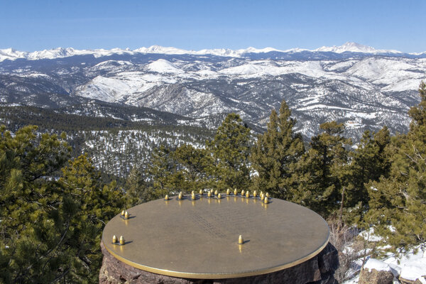
Green Mountain - Feb 13, 2022
The mountains didn't get a lot of snow over the past week, but Boulder did, so we headed up to Boulder to hike on some fresh powder. Even with the recent snowfall, we hiked with micro spikes, but we didn't need our snowshoes. Our original plan was to do Green mountain from the West parking lot which is only about 700 feet of elevation gain, but because there were no parking spots at that trailhead, we had to start a little lower which resulted in us doing twice the amount of elevation that we wanted to (in the same amount of distance). We took it easy last weekend, so it was probably good to have pushed ourselves a little on this 3.3 mile hike with almost 1500 feet of elevation gain.
There weren't that great of views during the hike, except for an occasional couple of mountains from the Indian Peak range or parts of Boulder through some trees. But once we got up to the top, the views were stunning of the Indian Peaks. There was even a little map at the top to help show you what peaks you were looking at. The only peak that we really know in this area is Longs and Meeker, so having the map definitely helped me identify some of the lesser-known peaks.
Read More
| Location: | Boulder |
| Distance: | 3.33mi |
| Hiking Time: | 2 hours, 10 minutes |
| Elevation Gain: | 1,476ft |
| Max Elevation: | 8,209ft |
View Hiking Stats

Bald Mountin - Feb 6, 2022
The mountains didn't get any snow this week, so we opted to do just regular hiking instead of snowshoeing. If we tried to go snowshoeing it would have been packed and icy, so we chose to stay a little bit lower in elevation (around 8,000ft) rather than going to our normal snowshoeing spots (around 10,000ft). We picked Bald Mountain which is up Boulder Canyon about 15 miles. Our hike started at the Sugarloaf Mountain trailhead and started off by hiking along the road for the first mile before the turnoff to go up Bald Mountain. The hike posed the entire 900 feet of elevation in the 3/4 of a mile once we turned off the road, which was quite the elevation to do trekking through the snow. Our assumption of not needing snowshoes was a good assumption. There were a few spots where snowshoes could have been helpful, but overall not having to carry the snowshoes up with us was the right decision.
The weather was pretty decent for us, partly cloudy and in the mid 20's (°F) with very little wind. Off to the East was clear and blue skies, but towards the Indian Peaks to the West were pretty harsh snowstorms that made for some pretty spectacular views being able to see a very drastic change in the weather just by turning your head. The storm got so bad that by the time we left the summit that we couldn't make out any of the Indian Peaks at all anymore. We didn't stay up at the top of Bald Mountain for too long because of the storms, even though they were pretty far away and didn't pose a real immediate threat, but the storms were pushing in just enough wind to make it uncomfortable to stay at the top. Despite the windchill, we stayed up at the summit long enough to eat our lunch before heading back down to the car.
The hike ended up being a little less than 4 miles round trip with about 900 feet of elevation gain. The whole hike took up just over 2 hours. Someday we will come back to hike up Sugarloaf mounting which is an even easier trail with less distance and less elevation gain.
Read More
| Location: | Boulder |
| Distance: | 3.73mi |
| Hiking Time: | 2 hours, 3 minutes |
| Elevation Gain: | 892ft |
| Max Elevation: | 9,253ft |
View Hiking Stats

Brainard Lake - Jan 23, 2022
We're on a roll - This is week 4 of 4 in the new year that we've gone snowshoeing.
Niether one of us had hiked in the Brainard Lake area before. We knew that the winter was our only chance at going since there are timed entry permits required in the summer, so we decided to head up that way this weekend. There wasn't any fresh snowfall, but there was snow two days prior, and some of that fresh powder was still on the ground. The first half of the hike from the car to the lake probably didn't require snowshoes, but the second half of the loop from the lake back to the car definitely needed snowshoes.
The weather was cooperating for the first half of the hike. There was no wind at the beginning of the hike, and then all of a sudden once we got to the lake it was gusting pretty hard for the remainder of the hike. Even though it was windy, the lake itself was gorgeous. I was worried about the lighting since we got to the lake midday, but the sun was perfectly and evenly lighting the surrounding mountains without making them hazy.
I would definitely like to come back to the Brainard Lake area again. It seems like unless you can snowshoe 8+ miles, there isn't a whole lot of trails to do, so this might be something that we wait until next year or the year after to come back to, or maybe come try it in the summer (since it's easier to hike long distances than snowshoe long distances).
The hike itself ended up being a little over a mile longer than we expected, and we could feel that extra mile in our legs by the time we got back. This is one of the hardest hikes we've done in a long time, but the views were worth it. One thing we did wrong was followed the summer trails, which put us on a ski-route-only trail for about a mile. I've never run into a ski-specific trail before, but a few skiers stopped to nicely tell us we were on the wrong trail, and we were able to hop off the trail and get back on the proper snowshoeing-only trail. But the next time we come to this area we need to double-check the distances of the hike we're attempting and double-check which route we are allowed to be on.
Read More
| Location: | Brainard Lake |
| Distance: | 6.57mi |
| Hiking Time: | 3 hours, 5 minutes |
| Elevation Gain: | 932ft |
| Max Elevation: | 10,251ft |
View Hiking Stats

Icy Hike to Bierstadt Lake - Jan 16, 2022
The weather has been great so we wanted to head up into the mountains for the 3rd weekend in a row. In fact, we're 3-for-3 for hiking on the weekends in 2022. That won't last for long, but we've been taking advantage of the unusually great weather during the weekends while we can. There hadn't been any recent snowfall, which doesn't make it great for snowshoeing, but since it was forecasted to be sunny with little wind, we figured why not go and try and snowshoe to Bierstadt Lake. This was the hike that we were planning on doing last weekend, but when we got hit with an unexpected road closure, we had to pivot to a different area of the park.
Every time I've ever driven past Bierstadt Lake Trailhead in Rocky Mountain National Park, the lot has been full. It's the 3rd parking lot from the top, so it usually fills up pretty quickly, particularly since it only has 12 parking spaces. Since Bierstadt Lake was our destination, that was our first pick for a parking spot. Our contingency was to start at Bear Lake (which also likely would have had a full parking lot), and our plan C was to start at the park and ride parking lot. We somehow managed to get a parking spot at Bierstadt Lake Trailhead, so we grabbed the last parking spot, considered ourselves lucky, and started the hike.
The views from the hiking trail were pretty spectacular. The whole way up we had clear views looking East to West, being able to make out many of the peaks along the Continental Divide. We got started with our hike a little earlier than normal, around 10 am, so the sun was still low enough to get some shots of the Western Peaks, but not any decent photos of the peaks looking due East or South. With no snowfall in over a week, the trail was packed down and icy, but that didn't stop us from snowshoeing it. Because it was practically ice, I think we would have had better balance with just crampons, but when we got to the lake we were finally in some snow where the snowshoes were necessary. The first views that we got from the South-West end of the lake were pretty disappointed because you couldn't really see anything beyond the lake and the surrounding trees. It wasn't until we hiked to the East side of the lake that we got gorgeous views of the lake with Hallet Peak in the distance, as well as Otis Peak, Flattop Mountain, and Ptarmigan Point.
Read More
| Location: | Rocky Mountain National Park |
| Distance: | 3.28mi |
| Hiking Time: | 2 hours, 14 minutes |
| Elevation Gain: | 712ft |
| Max Elevation: | 9,361ft |
View Hiking Stats

Deer Mountain - Jan 9, 2022
The weather was just about perfect for snowshoeing. There was snowfall during the week and this weekend it was forecasted to be sunny in Rocky with minimal wind and above freezing temperatures. We've been wanting to get out and snowshoe some more now that it's finally snowing in Colorado. We've only received two decent snowfalls in the foothills now, and prior to that, the high peaks just had a slight dusting on them, so this was really our first chance to get to enjoy the snow.
We always plan multiple hiking contingencies when going into Rocky Mountain National Park because the ability to park where we want to is always a gamble with their small parking lots (relative to the demand, at least). We started heading towards Bear Lake hoping to get a spot at one of the major 3 parking lots along the way, just to find out that the road was closed before we even got a chance to do not only our first or second choice of a hike, but also our third backup. Frustrated with the road closure, we quickly pivoted to try and find something else. At that point, we had been in the car for over an hour and a half, so we knew we had to do at least something, so we headed to the Deere Mountain trailhead. There isn't a lot of parking at that trailhead, but we managed to get a spot and we started the hike.
We were only originally planning on doing a 3.5-mile hike, and Deere Mountain is 6 miles round trip, so right off the bat, we knew that we weren't going to finish the hike. The hike started out completely snow-packed with absolutely no need for snowshoes. There were several points where we were walking on the dirt and there was just a dusting of snow on the trail. After about a half-mile into the hike, the snow started getting thicker and the snowshoes were necessary. So at least we did find a hike where we did need our snowshoes.
We ended up making it about two-thirds of the way to the summit of Deer Mountain for a round trip total of just under 4 miles and 1,000 feet of elevation gain. the hike took just love two and a half hours including stopping on the way up for lunch.
Read More
| Location: | Rocky Mountain National Park |
| Distance: | 3.88mi |
| Hiking Time: | 2 hours, 37 minutes |
| Elevation Gain: | 988ft |
| Max Elevation: | 9,659ft |
View Hiking Stats

Bobcat Ridge - Jan 2, 2022
We finally got our first snow of the season. It was quite a bit late, but we've been wanting to go do snow activities for quite some time now. Our original plan was to go up into the mountains and do some real snowshoeing, but since we had just driven 5 hours the day prior on icy roads back from the mountains, we didn't want to have to drive that far on potentially on slick roads. We decided that we needed to get out and enjoy the sunny weather, so we headed to Bobcat Ridge, an area that we have both explored on our own, but never together. Bobcat Ridge was an area that was engulfed in flames during the 2019 Cameron Peak fire so we wanted to check it out to see what kind of damage was done to the area. We only did the valley loop, which like its name suggests, is in a pretty open area, so there wasn't a whole lot to burn. We passed by a few patches of burned trees, but the lower areas of Bobcat Ridge seemed to be pretty unscathed from the fire.
There were about 6 inches of snow on the ground, and initially, we started the hike without even our microspikes thinking that it would be trampled down enough for us to hike on. Once we got off the pavement (which is about a quarter-mile from the road) we realized that we did need our microspikes and went back to the car for them. Including our half-mile out and back to get our microspikes, the hike was 3.75 miles long and took about an hour and a half. There was only about 400 feet of elevation, but everything is harder in the snow, something we often forget. I wouldn't call this challenging, but the snow definitely added a layer of complexity that we haven't experienced since the last snowshoeing season. Hopefully, soon we can get up into the mountains and do some real snowshoeing.
Read More
| Location: | Loveland |
| Distance: | 3.78mi |
| Hiking Time: | 1 hour, 33 minutes |
| Elevation Gain: | 338ft |
| Max Elevation: | 5,264ft |
View Hiking Stats
2021

Valley View 2021 - Dec 31, 2021
For the changing of the New Year, we spent some time up at Valley View Hot Springs on the South-West end of the state. We've celebrated the New Year up here once before, and it's a great way to ease into the New Year - relaxing in some hot springs and being in nature. This year was quite a lot different than the last time we were in this area in winter because of the lack of snow. This time there was just a small dusting on the ground, compared to a couple of years ago where there was several feet of snowpack on the ground. It's been quite a dry winter, but we were lucky to have gotten a snowstorm while we were there. The snowstorm wasn't that big at the hot springs itself, but when we got back home there was around 6 inches on the ground, which is much-needed moisture for this area.
We hiked up to the collapsed mine and bat caves like we always do (although the bats aren't there in the winter). The views were pretty spectacular, and because of the storms rolling in, I got some great shots of one of the nearby mountains getting hammered by snow. We hiked further than we typically do just to get up a little higher which was exposed and extremely windy. The extra portion of the hike past the main cave added some pretty steep elevation gain in a short amount of distance, but I think the views were worth both the extra difficulty and the excessive wind.
Read More
| Location: | San Luis Valley |
| Distance: | 4.47mi |
| Hiking Time: | 1 hour, 49 minutes |
| Elevation Gain: | 1,152ft |
| Max Elevation: | 9,718ft |
View Hiking Stats

Trekking Through The Forest - Nov 28, 2021
This November has been quite an unseasonably warm one. Most every day, I look at the photos that I've taken on the same day but in previous years (from my homepage), and just a few days ago, there was an album from 2017 where I was bragging about how we had a couple of warm days where I went on a hike. Now it's 2021 and we haven't even gotten a serious snow yet in Colorado, something that usually happens in October or at least early November. I'm certainly happy about the warm weather because it means that I can go hiking and still do other outdoor activities, but it also means that Colorado will stay dry and I would much rather have the moisture so that fires don't start in the mountains in the middle of November (I'm talking about the Kruger Rock Fire up in Estes Park). Let's hope it's a wet winter...
But I digress. We didn't want to go too high up into the mountains because the high mountains are actually cold (although still lacking snow for us to snowshoe), so we picked a hike just outside of Allenspark which started at an elevation of just under 9,000 feet. The hike up to Taylor Mountain and Big John Mountain is a pretty easy hike that starts on forest Roads. We even drove up to forest road 330 to make the hike shorter. The hike was just under 4 miles in distance and 1,100 feet in elevation gain which took us almost 2.5 hours.
This is not a frequently trafficked trail. We saw one group hiking down the forest road as we were driving up, and there was one more car parked next to us when we completed our hike (but we never saw that group). The trail to get to the fork for Taylor Mountain was pretty easy to follow, but the trail up to Taylor Mountain was non-existent and the trail from the Taylor Mountain fork to Big John Mountain was incredibly well marked with cairns, yet we still managed to get lost by following a rogue cairn. On the way back down, we were able to follow the path a little better, and even set up half a dozen new cairns for hikers so they don't get lost in the same way that we did. Once we got back to the area where we followed the rogue cairn, we kicked it over so that no one would get lost. I kicked over a total of 3 misleading cairns on the hike back, which made me feel like I did my duty as hiker by helping out future hikers.
The other cool thing about this hike is that there were two hiking logs at the top, one at Tylor Mountain and one at Big John Mountain. Both logs dated back to 2011 which is pretty long to survive up in the elements. It was exciting because I've only found one other hiking log before (at Stone Mountain). Both of the logs were just off the scenic view and protected by tall cairns. The log at Taylor mountain was in pretty bad shape, including cracks in the plastic jar plus the plastic bag around it being completely torn up. I always keep a gallon zip lock bag in my backpack in case it rains and I need to protect my camera, so I figured giving it up for the hiking log would be a worthy cause. The log at Big John Mountain was in much better shape in a plastic container that was holding together pretty well (which is good since I didn't have any more bags left).
The lack of people, the adventure of getting lost and trying to find, build, and destroy cairns, signing the hiking logs, and the great views made this a pretty fun hike.
Read More
| Location: | Allenspark |
| Distance: | 3.88mi |
| Hiking Time: | 2 hours, 23 minutes |
| Elevation Gain: | 1,132ft |
| Max Elevation: | 9,220ft |
View Hiking Stats
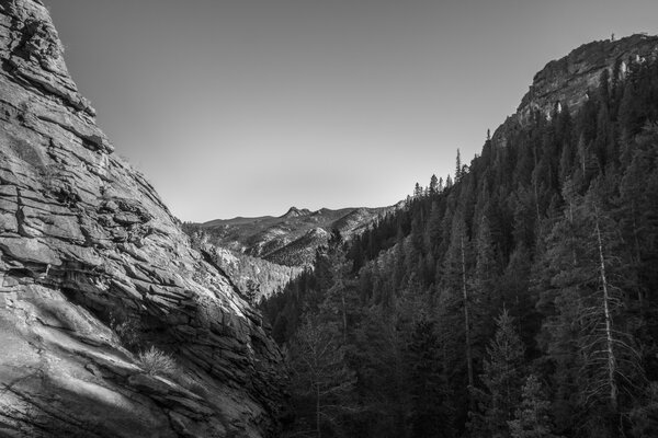
Bridal Veil Falls - Nov 7, 2021
We haven't been hiking since our fall colors trip to New England, and this weekend was the last weekend for the foreseeable future with nice summer-like weather. Estes Park had a forecasted high of 72°F, which is perfect hiking weather. With the following weekends forecasted at least 20°F lower than that, we knew we had to enjoy the weather while we could. I think the next time we hike we'll be needing snowshoes, or at least spikes.
We picked Bridal Veil Falls because it's been on our list to hike for a little while now. It's technically in Rocky Mountain National Park, although it's outside the pay gate. We have an annual pass, but we haven't done this hike yet because up until late October, you had to have a reservation just to enter Rocky Mountain National Park. I'm sure that no one was verifying the reservations since this area is outside of the pay gate for the park, but we stayed away from it just in case.
We got to the trailhead around 1 in the afternoon which was quite late considering that this morning was Day Light Savings, so we effectively started the hike at 2 PM. We only had about 4 hours of daylight left, but that wasn't a problem since this 6+ mile hike with 1,000 feet of elevation gain only took about 3 hours to complete. The hike wasn't too difficult, but we weren't used to hiking at elevation as opposed to when we were hiking last in New England. The elevation definitely takes its toll in the form of having to stop to catch your breath every so often, but it was nice to be hiking back in our mountains in our state.
Read More
| Location: | Rocky Mountain National Park |
| Distance: | 6.35mi |
| Hiking Time: | 2 hours, 42 minutes |
| Elevation Gain: | 1,093ft |
| Max Elevation: | 8,829ft |
View Hiking Stats

Last Day of the Trip - Oct 11, 2021
Today was the last day of our fall colors trip. After hiking at least once per day for over a week, we were completely exhausted. We picked out something easy for the day, which was seeing the highly touristy High Falls Gorge that you pay to get into and only have about a half-mile walk. The falls were uneventful and we felt like they were overhyped by marketing tactics, but they were still neat to see. The afternoon we spent in the downtown area of Lake Placid and did a little shopping for souvenirs, and then in the evening, we did our final hike of the trip: Up Haystack mountain.
This is the second Haystack Mountain that we've hiked on this trip. As our last hike, it was also the longest hike that we did, with a round trip distance of 5.5 miles. It was just over 1,000 feet of elevation gain, so it wasn't the highest hike we climbed, but it still was exhausting particularly since we've been hiking for over a week. The views were pretty good at the top with a few obstructing trees, but the lighting was bad. The hike would have been better in the morning for sunrise golden hour, or to watch the sunset. When we got to the summit (around 4pm), the sun was too high in the sky and washed away most of the views. The hike was still good, but both of us were excited that we wouldn't be hiking for a little bit after we completed this one.
Read More
| Location: | Adirondaks |
| Distance: | 5.45mi |
| Hiking Time: | 2 hours, 26 minutes |
| Elevation Gain: | 1,011ft |
| Max Elevation: | 2,834ft |
View Hiking Stats

Balanced Rock and Cobble Lookout - Oct 10, 2021
Today was our first full day in Lake Placid. We started off the day with a pretty tough hike to Balanced Rock, which gives a great view of Cascade Falls, the two Cascade lakes (upper and lower), as well as the High Peaks area. The hike was incredibly steep in a couple of spots, but we managed to make it all the way up to the top in about an hour. The hike was a little over 3 miles round trip and 1,200 feet in elevation gain. The summit was gorgeous, but the trees seemed like they were already past peak with many of them dead and not much color variety other than yellows and browns. When we drove into Lake Placid, we saw a lot of red varieties, so we were thinking this area would be perfect, but I guess that particular mountainside wasn't.
Since we knew that there were great colors in the Adirondacks, we ventured further North, closer to the route we drove in on where we knew we could find some red colors in the trees. Our evening hike was Cobble Lookout, which was an easy 2.5-mile round trip hike with only a couple hundred feet of elevation gain. The summit was a gorgeous 180-degree panorama that viewed East, South, and West and had all the colors that we were hoping for. The trees on this hike were still past peak colors, but not by too much and all we really cared about was seeing come color variety. The sun was behind clouds which made for even lighting across all the mountains to get a great photo. We spent a half-hour hiking to the summit, and half-hour enjoying the view, and then another half-hour driving back into town. Knowing that the colors are great in this area, we picked that area for the following day, which is our last full day of hiking.
Read More
| Location: | Adirondaks |
| Distance: | 5.79mi |
| Hiking Time: | 3 hours, 53 minutes |
| Elevation Gain: | 1,595ft |
| Max Elevation: | 3,021ft |
View Hiking Stats

Headed to the Adirondacks - Oct 9, 2021
Today we headed to Lake Placid for our Adirondack hiking with was the final segment of the trip. We drove for about 2 hours to get to our first hike of the day. The drive consisted of taking a boat Ferry, something that Katie has never experienced and I have only experienced when I was younger (I think). We got to our first hike of the day in New York which was the Poke-O-Moonshine Fire Tower trail. After signing into the hiking register, we learned that the locals just call it "Poko" for short, and that seems like an appropriate abbreviation. The hike was good and had great views, but because it was the middle of the day, the lighting wasn't great around us. The summit was extremely windy, so we didn't stay too long, and the observation deck on the fire tower was closed (although you could walk up the steps and get an even better view of the mountain).
Since we had quite the drive to get there, we were hiking pretty late in the day, and we failed to get lunch before the hike and ended up having a very late lunch that we were both pretty hungry to eat. Our lunch was at 2pm and was at a random pizza shop in a nearby town where we got New York Pizza. On our way from the hike to Lake Placid, we stopped at the Jay Covered Bridge, which is the only remaining covered bridge in Upstate New York. It was a gorgeous area, but a powerline right across the bridge ruins the photos. We got creative and were able to take a few, but I wouldn't recommend this stop to any photograhers for that reason.
We didn't have a lot of time in the evening for another hike before the sun went down, so we went to the High Peaks Wilderness area and walked around Heart Lake. The lake doesn't look like much of a heart shape, although the path that we took ended up looking like a better heart than the actual lake itself. The "hike" was pretty easy and flat and gave us a good chance to stretch our legs out before heading to dinner.
Read More
| Location: | Adirondacks, Upstate New York |
| Distance: | 5.45mi |
| Hiking Time: | 3 hours, 38 minutes |
| Elevation Gain: | 1,500ft |
| Max Elevation: | 2,219ft |
View Hiking Stats

Full Day in Vermont - Oct 8, 2021
Today was our only full day in Vermont. In the morning, we woke up for a quick hike up Spruce Peak to get a panoramic shot of Mount Mansfield. The views were pretty good, but the mountains around here weren't nearly as vibrant as New Hampshire, and I think that's because of the increased number of pine trees mixed in on the mountains. One thing that was strikingly different during this hike was the smell of pine trees during the hike. Vermont has trees that everyone associates with Pine trees (and Christmas), as opposed to the pine that we're used to in Colorado being more like a faint vanilla smell. So that provided for a unique hiking experience that we weren't used to. On our way back to the trailhead, we headed down a small 0.1 mile detour to get to Sterling Pond. Sterling Pond was a nice pond and a good stop, but it wasn't all that interesting since the sun was facing the wrong way and because there weren't any color-changing trees around the lake. The hike ended up being just under 3.5 miles and was 1,200 feet in elevation gain.
We then started to relax for the remainder of the day by first stopping at the Ben and Jerry's factory in Stowe. They weren't doing any tours due to renovations, so we just got some ice cream and went on our way to Burlington. In Burlington, we walked along Church Street which reminded me a lot of Pearl Street in Boulder. We went to a couple of breweries and came to the conclusion that no one in the East knows what a good beer is. Breweries here seem to just brew the classic german beers and IPAs and don't do anything too wild or experiment. There's nothing wrong with that, but those types of beers aren't all that exciting to us. In the late afternoon, we walked along the Colchester Causeway for about a mile which is a bike path in the middle of Lake Champlain. We ended the evening by having dinner at the Shanty by the Shore which had a fantastic view of the sunrise. The food was good, but not worth the 45-minute wait to be seated.
Read More
| Location: | Long Trail State Park |
| Distance: | 5.41mi |
| Hiking Time: | 3 hours, 17 minutes |
| Elevation Gain: | 1,280ft |
| Max Elevation: | 3,256ft |
View Hiking Stats

On to Vermont - Oct 7, 2021
Today was our last day in New Hampshire. We woke up and packed our bags and headed to one more hike before leaving the state. We picked The Nubble on haystack Mountain because it was a pretty easy hike, only 3 miles long and about 600 feet of elevation, and had great reviews of full panoramic views at the top. After driving up the highway, the trailhead was down a dirt road and very secluded which felt really good to get away from all the people. When we parked, there were only 3 other cars there, and we only passed one person on our way up and 2 groups on the way back down. The trail was so seldomly used that at some parts we weren't sure where the trail even was, which made us happy we were truly hiking in the middle of the mountains. The summit was truly incredible and you could see for hundreds of miles in every direction and the mountains were filled with colors. We even got some fog coverage low in the distance, which is something really weird to experience but provided some nice texture to the photos.
our afternoon consisted of driving to Vermont to the Smugglers Notch area. There isn't a lot of hiking in this area, so we opted to keep it pretty short of a stay here. This area, at first glance, seems to be a lot more touristy than where we were in New Hampshire, which is a little bit of a bummer, but the views so far have been pretty spectacular. Our evening hike was planned to be Plot Road to Roundtop Shelter based on a photo of a panoramic view. This hike was a little over 2 miles and 600 feet of elevation gain which seemed like a pretty easy hike for what it was promising us. When we got to the shelter, there was a bench overlooking the Western mountains that were mostly blocked by trees. It wasn't much of a panoramic view, and we later realized that the picture we saw was actually for a different hike.
The climate of Vermont is different than New Hampshire. It's lower in elevation, by about 1,000 feet, and it's a lot dryer. When we were hiking, the ground was actually dry in spots and the leaves crunched under our feet. We figured that the hiking would be pretty similar everywhere in the New England area, so it was a pleasant surprise that there are some differences in the area.
Read More
| Location: | Long Trail State Forest, White Mountain National Forest |
| Distance: | 5.52mi |
| Hiking Time: | 3 hours, 37 minutes |
| Elevation Gain: | 1,352ft |
| Max Elevation: | 2,752ft |
View Hiking Stats

Kancamagus Scenic Highway - Oct 6, 2021
Our morning started almost 2 hours before sunrise. The morning was supposed to be sunny and clear, so we wanted to get to our first destination, Lonesome Lake, before sunrise to catch the golden hour on the lake and mountainside. When our alarm went off at 5:00 am, I walked outside, noticed it was completely overcast, and we went back to sleep. We woke up at a more reasonable time (although still early) and headed to the trailhead.
The hike up to Lonesome Lake was extremely challenging. The hike is only about a mile and a quarter to the lake, but almost 1,100 feet in elevation gain. It was straight up for that entire time. For our skill level, a hike like this would usually be moderately difficult, but since we did a similar hike the day prior, we were pretty sore and tired and took our time making it up to the lake. The views at the lake were worth the pain and difficulty, and we had the lake almost completely to ourselves other than a couple of other fellow hikers. The lake was mostly still with an occasional breeze that would make the water shimmer, and the weather stayed overcast which made for even lighting all across the lake and surrounding mountainside.
The afternoon consisted of a 100 mile long drive through the Kancamagus Scenic Highway that took about 4 hours including stopping in many places to take photos and eating lunch in Conway, NH. The views were breathtaking and completely unreal. We, just like many other people, were complete tourists gawking at the beauty of the White Mountain National Forest driving along the Kancamagus Highway. We stopped along the way at many of the scenic overlooks to take a few photos, wherever we could get a parking spot. The sun started to come out in the afternoon which just amplified the vibrance of all the fall foliage.
We enjoyed the drive so much that we went back to a specific overlook on the Kancamagus Highway to watch the sun go down. It was the only time during our trip that the sky was completely clear, and the only time we had wished there were at least some clouds in the sky for a better sunset. Even though going back for sunset photos was a bust, we still enjoyed the sunset together. This was our second day in New Hampshire in the White Mountains area, and even though it feels like we just got here, we head on to Vermont in the morning.
Read More
| Location: | Franconia Notch State Park |
| Distance: | 3.75mi |
| Hiking Time: | 2 hours, 24 minutes |
| Elevation Gain: | 1,024ft |
| Max Elevation: | 2,707ft |
View Hiking Stats

Franconia State Park - Oct 5, 2021
Our trip to the East coast started with a flight to Boston. Flights are always pretty terrible for me since I'm tall, but we spent a good majority of the flight entertaining ourselves by studying up on portrait photography. Right before the trip, I purchased The Photographer's Guide to Posing by Lindsay Adler that we read to fill our time on the plane. One of the things Katie and I love doing together is taking each other's photos, so I figured we could use some technical reference and background to understand what makes a good pose and how to direct one another in the poses to be more photogenic. We both really liked the book (and would recommend it) since it provided examples of photos that had problems with them and then showed corrected photos and very specifically told you what the problem was and why it was a problem.
Our flight got in around 6:30PM local time, and Boston is too far South for any colors to have popped yet, so we proceeded to drive North. After driving for over 2 hours, we made it to our destination, an Airbnb in North Woodstock, New Hampshire. We were driving in the dark, and because of that, we had no idea what we were in for from a fall foliage perspective, which was the main focus of the trip. It wasn't until the morning that we really knew what we were working with.
With the morning forecasted to be overcast, we knew there would be no sunrise so there was no point in waking up early. It was nice to have gotten to sleep in and recover from the long day of traveling. We picked out our morning hike to be a moderately difficult hike to Mount Pemigewasset in Franconia Notch State Park which is almost 4 miles round trip and 1,300 feet of elevation gain that took us a little over two and a half hours. The hike to Mount Pemigewasset didn't disappoint us as the first hike of the trip. We hiked through the dense forest with no overlooks or any indication of where we were going until we hit the summit, and then all of a sudden there was a gorgeous panoramic view of the White Mountains filled with colors. The fall colors weren't quite peaking in this area yet, but the colors were still gorgeous and much more vibrant than what we're used to. The hike was extremely familiar to the ones we're used to hiking in the sense that you're hiking up to a summit on dirt, rocks, and over tree roots through trees and that you might not get any views until you're at the top. But that's where the similarities end with hiking on the East Coast versus in Colorado. Because the East Coast is much more humid than Colorado, we didn't have to try hard to find mushrooms and fungus growing on things. Mushrooms are rarety on Colorado hikes, but in New Hampshire, they were literally growing out of the middle of the hiking trail. The humidity also made it much trickier to hike because it made the rocks very slick, something we're not used to in the dryer climate of Colorado. It was neat to have an experience like this that was similar to our previous hiking experiences but completely different at the same time.
Since we did a moderately difficult hike in the morning, our afternoon hike was planned to be an easy one - the one to Artist's Bluff. The weather was forecasted to be clear and sunny, so we planned to do it during the golden hour, but the forecast was wrong and there were heavy clouds sitting low on the hillsides when we got there. The low clouds ended up providing for a cool perspective and good framing for the photos. The hike was only about 1.5 miles round trip and only a couple hundred feet of elevation gain, but it was deceptively challenging. It poses most of that elevation gain in such a short distance that the steps are incredibly steep and on very uneven and slippery terrain. We went the wrong direction around the loop that we intended, but luckily that way that wasn't nearly as steep since it was a longer distance to the top of Artist's Bluff. The only downside to doing the loop in the wrong direction was that we didn't get to go to the top of Bald Mountain, which was a small offshoot from the trail. The trail was pretty busy, including multiple professional photographers at the bluff taking photos of clients. Even though it was busy, the views were as great as the countless photos we've seen online.
One of the main reasons that I like to hike is that you get to explore the more obscure areas that most people don't typically get to see, but with something as popular as this hike, you're doing a hike to get the same photo as everyone else, and I can always guarantee that someone else has a better photo of it. Not necessarily because I don't think I'm a good photographer, but locals can get the perfect shot consisting of the right fall foliage colors and the right lighting by going back to the same spot multiple times on multiple days. It's not to say that I didn't enjoy the hike or get a great shot, but it's lacking the uniqueness that I like to capture in my hiking photography.
Read More
| Location: | Franconia State Park |
| Distance: | 5.23mi |
| Hiking Time: | 3 hours, 53 minutes |
| Elevation Gain: | 1,654ft |
| Max Elevation: | 2,478ft |
View Hiking Stats

Colorado Fall Colors - Sep 26, 2021
The last weekend in September is usually the best time to see fall colors in Colorado. That weekend was still almost a full week from the end of the month, and because of this I think we were a little early, but that's okay because getting perfect colors wasn't really the point of this mountain excursion. We went up into the mountains to try out a couple of new lenses that we recently purchased for our upcoming fall foliage photography trip to the East Coast. Since colors were peaking in Colorado before we left for our trip, we figured we better go and shoot with our new glass so we know what to expect. I bought the Canon 10-18mm f/4.5-5.6 wide-angle lens and Katie bought pretty much the exact same thing but for her Nikon, a Nikkor 10-20mm f/4.5-5.6 lens.
We picked the Silverdale Interpretive Site (just outside of Georgetown) like we had done the previous year because it was familiar and we knew it would be an easy "hike". This area has many different trails that you can make this as short or as long of a hike as you want. Since we only had the opportunity to go hiking in the evening due to other plans the rest of the weekend, it was important to not have a long or unknown hike that would have landed us in the dark as we hiked back to the car.
After a pretty lengthy drive (2+ hours), we got up to Georgetown about an hour and a half before the sun set which is typically about perfect from a lighting perspective. Unfortunately, the lighting wasn't actually perfect because of a large cloud that was covering the sun during the entire photo shoot, and even sprinkled on us a little bit. The cloud may have blocked golden hour lighting, but at least we didn't have to work around any harsh shadows. After the sun set, we drove the 2 hours back home. It was quite a bit of driving for such little time in the mountains actually shooting, but the photoshoot was worth it to try out the new lenses.
Read More
| Location: | Georgetown |
| Distance: | 2.02mi |
| Hiking Time: | 1 hour, 41 minutes |
| Elevation Gain: | 276ft |
| Max Elevation: | 9,345ft |
View Hiking Stats

Moose at Cub Lake - Sep 19, 2021
Today we ventured into Rocky Mountain National Park for the first time of the summer. That seems a little odd since summer ends in a few days but we completely avoided the park all summer long on purpose because of the new timed entry system. In a couple of weeks we should be able to get into the park without making a reservation, but this weekend we wanted to go up there and I was able to get a reservation despite them being sold out within minutes. I was originally trying to get the 9am time slot, but when I tried to add that pass to my cart literally seconds after they were available, they were gone. Instead, I was able to get a 11am reservation successfully added to my cart. That gave us a little more time in the morning to get ready and it was okay since the weather was forecasted to be clear and in the mid 60's all afternoon. The only drawback to getting to the trailhead so late was the location of the sun which doesn't provide the best lighting for taking photos, but it was either that or hiking outside of Rocky Mountain National Park.
After waiting in line to get into the park for about 20 minutes, we made it to our destination, Cub Lake Trailhead in the middle of Moraine Park. We got extremely lucky that there was a parking spot literally right in front of the trailhead. There seemed to be a few other parking spots along the way, so it wouldn't have been too terrible to park down the road, particularly since when you make a loop out of this hike you end up hiking a mile along the road which means it doesn't matter where you truly start the hike. The hike started off exciting with a herd of elk; one bull, and maybe a dozen cows were just a few hundred feet from the trailhead. We knew something was up since there were so many photographers on the trail. We just thought it was a particularly busy trail, but luckily for us, the trail wasn't too busy after we got past the herd of elk. This was the first time that I have ever regretted not bringing my telephoto lens with me on a hike. Usually, hikes are about landscapes, not wildlife, and my telephoto lens is heavy and bulky. Oh well, it's only a herd of elk, it's not like it's anything special like a moose (yet...).
The wildlife got a little less exciting on the way to the lake, however still more exciting than most hikes. We followed a wild turkey for about a hundred feet as he ran from us by using the trail, probably not realizing that we too were following the trail. About a quarter-mile from the trail we passed a group of hikers who were extremely excited to tell us that there was a moose at Cub Lake. I tried to not be too excited, especially since we weren't at the lake just yet. When we passed another group of people a little closer to the lake and were told again that there was a moose, that's when we knew that there was a great chance we'd see it too. Just like everyone promised, when we got to the lake there was a massive bull moose just on the other side of the lake eating some lunch. While the moose sat and ate his lunch, we sat and ate ours while watching for him to do something, and I again was disappointed that I did not have the right lens with me.
We sat at the lake for almost an hour, mostly waiting for cloud coverage to try and get some better lighting on the moose. Luckily I had at least my 50mm prime lens with me, which was the most "zoomed-in" lens I had with me (which is a little more zoomed in than the naked eye). There were massive clouds to the West and the wind was pushing them to the East, however, they kept splitting and going both North-East and South-East, but never directly East to cover us the sun. There were multiple times we were completely surrounded by clouds, but nothing directly above us covering up the harsh sun. So after an hour of waiting, we decided to carry on, and then immediately after we started hiking the sun was covered up for about 30 seconds with a random cloud that we didn't see coming. I guess I can't complain too much, I did get to see a moose, afterall.
The rest of the hike did not disappoint. We got to hike through a section of burned area that was recently burned last year during the Cameron's Peak fire, as well as being on top of a highly exposed ridge that gave us spectacular views to the North. Unfortunately the lighting was never that great because of the location of the sun, but that didn't make the views any less spectacular, it only made the photos less spectacular (which is your problem, whoever is reading this, not mine). The hike ended up taking us almost 3 and a half hours, including our hour lunch break, which is pretty great time for a 6.3 mile hike that had 1,000 feet in elevation gain.
Read More
| Location: | Rocky Mountain National Park |
| Distance: | 6.32mi |
| Hiking Time: | 3 hours, 21 minutes |
| Elevation Gain: | 1,001ft |
| Max Elevation: | 8,726ft |
View Hiking Stats
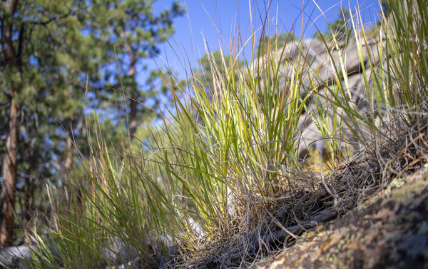
Granite Ridge - Sep 5, 2021
It's finally not the hottest month anymore, so I think it's time we get back into doing some hiking. Don't get me wrong, it's still pretty hot in September, but it wasn't nearly as bad as it would have been last month hiking in the Red Feather Lakes Area. We picked this hike out based on it being in our current skill level and because literally everywhere else has adopted a really terrible timed entry system that's ruining one of the great benefits of living in Colorado - being able to go into the mountains whenever I feel like it and not having to worry about making a reservation.
But I digress, This hike was an alright hike that was a little over 6 miles but under 1,000 feet in elevation gain. I was hoping for better views but there were trees in the way for most of the shots. The trail that we picked didn't have a defining ending point, we just wandered in and ended up making a loop out of the hike by taking Lady Moon trail South until it met up with Granite Ridge Trail which we turned West on, and then looped back on the Molly Moon Trail back Lady Moon trail which took us right back to the parking lot. But because there was no summit, there was no real spot for panoramic views or a great spot to eat our lunch.
Read More
| Location: | Red Feather Lakes |
| Distance: | 6.34mi |
| Hiking Time: | 2 hours, 29 minutes |
| Elevation Gain: | 824ft |
| Max Elevation: | 8,612ft |
View Hiking Stats

Lake Agnes - Jul 25, 2021
Today was our last day camping in State Forest State Park. Our park pass was good until noon, so we packed up camp and headed to Lake Agnes which is overlooked by the Crag mountains. It was still a little hazy from the smoke from the previous day, but it wasn't windy anymore so some of the smoke was able to settle without more getting blown in. The views weren't clear, but they were clear enough for us to enjoy some of the views. What we both really wanted photos of, however, were the Nokhu Crags which are some very jagged and pointed mountain peaks. The Nokhu Crags were on the East side of the lake, which since we were hiking in the morning was incredibly washed out from the sun. We both ended up being okay with that because the Nokhu Crags weren't very photogenic from Lake Agnes anyway. The mountainside leading up to them was just a massive rock pile. Instead, from the Eastside of the lake looking West were more magnificent views of some of the other peaks in the Never Summer Mountain Range like Mount Richthofen.
After reading more about this area after the hike, I wish I would have gotten some better photos of the whole area because of the different types of rock. The Nokhu Crags are Shale versus the Granit from Mount Richthofen, and the division between the two was very clear in the color of the rocks. You can see this a little bit in the panorama photo, which I hiked 250ft straight up the rock pile to get. The Never Summer Mountain Range is a fairly "young" mountain range that was formed 28 million years ago from volcanic eruptions from the seafloor, as opposed to the rest of the Front Range mountains that are over 1 billion years old.
Read More
| Location: | State Forest State Park |
| Distance: | 2.96mi |
| Hiking Time: | 2 hours, 11 minutes |
| Elevation Gain: | 787ft |
| Max Elevation: | 10,907ft |
View Hiking Stats

Jewel Lake - Jul 24, 2021
We woke up at our campsite, ate breakfast, and headed to our first real hike in State Forest State Park. We picked out Jewel Lake because it was the hardest hike we were planning on doing and figured we should do that on our first day when we're better rested rather than on our second day. The morning was really overcast and windy. The wind blew some smoke into the valley which made all the surrounding mountains extremely hazy.
I had no idea what to expect from this hike in terms of distance. Online, the hike is about 6 miles and 1,500ft of elevation. However, the first mile of that was hiking on a road to get to a closer trailhead. So our plan was to drive to the closest trailhead so we could do the least amount of work to get to the lake. We passed the first trailhead and immediately noticed a sign that said no 2-wheeled drive vehicles. Being in a Subaru, we were set with our 4-wheel drive and continued on. The road quickly turned rocky and bumpy. After making it about halfway and being concerned about popping a tire the entire time, we decided to park our car on the side of the road and hike the rest of the way.
The hike ended up being just under 5 miles with our odd starting point mid-way between trailheads and took us about 3 hours. We climbed a total of 1,300 feet in elevation. The hike was extremely windy and the lake was not all that interesting (at least for an alpine lake), not to mention that it was incredibly hazy. So we didn't stay at the lake for too long and instead headed back down the trail to get into the trees to sit and eat our lunch in a less windy spot. The hike was disappointing, but the highlight was when we got back to our car - which was parked obviously not at a trailhead - there were 2 other cars that parked next to us, presumably because they had the same concerns that we did in that the road was too sketchy to try and continue.
Read More
| Location: | State Forest State Park |
| Distance: | 4.83mi |
| Hiking Time: | 2 hours, 47 minutes |
| Elevation Gain: | 1,365ft |
| Max Elevation: | 11,228ft |
View Hiking Stats

State Forest State Park Camping - Jul 23, 2021
We went up into the mountains this weekend for some camping. Katie wanted to camp in State Forest State Park because that area has one of the largest populations of moose in Colorado. So this year's camping trip we were focused on wildlife and we saw more than we thought we would! In total, we saw one moose very close up (safely from the car), several foxes (including one that visited our camp both nights trying to steal food), a pika with its mouth full of food for the winter, and a wild porcupine.
On the first day, we got to the campground and made our camp and went for a quick "hike" on the Mountain View Nature Trail. This wasn't much of a hike since it was barely a mile, but we were in the middle of a forest so I think it counts. On our drive to the trailhead, we turned a corner and saw a moose. Katie slammed on the brakes and the moose hid back behind the bush it was eating. After sitting for about a minute the moose came back out. We were probably only about 30 feet from the moose, but since we were viewing from the car we were able to stay safe and I was able to get some spectacular photos of it. Since we were only in the park for a couple of hours and saw one moose, we figured we'd see many more during the trip, but that one ended up being the only one that we saw the whole trip.
Read More
| Location: | State Forest State Park |
| Distance: | 1.2mi |
| Hiking Time: | 28 minutes |
| Elevation Gain: | 102ft |
| Max Elevation: | 8,899ft |
View Hiking Stats

Accidental Hike Towards Stormy Peaks - Jul 17, 2021
We went into Pingree Park this weekend to hike the B-17 crash site hike where a B-17 plane crashed in 1944 killing 4 of the 10 person crew. I've been wanting to hike this area for a while, but the distance to get there has always been a deterrent since it takes almost 2 hours to get to Pingree Park. It's not that Pingree Park is that far away from our home, but the drive has a 20 miles stretch of unpaved road that you can't drive very fast on. I've never been to the Pingree Park area, again because of the drive time, but I'm happy to have gotten to finally explore this area. The Cameron's Peak fire almost went through Pingree Park last year. But in this area, the fire seemed to skip certain patches of trees and obliterate others which made for a fascinatingly sad but colorful hillside.
We got to the trailhead and at the fork about a half-mile in, we went the wrong direction and never made it to the B-17 crash site. Instead, we were headed towards Stormy Peaks. Once we realized that we were headed on the wrong path it was too late to fix our mistake, we decided to hike about the same distance we were originally planning on doing and call it good. It started to rain on us during the last half-mile of the hike on the way back to the car, so it's good that we turned around when we did and didn't try and go further on the Stormy Peaks trail. But let's be honest, we would have never made it all 6 miles one way and 3,500 feet in elevation to the Stormy Peaks summit anyway. It wasn't raining hard at the end, but a little more than comfortable rain while hiking. We saw several people hiking up while we were heading down, and with Stormy Peaks above the tree line, I hope they didn't get caught in a storm.
After about 2.5 miles we passed an amazing overlook. We stopped to take some photos and continued on, but didn't make it much further. At the 3-mile mark, we turned around and stopped at the same overlook to eat our lunch. The view was gorgeous and stunning in a breathtaking and sad way because of the burn scars on the mountainside. Because Pingree Park is home to the CSU Mountain campus and many other buildings, the firefighters fought pretty hard to keep the Cameron's Peak fire from engulfing the area. They did succeed in this area, but the fire got very close which is evident in the photos where the green trees quickly turn black.
Our hike ended up being just over 6 miles and 1100ft of elevation gain which took us 3 hours to complete.
Read More
| Location: | Pingree Park |
| Distance: | 6.18mi |
| Hiking Time: | 3 hours, 8 minutes |
| Elevation Gain: | 1,148ft |
| Max Elevation: | 10,141ft |
View Hiking Stats

Raining Hike in Estes Park - Jul 3, 2021
It's been a long time since we had gotten outside and hiked anything, so this weekend we attempted a 7.5 mile hike to get to Pierson mountain. There were some storms in the skies but nothing on the radar looked too threatening. We started hiking and immediately got poured on in the first third mile of the hike. So we went back to the car and waited for the storm to pass. At that point, we weren't really up to finish that hike so we decided to forget about that idea and do something else a little easier instead. We headed over to the area that we hiked the last time we were in the mountains to go on a slightly different trail. When we did Panorama Peak in May, we intended to go over to the Notch, but didn't end up missing the turn to get there. So today we decided that going to the Notch would be a really nice easy hike after our rainy failure at Pierson Mountain.
It ended up raining on us again as we were hiking to the Notch, but it was a pretty light rain and we were able to stand under a tree and get good shelter for the 5 minutes that we had to wait for the storm to pass. The hike itself was under 4 miles and took us an hour and a half, including a pretty lengthy rest at the notch while we waited for some clouds to pass over the sun to get better photos.
Read More
| Location: | Estes Park |
| Distance: | 3.72mi |
| Hiking Time: | 1 hour, 36 minutes |
| Elevation Gain: | 643ft |
| Max Elevation: | 8,675ft |
View Hiking Stats

Wildflowers at Coyote Ridge - Jun 21, 2021
A few weeks ago I biked along Coyote Ridge to the Prarie Ridge Trail and noticed an abundance of wildflowers. Sure there are wildflowers everywhere in Colorado, but I wasn't expecting the number of wildflowers and the variety so close to the foothills. So I knew that I had to come back to this spot at some point to take some photos. Even though it took several weeks before Katie and I had a chance to go out to take photos of the wildflowers, they did not disappoint. Just in the few weeks between when I first noticed them and when we got out, they had already changed so much.
Wew actually attempted to go out shooting twice, two days in a row. The first evening we got there way too late and by the time we had hiked to the large patch of flowers, it was already too dark to take good photos. The next evening we went a little bit earlier, however, it was overcast so we still didn't get great lighting (although much better than the night before), and it was really windy which made shooting in low light that much more difficult.
The last thing about this hike worth mentioning were the rattlesnakes. This was prime rattlesnake territory, and taking photos of wildflowers requires you to go a little bit off the trail. We didn't venture too far, but we were definitely cautious and luckily never ran into any wildlife.
Read More
| Location: | Fort Collins |
| Distance: | 2.99mi |
| Hiking Time: | 1 hour, 23 minutes |
| Elevation Gain: | 302ft |
| Max Elevation: | 0ft |
View Hiking Stats

Venturing on Forest Roads - May 29, 2021
The weather over Memorial Day weekend wasn't looking that great, but we knew we wanted to get out and enjoy the great outdoors on our 3-day weekend. Saturday had the lowest chance of rain, so we decided that was the day we were hiking. Rain wasn't supposed to start until mid-afternoon, so we figured if we got to the trailhead by late morning that we would be okay. The trail we chose was hiking up a bunch of forest roads that are typically used for offroading. However, there were some recent reviews on hiking websites that said the OHV gate was closed, which meant that it would be perfect for hiking without all the 4-wheelers trying to run us over. The trail we picked was hiking up to Panorama Peak which starts at Pole Hill Road just outside of Estes Park. We built it up in our heads as something that would probably have pretty awesome views at the summit. That build-up lead us to disappointment at the summit where there were so many trees that you couldn't get a clear view of the surrounding mountain ranges.
As we walked up to Panorama Peak, we noticed an observation tower. We thought it was pretty awesome that there was a public tower in the middle of Rosevelt National Forest. But we quickly realized that it was locked and we couldn't go up. We later found out it's owned by a local OHV company. So in order to get panoramic views at Panorama Peak, you have to pay an OHV company to drive you up there. Oh well, there are other places that we can get panoramic views for free that people can't simply pay someone to drive up to.
The hike itself was pretty great other than the summit. This hike is right outside of Estes Park and its peak tourist season, so we were expecting to have to fight for a parking spot in the small, half-dozen car lot. But as we drove up, we found 2 other cars there. Since the whole point of hiking is to get away from everyone, we both thought this was great, and didn't see a single person on the hike except at the summit (where there was an OHV tour group that we presume got to go up the tower).
The 3-mile hike to the summit included some great views of still snow-capped Longs Peak through the trees and views of the Mummy Range. As the storms rolled over the mountains, we got to see all different types of lighting, ranging from fully sunny to very stormy over Longs Peak. But luckily for us, the storms parted as they went over Estes Park and we didn't get a single drop of rain during our 3 hour hike. We intended to head to the Notch as well on this hike, which would have only added a mile onto the hike, however, we missed the turnoff onto FDR 247D. After the hike, we looked it up and saw the road was at the bottom of the large meadow we passed through, and the photos I took confirmed that there was a road there, but it was completely fenced off.
Read More
| Location: | Estes Park |
| Distance: | 6.25mi |
| Hiking Time: | 2 hours, 41 minutes |
| Elevation Gain: | 1,155ft |
| Max Elevation: | 9,267ft |
View Hiking Stats

Picnic at Realization Point Via Gregory Canyon - May 23, 2021
We headed into Boulder this weekend for some hiking. This is the last week that you can park around Chautauqua for free since they charge for parking during the summer between Memorial Day and Labor Day. We decided to go up Gregory Canyon and loop back on the Ranger trail, but by the time we made it up the steep incline up Gregory Canyon to Realization Point, we were both pretty tired. We ate our lunch at a picnic table and headed back down the mountain.
I've hiked this before and I think my reaction was about the same in that it's pretty boring to hike to another parking lot. I like hikes that you can't simply drive to, so the summit wasn't all that great. However, since we had sandwiches with us and spent about 20 minutes at the top resting and enjoying our lunch, it felt like more of a hiking picnic than a real hike.
The hike took us a little over 2 hours to do the 4 mile round trip hike, including a 20 minute lunch break. The total elevation was just under 1,200 feet.
Read More
| Location: | Boulder |
| Distance: | 3.91mi |
| Hiking Time: | 2 hours, 14 minutes |
| Elevation Gain: | 1,168ft |
| Max Elevation: | 6,723ft |
View Hiking Stats

Bitterbrush Trail at Hall Ranch - May 15, 2021
We ventured into Lyons this weekend to do a little bit of hiking. Our original destination was the Antelope trailhead nad to do Antelope, Bitterbrush, and the Nelson loop, but the parking lot was completely full when we arrived. It was no surprise since it was about 10:30 in the morning and since that trailhead literally only has 5 parking spots. So we decided to drive to the Bitterbursh trailhead instead, a quick 5 minute detour. However, starting the hike from Biterbrush instead of Antelope added some length to the hike, so we decided to turn around at Nelson Loop, which ended in a 7 mile hike with 1100 feet of elevation gain. Even though there was more that could have been hiked, this was a pretty exhausting and lengthy hike for us, considering it's been almost a month since our last hike.
The trail itself was great. There was a nice mix of open meadows and some rocky terrain. There wasn't any tree coverage for shade, but we didn't need it since it was overcast the entirety of the hike. It was pretty humid though since we've been getting a lot of rain. The humidity was out of character for Colorado hiking and added an extra layer of difficulty to this 3-hour hike. Additionally, this trail is mountain bike central apparently, so every 20 feet we had to step off the path to let some bikes go by. Okay, maybe it wasn't quite that bad, but there were a lot of bikes and it got pretty obnoxious. So for that reason alone, I don't think we'll be heading back to this area anytime soon.
Read More
| Location: | Lyons |
| Distance: | 7.06mi |
| Hiking Time: | 2 hours, 47 minutes |
| Elevation Gain: | 1,106ft |
| Max Elevation: | 6,255ft |
View Hiking Stats

Zimmerman Lake - Apr 18, 2021
It was a snowy week, so we thought that maybe we'd be able to get in one more snowshoeing trip of the season. To do this, we knew we had to get up high and saw that Zimmerman Lake was forecasted to get 7 inches of snow so that was our destination. Zimmerman Lake is a pretty easy hike, less than 3 miles round trip and less than 500 feet of elevation gain, but it starts at an elevation of 10,000 feet which makes it a little more challenging. We probably didn't need snowshoes for most of the hike because the trail was snow packed and icy since it last snowed on Friday and we went hiking on Sunday.
When we got to the trailhead after driving for almost 2 hours, it was starting to get cloudy. Storms move quickly at that elevation so we knew that it would either clear up or we'd get caught in a snowstorm. It was lightly snowing when we got to the trailhead but decided to do the hike because the hike wasn't that long. The snowing stopped, but the storm completely covered Cameron's Peak, which was the main thing we wanted to look at during the hike. Cameron's Peak was just recently in the news for being the starting point of the worst fire in Northern Colorado burning more than 200,000 acres over the course of 6 months. We figured Zimmerman Lake would have been hit hard by this fire, but it was completely intact and unharmed, which makes sense now that I think about it since it's the only trail open along the Poudre River. There were lots of bare and charred mountains around us, but the mountain that Zimmerman Lake was on remained untouched and safe to hike.
The drive up towards Cameron's Peak was pretty saddening. The Cameron's Peak fire destroyed so many trees, including some right next to the highway that haven't been cut down yet. It was quite surreal. But I guess that's nature's way of clearing out the forest to make room for new trees to grow. The saddest part, though, is that now every trail along the Poudre River is hiking through a burned area, either from the High Park fire in 2012 or now from the Cameron's Peak fire. But I guess burned areas are beautiful in their own way.
Read More
| Location: | Poudre Canyon |
| Distance: | 2.77mi |
| Hiking Time: | 1 hour, 35 minutes |
| Elevation Gain: | 463ft |
| Max Elevation: | 10,469ft |
View Hiking Stats
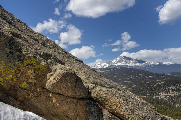
Miller Rock - Apr 11, 2021
We made it out to the mountains after taking a weekend off since our trip to Moab. We wanted to pick a hike that wasn't too terribly difficult from an elevation standpoint but had a decent length to it and Miller Rock fit the bill. The hike was a little over 6 miles and was supposed to be right at 1,000 feet in elevation gain but it ended up being over 1,200. But maybe the elevation discrepancy was because we didn't do the real loop, we turned around at the summit instead of continuing but we ended up finding another loop back to the main trail. The hike took a little under two and three-quarter hours.
This hike ended up being pretty great because it was a gorgeous area that followed a stream for about half of the hike, which was partially frozen over. The river was flowing strong from the snowmelt and it would duck into ice tunnels where you couldn't see it at all but you could still hear it. The other great thing about this hike was the spectacular views at the summit. There were absolutely no panoramic views until you scrambled to the top of Miller Rock. And it was a scramble. There was no defined way to get to the top but we did a little bit of climbing and made it up with only a little bit of struggle. But that scramble made the view all that much better since all we could see up until reaching the summit was just trees and the river.
At the summit, there was a spectacular view of both Longs Peak and the Twin Peaks, which I feel is something that you don't get a view of both of from the same summit. So I thought that was a pretty great view to see two enormous peaks, all in one view.
Read More
| Location: | Jamestown |
| Distance: | 6.22mi |
| Hiking Time: | 2 hours, 44 minutes |
| Elevation Gain: | 1,266ft |
| Max Elevation: | 8,666ft |
View Hiking Stats

Funnel Arch and Longbow Arch - Mar 25, 2021
We went to Moab to explore the area and do some photography exploration over a week-long period. We arrived late on Sunday and left early on Friday which gave us 4 full days of hiking in this beautiful area. The weather cooperated most mornings and a few evenings for golden hour photography, but we got a variety of lighting from overcast, snowing, foggy, and full sun. In total, we hiked a little over 30 miles and over a mile in elevation on this trip. We came to the same conclusion that our favorite type of hiking is the type where we're alone or hiking with very few people so that we can enjoy nature to the fullest extent, as well as get a perfect photo with no one in it.
Thursday was our last full day in Moab, and we weren't too sure if the weather would be permitting us to do very much because the forecast had light rain the entire day. Because of this, we decided to sleep in and start the day whenever we got up. We didn't leave the hotel until a little after 8 and even then we were pretty slow to get going. Our first stop of the day wasn't even to an arch, but instead to Faux Falls, a manmade waterfall that was created to divert some water. The falls were kinda cool, but the hike itself and the fact that it was manmade made it pretty boring, especially compared to all the cool natural features that we've been seeing all week.
Our second trip of the day was over to Funnel Arch which requires a pretty steep scramble to get to. When we go to the area that we had to climb up, there was a tour group coming back down that was using ropes to repel down the section that we climbed up and down with no problems. It was definitely more rock climbing than scrambling, but it was a fun experience and not terribly dangerous. When we got to Funnel Arch, we were the only ones there, which is our favorite type of destination hike. We shot some photos of the arch in both directions (definitely better shooting from the North looking South through the arch), and I decided to climb around the backside to get on top of the arch. Since this arch was in the BLM lands, there were no restrictions on climbing ontop, and in fact, this arch even had some clip-ins specifically for repelling down through the arch. It was a pretty steep slick rock face that was incredibly exposed to get to the top of the arch, but I made it up and back down without falling to my death. In hindsight, I probably shouldn't have done that without ropes, but that's a lesson learned for the next time we're in this area. Funnel Arch might be my favorite arch of this trip from a non-photography standpoint. The rock climbing and the great secluded views made it pretty awesome.
After taking a break in the middle of the day, the final destination of our trip was Longbow Arch. This one was also out in the middle of nowhere which meant once again, we'd get to hike alone. When we got to the arch there was a group leaving which left us the arch all to ourselves. We spent half an hour up there and on our way out, we passed a group of hikers heading to the arch and we were able to give them the same enjoyment that we had of being alone at the arch. Longbow arch isn't terribly photogenic since there's a wall of rick right behind it as well as the lack of great lighting (this arch faces North, so our overcast hike was probably the best lighting that this arch gets). It was a good hike and we were glad we did it, but it wasn't as spectacular as some of the other arches that we did yesterday (Corona Arch) or this morning (Funnel Arch).
Read More
| Location: | Moab BLM, Moab |
| Distance: | 4.8mi |
| Hiking Time: | 3 hours, 4 minutes |
| Elevation Gain: | 1,191ft |
| Max Elevation: | 5,218ft |
View Hiking Stats
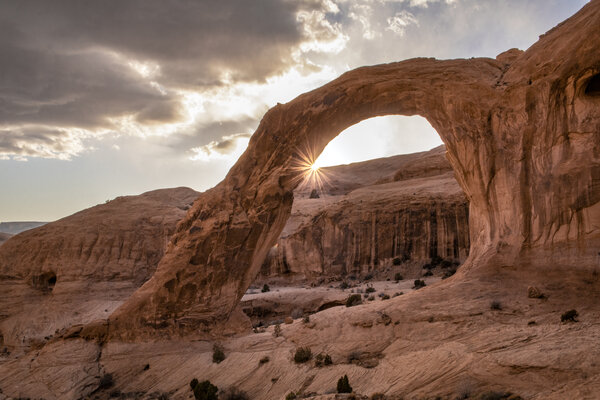
Landscape and Corona Arch - Mar 24, 2021
We went to Moab to explore the area and do some photography exploration over a week-long period. We arrived late on Sunday and left early on Friday which gave us 4 full days of hiking in this beautiful area. The weather cooperated most mornings and a few evenings for golden hour photography, but we got a variety of lighting from overcast, snowing, foggy, and full sun. In total, we hiked a little over 30 miles and over a mile in elevation on this trip. We came to the same conclusion that our favorite type of hiking is the type where we're alone or hiking with very few people so that we can enjoy nature to the fullest extent, as well as get a perfect photo with no one in it.
Wer're right at half-way through our trip at the start of this day and we're pretty exhausted. But we're here so we knew we had to venture on. Because the forecast for our last day was looking pretty bad, we decided to try and do all the things we had left on our list today. The morning started out early, which resulted in us getting to the Devil's Garden area before anyone else to make sure we were at Landscape Arch before the sun came up. We ended up getting there a little too early and waited around for about an hour at Landscape Arch before the sun finally broke through the clouds and above the large rock features to the East of the arch that was providing shade to it. I'm not sure that this arch even gets to benefit from a golden hour, but as soon as it lit up we got some good lighting that we took some photos and continued on.
We didn't intend to keep hiking past Landscape Arch, but Double O Arch was only one more mile from where we were, or so the sign said. It was closer to 1.5 miles, but we didn't know that when we decided to keep going. We didn't have adequate footwear or water (because we weren't planning on continuing on) which definitely made this hike harder than it should have been. Double O Arch was just as I remembered it 7 years ago in that it wasn't very photogenic. I don't think there's a time where the arch is ever fully lit up, so there were some harsh shadows on it. But the hike to get there was pretty scenic with Fin Canyon just to the East of us. Knowing that I wasn't going to get any good photos of Double O Arch helped me enjoy the hike a little bit more.
We took a pretty large break in the middle of the day. The morning hike was over 5 miles and resulted in us being outside for over three hours, so we knew we had to rest up to do another somewhat lengthy hike in the evening. Our evening plan was to head over to Bowtie Arch and Corona Arch which is supposed to get good evening golden hour lighting. This time, we decided to grab some sandwiches to take with us since all our evening hikes have started around 5 and we haven't gotten back into town until about 8. We got to the trailhead and hiked up to the arch and it did not disappoint. Corona Arch is in a pretty open area and we got there about 45 minutes before sunset which gave us plenty of time to take photos of both sides of the arch and eat our dinner and relax while the sun went down. I ended up running back and forth between the East and West side of the arch, and the map reflects that craziness that is being a photographer.
Of all the places we went on this trip, both Katie and I liked Corona Arch the best because of the spectacular sun setting views and also the lack of people. We definitely went on hikes with fewer people, but the people that we encountered were other photographers (who stayed out of our way) or courteous picnickers (who also stayed out of our way).
Read More
| Location: | Arches National Park, Moab BLM |
| Distance: | 9.31mi |
| Hiking Time: | 5 hours, 34 minutes |
| Elevation Gain: | 1,476ft |
| Max Elevation: | 5,486ft |
View Hiking Stats

The Small Hikes - Mar 23, 2021
We went to Moab to explore the area and do some photography exploration over a week-long period. We arrived late on Sunday and left early on Friday which gave us 4 full days of hiking in this beautiful area. The weather cooperated most mornings and a few evenings for golden hour photography, but we got a variety of lighting from overcast, snowing, foggy, and full sun. In total, we hiked a little over 30 miles and over a mile in elevation on this trip. We came to the same conclusion that our favorite type of hiking is the type where we're alone or hiking with very few people so that we can enjoy nature to the fullest extent, as well as get a perfect photo with no one in it.
We did so many little hikes on our second full day in Moab. We started pretty early to try and get some earlyish morning photos, but the sun didn't come out. In fact, it started snowing as we were driving through the park and was snowing pretty hard as we got to the far end of the park in Devils Garden. But we were there and we're in Moab to hike, so we got out of the car and headed to Tunnel Arch and Pine Tree Arch, which were a short half mile to get to. The snow wasn't ideal, but the temperature wasn't too terrible and there was a slight breeze but overall made the hike pretty tolerable. Tunnel arch wasn't much to look at, and neither was Pine Tree Arch, but we did get some cool views of fog rolling through the area we were hiking.
After leaving the Devil's Garden area, we stopped quickly at Skyline Arch, which is right off the side of the road and I wouldn't even consider a hike.
We moved onto Sandstone arch and Broken Arch after that which was the first real hike of the day at just over 2 miles long. It was still snowing when we started the hike, but only barely so. By the time we finished the hike, the sun was starting to peek out of the clouds. Sandstone arch is very aptly named since you hike through very thick sand that holds your feet down as you take each step. It wasn't very far, but the sand makes it much harder to walk. The hike to Broken Arch was different from the rest - we hiked through a prairie instead of between canyons or walls of sandstone. There were great views in every direction of the hike, including being able to see Broken Arch the entire time. When we got to Broken arch we wandered around to the backside and got a bunch of different views. Right before we left, the sun lit up the prairie behind Broken arch for us to get a well-lit photo.
We then went back to the Windows area to try and get some better photos from a lighting perspective. With the sun being covered by clouds, we figured the photos would be different than the first day of this trip when we walked up to the Windows. We were also able to get some better photos of Turret Arch since the sun was still in the East and that's an arch that you shoot looking West. We took the "primitive" trail around the Windows which wasn't primitive at all, and wandered down to Double Arch which was just covered with people. There is no way we'd be able to get a photograph without people in Double Arch, but we weren't expecting too so the Arch met our expectations.
After resting in the hotel for a little bit and getting some ice cream from downtown, we headed into Canyonlands to spend our evening. We weren't expecting a good sunset because of the clouds and forecast, so we ventured to take a look at the White Rim Overlook which has spectacular views on the Eastern side of the Canyonlands National Park area. The White Rime Overlook provided a better-than-expected view of the White Rim that was very surreal to look at. On our way driving back into town for some dinner we saw the sun peek through the clouds as it was setting and provided some perfect light, which made us a little sad that we didn't pick a destination for an evening hike to catch golden hour, but we were exhausted and it was what it was at that point.
Read More
| Location: | Canyonlands, Arches National Park |
| Distance: | 7.24mi |
| Hiking Time: | 3 hours, 34 minutes |
| Elevation Gain: | 860ft |
| Max Elevation: | 6,252ft |
View Hiking Stats

Mesa Arch and Delicate Arch - Mar 22, 2021
We went to Moab to explore the area and do some photography exploration over a week-long period. We arrived late on Sunday and left early on Friday which gave us 4 full days of hiking in this beautiful area. The weather cooperated most mornings and a few evenings for golden hour photography, but we got a variety of lighting from overcast, snowing, foggy, and full sun. In total, we hiked a little over 30 miles and over a mile in elevation on this trip. We came to the same conclusion that our favorite type of hiking is the type where we're alone or hiking with very few people so that we can enjoy nature to the fullest extent, as well as get a perfect photo with no one in it.
On our first full day of being in Moab we did our two most important hikes; Mesa Arch at sunrise and Delicate Arch at sunset. We woke up before sunrise and got to the trailhead for Mesa Arch in Canyonlands National Park right around 6:45. With sunrise being around 7:15, we figured that would give us enough time to get to the arch (less than a quarter-mile hike) and get set up with our cameras. When we got to the parking lot, we got one of the last spots - I guess everyone else had the same idea that we did. We got to the arch and it was packed with at least two dozen other people, mostly there with their tripods set up to take a photo of the sunrise lighting up the underside of the arch. There were some clouds in the Eastern horizon, so the sunrise didn't actually break through the clouds until about 7:45, all while we and everyone else were eagerly waiting for the perfect photo. The only complaint I had was that everyone was so close to the arch that I couldn't get a full photo of the arch because I didn't have a wide enough lens. But I guess that's what happens when you're an amateur photographer showing up to professional photographer "events". As we were waiting for the sun to rise, we chatted up a few people and there was one person who got there at 4am in the pitch dark to get his spot right at the center of the arch. The weather was in the 30's which isn't terrible, but the wind was blowing pretty strong, and even stronger after the sun rose, which made waiting a little bit miserable. Everyone was completely frozen but everyone was dedicated to wait for the sun to come up. Even though it was cold and packed, at least we were there with like-minded people just trying to get a good photo. The wait and the cold was worth it in the end.
After our early morning hike we decided to stay in Canyonlands National Park and drive the Shafer trail and back to Moab via Potash road. First, we drove through the park to look at the canyons since we couldn't see them as we were driving up in the dark. But because the sun was low, the canyons were a bit washed out and we didn't get any good shots or really even any good views of them. The Shafer trail is a 40-mile dirt road that requires an all-wheel drive vehicle with high clearance. We were a little unsure if we'd be able to make it in Katie's Subaru Crostrek, but when we asked the park ranger he said that it was "super easy" so we figured we'd give it a shot. Shafer trail was pretty steep and winding, but it wasn't all that technical and was pretty easy to drive. Potash Road on the other hand was not all that steep but a wildly bumpy ride, but we made it out without any problems. I can definitely see why all wheel drive and high clearance was required for that portion of the drive. The drive took us about two and a half hours in total including stopping several spots along the way to take photos.
During the day we rested and went into town to do some shopping and see what the downtown area was like. You can definitely tell that this area only exists for tourism, but it's a cute town nonetheless.
In the evening we did the cliche Delicate Arch hike which everyone who comes to Arches National Park does, even though it's rated as a moderately difficult hike. We wanted to get good sunset photos but unfortunately, there really was no sunset. There were clouds in the West and the whole hike was pretty overcast so the lighting wasn't great. The lighting was still better than the last time I was on this hike in 2014 in which I hiked that at noon and there were pretty harsh shadows. The hike itself wasn't terribly difficult, it was just incredibly steep in a very short distance so it was easy to get winded quickly. Once we got up there, it was a magnificent view, but the number of people ruined it. The hike we did yesterday evening was by far more interesting and spectacular because there weren't screaming kids running around in the foreground. We stayed up there for nearly 2 hours to try and get some photos without people in them, which we barely did, and also to see if the lighting would get any better. We cut our losses right around sunset and hiked back to the car before it got too dark.
Read More
| Location: | Arches National Park, Canyonlands |
| Distance: | 4.58mi |
| Hiking Time: | 3 hours, 59 minutes |
| Elevation Gain: | 866ft |
| Max Elevation: | 6,207ft |
View Hiking Stats

First Day in Arches National Park - Mar 21, 2021
We went to Moab to explore the area and do some photography exploration over a week-long period. We arrived late on Sunday and left early on Friday which gave us 4 full days of hiking in this beautiful area. The weather cooperated most mornings and a few evenings for golden hour photography, but we got a variety of lighting from overcast, snowing, foggy, and full sun. In total, we hiked a little over 30 miles and over a mile in elevation on this trip. We came to the same conclusion that our favorite type of hiking is the type where we're alone or hiking with very few people so that we can enjoy nature to the fullest extent, as well as get a perfect photo with no one in it.
We arrive in Moab around 2PM after a 6 hour drive from our home. It was a long drive, but we were excited to get there and the drive went by pretty quickly. When we got to Moab, we went into Arches National Park to just wander around a little bit with nowhere in particular that we wanted to really go.
We first stopped at Balance rock, right off the road and pretty easy to walk around. The lighting was a little harsh but since you can walk around the entire thing, there's always a side that's lit up. We then ventured on to the North and South Windows as well at Turret Arch. This one was barely considered a hike since it was less than a mile and paved almost the entire way. There was always someone up close to or in the South window, which made it pretty hard to get a good photo. There were a few spots where I could get low enough to cover most of the people up with brush or the trail went off to the side that I could get almost no one in the photo, but for the most part, this area was packed. The South Window had fewer people on it. Maybe because you don't quite walk right up to it, so it was nice that we could at least get photos of one of the windows. Turret Arch was shooting directly into the sun and not very photogenic. Maybe we'll come back to this spot a little later in our trip to get Turret Arch in the early or mid morning.
Our final destination for an evening was Tower Arch. We have several hikes planned out in the early morning or late afternoon to try and get some good golden hour lighting. The first thing we had to do to get to this hike was to drive on a dirt road, which made us feel pretty secluded which was nice after coming from the packed Windows area. When we got to the parking lot, there were only 2 other cars there, and one group was on their way out. When we got to Tower Arch, there was a couple with their children running around screaming, but they left shortly after we got there and had the arch all to ourselves for the entire evening. The sunset wasn't all that great because there were too many clouds in the way, although I'm not sure that sunset was the right time to be there anyway because of the location of some prominent features directly to the West of Tower Arch that cast a shadow. Even though we weren't there at just the perfect time for the lighting, we still enjoyed being there alone in the quiet vastness that is Arches National Park.
Read More
| Location: | Arches National Park |
| Distance: | 4.22mi |
| Hiking Time: | 2 hours, 24 minutes |
| Elevation Gain: | 948ft |
| Max Elevation: | 5,270ft |
View Hiking Stats

Gem Lake - Mar 7, 2021
The weather was fantastic this weekend. It was great all week long, which meant that there was no fresh snow to go snowshoeing. Since we knew that we wouldn't find any fresh snow, we decided to not even try to pick something that had snow potential and we stayed at the (relatively) lower altitude in Estes Park. The weather was in the 60's which makes for perfect hiking weather. Not too cold that the hiking can't warm you up and not so hot that you're sweating (although I did sweat a little on this hike).
We got to the trailhead around 11am and at 3.5 miles and 1,000ft elevation gain, the hike took us 2 hours. Since it was mid-day, the sun was in a horrible spot in the sky and washed out a lot of the Western mountain photos of Longs Peak. All things aside, it was a pretty mild hike for our hiking range, but my only complaint was the lighting. I guess that's what happens when you wake up late and slowly get to the trailhead.
Read More
| Location: | Rocky Mountain National Park |
| Distance: | 3.57mi |
| Hiking Time: | 1 hour, 58 minutes |
| Elevation Gain: | 1,030ft |
| Max Elevation: | 8,821ft |
View Hiking Stats

Freezing Hike to Mills Lake - Feb 28, 2021
We wanted to get out this weekend and up into the mountains so we headed up to Rocky Mountain National Park. We were really hoping to go snowshoeing, but nowhere in the mountains in Northern Colorado got any snow over the past week so we figured we'd bring our snowshoes but probably wouldn't use them.
We got to the trailhead around 1PM, and the Glacier Gorge parking lot was completely full. So we headed up to Bear Lake knowing that it probably wouldn't be a much better parking situation there, and it wasn't. However, since the Bear Lake parking lot is so big and since we got there in the early afternoon, there was a stream of people leaving and we were able to get a parking spot with little trouble.
Even though we couldn't park at the parking lot we wanted to, Bear Lake and Glacier Gorge are connected by a small 0.4 mile trail. The thing that sucked the most was that Bear Lake was higher than Glacier Gorge, so we hiked down 250 feet in elevation immediately which meant that the last half-mile was straight up and torturous. The whole hike ended up being pretty difficult for where we're at with our hiking this early in the season. It was a modest 5.5 mile hike with 1,300 feet of elevation gain that took us two and a half hours. We started the hike with the weather in the lower 20's and there were supposed to be little (5mph) winds, but there were a few unexpected windy spots on the trail, including at the lake, which is always expected at an alpine lake. The temperature dropped considerably on the hike and definitely got into single digits if not below, plus the 30mph wind chill made for the summit to be pretty miserable. However, because of the wind, there was a lot of snow drifting off the nearby mountains that made for some pretty great views.
Read More
| Location: | Rocky Mountain National Park |
| Distance: | 5.49mi |
| Hiking Time: | 2 hours, 33 minutes |
| Elevation Gain: | 1,319ft |
| Max Elevation: | 9,942ft |
View Hiking Stats
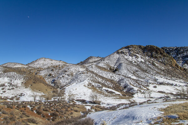
Windy Boring Hike in Livermore - Feb 21, 2021
Katie and I went up to Livermore to hike in the Eagle's Nest Open Space. Neither of us had been there before, so we figured we'd give it a shot. When we got there, the temperatures were in the upper 30's, which we couldn't have asked for nicer temperatures in the middle of February. However, there was a constant wind with gusts that made the hike not so pleasant.
We were originally going to do both the Triple Bar loop and the OT Loop for a total of a little over 5 miles, but because the hike wasn't that scenic and because of the wind, we cut the hike short at 2.5 miles by just doing the Triple Bar loop. I don't think either of us will come back to this area anytime soon to hike because there are many more scenic places to hike in Colorado.
Read More
| Location: | Livermore |
| Distance: | 2.53mi |
| Hiking Time: | 53 minutes |
| Elevation Gain: | 548ft |
| Max Elevation: | 6,098ft |
View Hiking Stats

Nymph, Dream, and Emerald Lake - Feb 7, 2021
We headed up into the mountains for the first time this year to go snowshoeing in Rocky Mountain National Park. We bought a parks pass since this is pretty much the only area that didn't get burned to the ground this summer (although it got its fair share of burning as well). We figured that this year will be a lot of Rocky Mountain National Park hiking so we might as well buy a pass to get into the park all year long.
We got to the trailhead at about 9:30, right as the storm over the trail was dissipating. It was perfect because we had pretty good fresh snow but it wasn't snowing directly on top of us. The trail was also a little less busy when we started our hike since people were waiting for the storms to pass.
We were well prepared with our clothing and equipment, however, I did forget one critical item: an SD card fro my camera. I even had 4 camera batteries with me, but no SD card. So all of these photos were taken with my phone which did a decent job, however, it didn't do so great with the colors (which is why there's a lot of black and white photos in this album). Oh well, you live and you learn and this isn't a mistake I'll be making again during the 2021 hiking season.
We didn't need our snowshoes to get to Nymph Lake, they were arguably needed to get from Nymph Lake to Dream Lake, and they were essential to get from Dream to Emerald Lake. The hike took us almost 2 and a half hours for the 3.5 mile round trip hike that was only 827 feet of elevation gain.
Read More
| Location: | Rocky Mountain National Park |
| Distance: | 3.45mi |
| Hiking Time: | 2 hours, 23 minutes |
| Elevation Gain: | 827ft |
| Max Elevation: | 10,051ft |
View Hiking Stats
2020
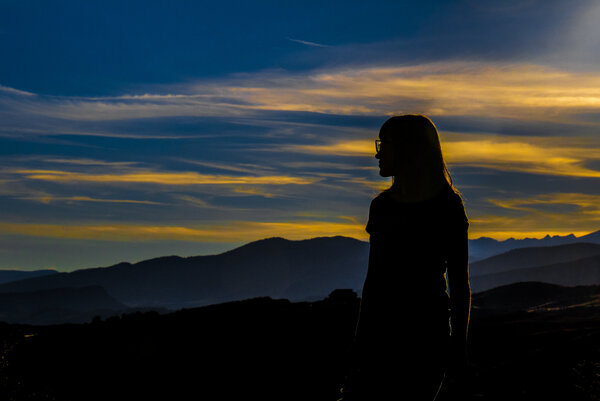
Christmas Hike - Dec 25, 2020
The weather was exceptionally nice on Christmas. With the temperatures in the mid 50s, we knew we had to get outside. Plus, I got a new GPS watch, a Garmin Instinct, so I needed an excuse to go try it out. We got done with our Christmas activities around 2 and decided to hit the trails. Since it was so late (and since the sun sets around 4:30), we didn't have much time to hike so we picked something close. We ended up hiking Coyotee Ridge which is a short 10-minute drive from our hours. The 4-mile hike was only 600 feet in elevation gain and only took us an hour and a half.
Read More
| Location: | Fort Collins |
| Distance: | 4.13mi |
| Hiking Time: | 1 hour, 26 minutes |
| Elevation Gain: | 594ft |
| Max Elevation: | 5,713ft |
View Hiking Stats
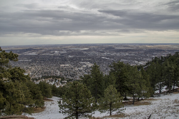
Mount Sanitas Via Lions Lair Spur - Dec 20, 2020
It was a warm wintery day, in the low 50's, so we decided to get out and hike. It's been a little while since we've done a real hike so we decided to keep it easy. We picked a 4.5 mile round trip hike with about 800 feet of elevation gain. Not too difficult but still hard enough to give us a workout. The hike ended up being double the elevation gain than we were thinking. Not sure how that happened, but we made it and didn't suffer too much from the unexpected difficulty of the extra elevation gain.
Read More
| Location: | Boulder |
| Distance: | 4.73mi |
| Hiking Time: | 1 hour, 52 minutes |
| Elevation Gain: | 1,647ft |
| Max Elevation: | 6,875ft |
View Hiking Stats

Reservoir Ridge - Dec 6, 2020
The weather was pretty nice so we went on an afternoon hike up Reservoir Ridge in North Fort Collins. It was decently warm at 60° for a December afternoon, but we didn't question it. We knew that the further into the mountains we went the colder it would be, so we stayed in Fort Collins and just did the short 3.5 mile loop which had less than 500 feet of elevation gain.
Read More
| Location: | Fort Collins |
| Distance: | 3.84mi |
| Hiking Time: | 1 hour, 18 minutes |
| Elevation Gain: | 489ft |
| Max Elevation: | 5,565ft |
View Hiking Stats

Shanahan Ridge - Nov 1, 2020
It's been a while since we've gotten out and hiked because of all the fires. We knew we needed to get out and enjoy the mountains while there was no smoke and before it starts getting too cold. We headed to Boulder because it's a location that wasn't too far away and also not currently on fire. Because of the fires, our options for hiking are pretty limited. It seems like most of the fires have almost died out or slowed enough that they're not a major thread to rapidly spread, but there's a lot of damage that's either blocking road access to get to hiking trails or the fire went through hiking trails and isn't safe to hike yet.
Shanahan Ridge was a great trail to come back to hiking. It was under 4 and a half miles and less than 1,000 feet of elevation gain. Just like all the trails in Boulder, there were many options that would allow us to go more or less distance, but we set out to do the entire 4 miles hike and completed all of it, but nothing extra.
Read More
| Location: | Boulder |
| Distance: | 4.29mi |
| Hiking Time: | 1 hour, 33 minutes |
| Elevation Gain: | 817ft |
| Max Elevation: | 6,408ft |
View Hiking Stats

Leaf Peeping at Guanella Pass - Sep 27, 2020
It's that time of the year where the colors start changing. The colors in Colorado don't really stick around, so you have to be prepared the last couple of weekends in September and the first weekend in October to go hunt for fall colors. Since it's still a little early, we knew we had to get up high in elevation to see some color, so we started doing some searching in local newspapers to figure out where is recommended for this year this weekend. We found one article with a recent photo that specifically showed some gorgeous colors at the Silver Dale Interpretive Site just outside of Georgetown on the Guanella Pass scenic highway. Because we weren't guessing where to go and what elevation the colors would be at, we found an amazing site packed with tons of turning aspens. The weather was cooperative being in the 50s but partially cloudy which gave us a lot of different lighting, everything from cloudy, to sunny and even some soft lighting in between. The trees were perfect and the lighting was perfect, so I don't think it could have gotten much better. The Guanella Pass area surpassed our expectations and will definitely be on our shortlist for leaf-peeping in future years.
I am considering this a hike since it was up in the mountains, had some elevation gain (over 500ft), and was over 3 miles round trip. Even though it took us over 2 hours, this was a very slow moving hike that we had lots of fun stopping and shooting along the way.
Read More
| Location: | Georgetown |
| Distance: | 3.17mi |
| Hiking Time: | 2 hours, 11 minutes |
| Elevation Gain: | 551ft |
| Max Elevation: | 9,656ft |
View Hiking Stats
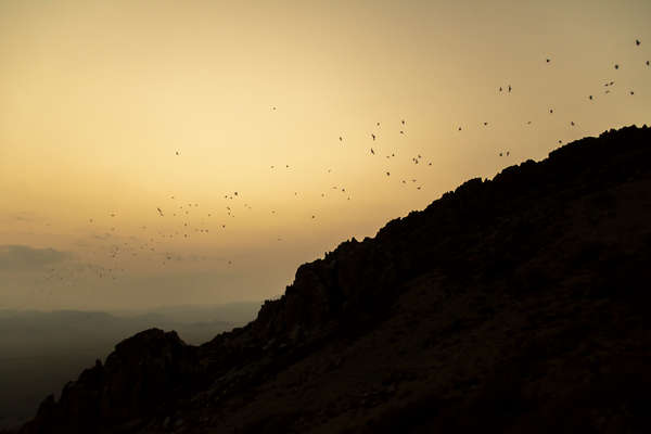
Orient Mine Hike - Sep 17, 2020
This is the second time I've hiked to the top of the Orient mine this year. Katie and I came up to the hot springs in early January and I hike this on a cold morning on the fourth. This hike was quite a bit easier this time for a number of reasons, but mostly because it wasn't freezing cold since it was September. However, it did drop into the 40's at night, and since we did this as a sunset hike to see the bats, we were up there until the sun went down and it got really cold.
The hike ended up taking an hour to get up and a half hour to get down, and we stayed at the top for an hour while we waited for the bats to come out. The 4 mile hike was only 761 verticle feet in ascent, but we went on this hike to see the bats, not necessarily get in a difficult hike.
Read More
| Location: | San Luis Valley |
| Distance: | 4.34mi |
| Hiking Time: | 2 hours, 42 minutes |
| Elevation Gain: | 761ft |
| Max Elevation: | 9,319ft |
View Hiking Stats

Coulson Gulch to Ralph Price Reservoir - Aug 31, 2020
We haven't gone hiking in a little while because of the smoke. This weekend the winds were blowing West, so it kept the East side of the mountains pretty clear so we decided to go for a hike. We were originally planning on a 5 mile round trip hike which would have been turning around once we hit a forest road but ended up walking down the service road to Ralph Prince Reservoir which added an extra two and a half miles round trip making the total hike just under 7.5 miles and just over 1,500 feet in elevation gain. The hike took us 3 and a quarter hours to complete. I'm glad we made it to the reservoir because it gave us a nice destination with some great views.
This hike was a lot different than all the others we have gone on because the hike started at the high point. So we hiked down 1,500 feet in elevation, and the hard part was the return back to the car. Typically hikes start low, you hike up high, and the hike back is nice and easy. Because of this, we were never given the point of turning around early from exhaustion since going down is always easier than going up. We paid for this in some sore muscles the next day, but overall it was a pretty good hike.
Read More
| Location: | Lyons |
| Distance: | 7.43mi |
| Hiking Time: | 3 hours, 14 minutes |
| Elevation Gain: | 1,558ft |
| Max Elevation: | 7,707ft |
View Hiking Stats

Bulwark Ridge - Aug 9, 2020
We ventured into Glen Haven to look for a hike this weekend. We've only done one other hike in Glen Haven, Crosier Mountain, and that hike was a lot of fun with spectacular views so we decided to give another hike in the area a try. We picked the Bulwark Ridge area because there were lots of options depending on how we were feeling. Our original goal was to make it to the Miller Fork Loop, but we decided against it after hiking up 1,000 feet and not wanting to hike down Bulwark Ridge just to hike back up to Miller Fork. And more importantly, we did not want to have a 1,000 foot ascent on our way back to the car - hikes should be easy on the way back! Instead, we stayed on Bulwark Trail and almost made it to the Wilderness Border.
The problem with this kind of hike is that we had no destination which kind of made the whole hike a little boring. The closest thing that we could have hiked to on Bulwark Ridge was Signal Mountain, which is out of our skill level (it's 3,000+ feet in elevation gain and over 10 miles long). Since there's no destination, there's no motivation to get to the "end" and you just turn around whenever you really like. Some people might like that option, but I really like hiking to a destination, be that a lake, waterfall, or top of a mountain. When you hike to a destination, it just gives you a sense of accomplishment and a good spot to rest.
There were some pretty great views early on in the hike. You start on a South-facing ridge that's pretty exposed, so you get to see all the Southern mountain ranges. It was pretty hazy, most likely from the Pine Gulch fire all the way in Grand Junction. That fire started a little over a week ago and is over 200 miles away from us. So the fact that we can see and smell it way over in Northern Colorado shows how big this 20k acre fire really is. Hopefully, they get in contained sometime soon.
We turned around after hitting the 3-mile mark, making for a total round trip distance of just under 6 miles and over 1,400 feet in elevation gain. We started the hike at about 9:30am, and the temperatures were already into the upper 70's. By the end of the hike, it was certainly into the 80's. My watch recorded a max temperature of 93°F, but that's my skin temperature which tends to be a little hotter than the outdoor temperature. The heat combined with the steep incline immediately and the lack of shade for a good portion of the hike made this a pretty difficult hike.
Read More
| Location: | Glen Haven |
| Distance: | 5.92mi |
| Hiking Time: | 3 hours, 2 minutes |
| Elevation Gain: | 1,444ft |
| Max Elevation: | 9,218ft |
View Hiking Stats

Stone Mountain - Jul 26, 2020
Since it's been 3 weeks since our last hiking adventure, Katie and I ventured into the woods. We picked a pretty close hike that was only thirty minutes away from our house because the weather wasn't supposed to be great anywhere, so we figured the closer it the trailhead is the earlier we can get started. Because of this, it was pretty low in elevation, starting a little over 5,000 feet. Since we didn't get somewhere higher or further in the mountains, we didn't escape the city heat very much, but that was okay since it only got in the upper 70's and stayed overcast for the majority of the hike. It even started sprinkling a little bit during the hike which was refreshing.
Katie was pretty tired and only made it about halfway before deciding to turn around at wait in the car, so for the last 2.5 miles of the hike up and entire way down I was hiking by myself. Her hike was about 4 miles and 1,000 feet in elevation gain, mine ended up being 8 and a half miles and 2,300 feet in elevation gain. It took me 2 hours longer than Katie for a total hike time just under 4 hours.
Compared to some of the other hikes we've done, this one wasn't all that memorable - the views at the top were okay, and there's weren't many spots that overlooked the trail. The trail is also pretty close to the road for the first several miles, so you don't really feel like you escaped civilization. The summit was a little bit of a scramble to get all the way to the top (hence why it's called Stone Mountain) which was a little bit of fun.
Read More
| Location: | Loveland |
| Distance: | 8.57mi |
| Hiking Time: | 3 hours, 52 minutes |
| Elevation Gain: | 2,346ft |
| Max Elevation: | 7,539ft |
View Hiking Stats

Bighorn Lake - Jul 3, 2020
Bighorn Lake was a tough challenge. Having hiked a moderately difficult hike the day prior, plus poorly sleeping from camping, I'm quite impressed that we made it to another alpine lake that was even further and higher than the hike prior. But we had all day to accomplish it, so we took our time. 5 and a half hours to be more precise. considering we've done similar length and elevation hikes in about 3 and a half hours show how lazy we were on this 8.5 mile and 1,400-foot elevation hike. Our first main break was where the river that runs off of Lake Katherine meets the Lone Pine Creek. We encountered this one the day before since Lake Katherine and the Bighorn Lake trailhead start at the same place, so we knew this would be a great resting point which was less than a mile and a half into the hike. We took off our boots and stuck our feet int he freezing cold water. The lakes are at 10,000 feet, so the water is quite cold since it's from snowmelt (yes, even in July). We didn't have our toes in the water for long, but we did eat some cookies and relax for about 20 minutes before proceeding down the new path that we hadn't been on to get to Bighorn Lake.
We got completely lost on this hike. But we weren't concerned since my watch tracks our location and since Katie had a map downloaded to her cell phone and she had GPS signal. We were trying to follow the phone map, but the map wasn't quite up to date and we headed down what looked like a legitimate path, which quickly turned into a deer trail, and then eventually nothing. We knew the trail followed the river for a little bit, so we followed the river and eventually caught up to the trail. I will say the path we took seemed less steep even though we didn't go too much farther in distance. So maybe getting lost was a good thing?
When we made it to the lake, we were the only ones there. We sat and ate some lunch and relaxed while looking over the lake. It was beautiful, and being alone made it all that much more peaceful. We proceeded to try and make it to the far point on the lake. We stopped on the shore by a rock that was perfectly shaped like a recliner where we sat for a little longer until we weren't alone on the lake anymore and another group of hikers had summited. We proceeded to the far end of the lake which was spectacular and worth the trouble of crossing over an almost-waterfall to get to a glacier-looking area that we walked onto. The snow gave a blueish hue to the lake that was almost surreal.
Just another 500 feet above a steep rock face was the continental divide which was a crazy thing to stop and think about - the snow we had been standing on and all the snow we could see still on the peaks around us would fall into this lake and end up on the East side of the country.
Read More
| Location: | Medicine Bow-Routt National Forests |
| Distance: | 8.49mi |
| Hiking Time: | 5 hours, 24 minutes |
| Elevation Gain: | 1,430ft |
| Max Elevation: | 10,074ft |
View Hiking Stats

Lake Katherine - Jul 2, 2020
For the Fourth of July weekend, Katie and I decided to head up to the Medicine Bow-Routt National Forest. Katie got the two days leading up to the weekend off and I took vacation time from work so that we could beat the crowds to camping and head out on Thursday. We picked this location because it was pretty far away (so there was a good chance of little people, even for a holiday weekend), and because there was no fire ban in the Medicine Bow-Routt National Forest until starting July third. Since we were getting up there on the second and coming back on the fourth, this at least let us set up a campfire for one of the two nights we were camping. All the other forests and dispersed camping areas already had fire bans in place, so we figured this was the best that we could do. This area did not disappoint. Getting there on Thursday we were the only ones camping off the side of the road.
We got a lazy and late start to leave for camping. We left Fort Collins a little after noon and got to the campsite around 3. It took us an hour to set up camp and then we decided to do our first hike. It was a pretty late hike to get going in the afternoon, but since we didn't have anywhere to be or anything that needed to get done, we figured why not go hiking?
The hike wasn't all that difficult but did have quite a bit of elevation - 1,000 feet - in just 2.6 miles one way. The hike took up almost 2 hours and thirty minutes, although we went off trail at the lake to try and make it to a better location to take photos. We only encountered a few people along the way - There were a few people fishing on the river and we saw two groups of backpackers heading up to the lake to set up camp.
Read More
| Location: | Medicine Bow-Routt National Forest |
| Distance: | 5.2mi |
| Hiking Time: | 2 hours, 23 minutes |
| Elevation Gain: | 1,004ft |
| Max Elevation: | 9,831ft |
View Hiking Stats

Crosier Mountain Via Devils Gulch Road - Jun 21, 2020
We haven't been hiking in a couple of weeks. With Katie starting her new job and us only having Sundays together without either of us having to work, it's hard to get everything we want to do together done in just one day. But since we didn't go hiking the week prior, we knew we had to go this weekend!
Summiting Crosier Mountain is no easy task. First, you have to pick one of three different trailheads, all of which are over 7 miles in round trip length and over 2,000 feet of elevation gain. We thought we were picking the shortest and least steep of the three trailheads, but our hike ended up being 9 miles and 2,100 feet of elevation gain. The maps lied to us with the distance but we made it none the less and I'm pretty sure the other 2 trailheads would have been even longer and steeper.
We did the 9-mile round trip hike in just over 4 hours. The weather ended up being perfect. It was a little hot and sunny for the first couple of miles, then overcast for the rest of the hike with cooler low-70° temperatures and just a tiny bit of rain sprinkles. We stopped for 30 minutes at the summit to eat a late lunch and to rest a bit before heading down. The hike had everything from a large meadow with awesome views of the Mummy Range to dense woods, both alive and completely and eerily dead, and a spectacular summit panorama.
Read More
| Location: | Glen Haven |
| Distance: | 8.47mi |
| Hiking Time: | 4 hours, 3 minutes |
| Elevation Gain: | 2,162ft |
| Max Elevation: | 9,137ft |
View Hiking Stats
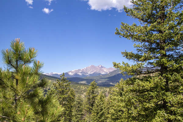
Button Rock Mountain - Jun 7, 2020
We haven't ventured into Lyons all that much, but there are lots of untapped hikes in the mountains West of Lyons. It seems like most people don't know about this area of Colorado because most people willing to drive at least to Lyons are willing to drive all the way up to Rocky Mountain National Park in Estes Park which is known for it's hiking. The thing is that Lyons hiking offers a very similar feel for hikes as Rocky Mountain National Park but with less drive and fewer people.
We picked Button Rock Mountain because it was rated right in the middle on my hike list in terms of difficulty rating (which is a total B.S. calculated number - but there is some math behind it). The hike list has actually become a great spot for us to pick hikes from. It's smaller and tailored towards what we want to do and still has a wealth of information for picking a hike.
There was a group of hikers that started hiking at the same time as we did and hiked with us most of the way to the top. I suspect they followed us pretty closely because at the first fork, they asked us about which way to go and learned quickly that they weren't hiking the trail they thought they were hiking. There were some times when them following us was a little annoying (since we hike to be alone), but it didn't bother me too much. Because of all the turnoffs and different trails in the area, I wouldn't recommend hiking this without a map, but they seemed to do OK (as far as we know).
Both Katie and I ended the hike pretty exhausted since we were hiking for over four hours. The last mile was the hardest because we were both ready to be done. The hike itself was a little over 9 miles (less if you don't get lost as we did with all the turn-offs) and over 1,600 feet of elevation gain.
Read More
| Location: | Lyons |
| Distance: | 9.17mi |
| Hiking Time: | 4 hours, 3 minutes |
| Elevation Gain: | 1,657ft |
| Max Elevation: | 8,372ft |
View Hiking Stats
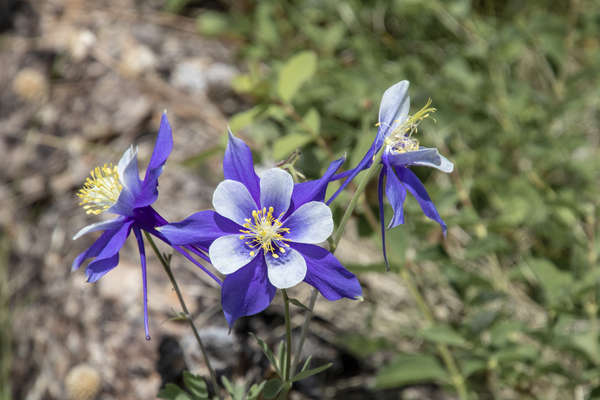
Wildflowers at Young Gulch - May 31, 2020
Knowing that we had to keep going on hikes if we were to make our goal of hiking a 14er, we decided to go on a hike. We've been in the middle of doing some home renovation which takes most of our physical strength. But the hikes must go on.
We picked Young Gulch because we knew that we would be able to get a parking spot (it's not a very popular trail and it's a bit further up the Poudre than other hikes). We got to the trailhead pretty late, almost noon, because then we went out to take photos of the horses at the barn Katie boards her horse at (hence yesterday's post). The barn closes the pasture for the horses for a month and a half which at the end results in some pent up horses running wild.
The best and worst thing about hiking through gulches is that there's no real destination. Young Gulch ends at another road, so there's really no incentive to go all the way. So even though the trail is 10 miles all the way out and back, we only did a little over 6 miles in the course of 2 hours and 19 minutes. I'd like to blame it on the weather (it did start raining pretty good right when we turned back), but the reality was that we were both pretty tired. The best part of the hike was the wildflowers. I've never seen so many varieties of wildflowers on a single hike. Most of this post is filled with the wildflowers.
Read More
| Location: | Poudre Canyon |
| Distance: | 6.03mi |
| Hiking Time: | 2 hours, 19 minutes |
| Elevation Gain: | 843ft |
| Max Elevation: | 6,594ft |
View Hiking Stats

Gray Rock - May 17, 2020
The hiking gods were against us today. Well at least me. As soon as I left the car, I turned on my GPS on my watch and the screen went blank. It's done this before and usually takes me plugging it in to get it to turn back on. I didn't have the charger with me so I was out of luck. The thing was at full battery so I was pretty disappointed that it decided to not work for this hike. As such, I don't have accurate geotagging for any of the photos, along with accurate mileage or elevation. Oh well.
the second thing that went wrong was after I took the first photo. I realized that there was a pretty fuzzy section in the corner of the photo. Turns out my UV filter was completely shattered. Easy enough fix, I just took the filter off. But it was still pretty baffling to find a shattered UV filter considering that takes a pretty hefty drop to break one of those and I think I would remember dropping my camera like that.
This was the hardest hike we attempted. With over 1,000 feet more elevation gain of any other hike we've done, this hike comes in at half a mile of elevation gain in 4 horizontal miles of hiking (round trip just over 8 miles). Considering it took us four and a half hours, I'm just glad we survived. We got lost a few times including one time when we were full-on mountaineering down some very steep rocks trying to find the trail. The hike itself had some spectacular views at the summit. It was pretty hazy, so I'm sure the photos don't do it justice, but other than the panoramic views there were some blooming wildflowers and a gorgeous green meadow. On the other side of the loop trail, we hiked through a burn area (from the Hewlett's Gulch Fire in 2012) that was starting to recover.
Read More
| Location: | Poudre Canyon |
| Distance: | 8.5mi |
| Hiking Time: | 4 hours, 30 minutes |
| Elevation Gain: | 2,421ft |
| Max Elevation: | 7,616ft |
View Hiking Stats

Prairie Ridge Natural Area - May 10, 2020
The City of Fort Collins put in a new nature trail that connects up with Coyote Ridge. It's not a hard hike, and not really a hike per se, but with Katie's blisters we decided not to do anything with too much (or any) elevation gain. The walk was about 5 miles and took us an hour and a half. We didn't make it all the way to the coyote ridge trail, we turned back a little early. I didn't take many photos because the area is a little bland and not all that exciting to me anymore. My main takeaway from this was that I'm definitely going to have to come back here to bike this winding trail sometime.
Read More
| Location: | Fort Collins |
| Distance: | 5mi |
| Hiking Time: | 1 hour, 25 minutes |
| Elevation Gain: | 315ft |
| Max Elevation: | 5,331ft |
View Hiking Stats

Lion Gulch - May 3, 2020
We ventured into Estes in hopes that we could go hike Bridal Veil Falls, which starts at McGraw ranch. Since McGraw ranch is in Rocky Mountain National Park, the parking lot was closed, not even allowing up to get to the trailhead. We pulled over on the side of the road and did some quick Googling to find an appropriate substitute and we landed on Lions Gulch, which was just a 15 minute drive from where we were at.
After arriving at the trailhead, we immediately went the wrong way and spent the first three-quarters of a mile trying to find the trail again. Once we found it, everything was great until a few miles in when Katie started getting blisters on her feet. It was a painful rest of the hike for her, and a hot rest of the hike for both of us. The temperature was in the mid 70's, plus being exposed for a good majority of the hike made this the most sweaty hike of 2020 (so far).
The hike itself was okay, not really that spectacular from what we've been hiking recently, but it was still a challenging 7.75 mile, 1,500 foot elevation gain hike that took us three and a half hours.
Read More
| Location: | Estes Park |
| Distance: | 7.74mi |
| Hiking Time: | 3 hours, 25 minutes |
| Elevation Gain: | 1,552ft |
| Max Elevation: | 8,424ft |
View Hiking Stats
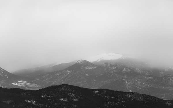
Storm Mountain - Apr 26, 2020
We have been waiting for the weather to be nice enough to go up to Storm Mountain. It's a bit higher in elevation, starting at over 8,000ft, so we knew that there would be some snow on the trail. Someone submitted a post on a hiking website from the day prior saying it was snowy but well packed down. That hiker lied. The last mile of the trail was really soft snow that had us at some points stepping into snow that was knee-deep. The combination of the steep trail in itself plus the deep snow made this a really difficult and somewhat dangerous hike.
The name of this mountain didn't disappoint. As we were hiking up, something was rolling over the mountains. By the time we were almost back to the car, the storm had made it over storm mountain and was sprinkling on us a little bit. But the views were spectacular. Over the course of the hike, we got a full view of all the mountain ranges around Storm Mountain. Unfortunately, the storms coming from the West made the Western mountains pretty hazy.
Overall, the hike was 5 and a half miles long, took us two hours and 40 minutes, and was 1,400 feet in elevation gain.
Read More
| Location: | Roosevelt National Forest |
| Distance: | 5.52mi |
| Hiking Time: | 2 hours, 40 minutes |
| Elevation Gain: | 1,381ft |
| Max Elevation: | 9,788ft |
View Hiking Stats

Pawnee Buttes - Apr 19, 2020
Because of all the snow we got the previous week, we figured everywhere in the mountains would be snowy, icy, muddy, or all 3. So we decided to venture into the Pawnee Grasslands instead. It was a little bit further of a drive than we'd like, about an hour and a half, but the views were worth it.
The hike itself was pretty easy, just over 5 miles and only 600 feet of elevation gain. But you can't expect much for Eastern Colorado where it's pretty much flat everywhere. Just looking at the length and elevation, this isn't a hike we would have chosen, but I had always wanted to go back here after coming here in March of 2010.
Read More
| Location: | Pawnee Grasslands |
| Distance: | 5.16mi |
| Hiking Time: | 1 hour, 57 minutes |
| Elevation Gain: | 604ft |
| Max Elevation: | 5,350ft |
View Hiking Stats

Mount McConnel - Apr 11, 2020
Katie and I are trying to get in shape for a fourteener so we made a goal to hike just about every weekend. I even created a nifty site that has all of our adventurous hiking goals on it for us to be able to pick out hikes quickly. We really wanted to do Storm Mountain, but reports of other hikers said that it was still pretty snowy and cold, so we opted to go up the Poudre again, this time just a few miles East of the trail we hiked last week. I was a little worried that this trail would be so similar to Dadd Gulch due to the proximity, but this hike was completely different. This hike was surprisingly perfect. The scenery was absolutely gorgeous (in the kind of way that a burn area can be), was short in distance (but not too short), and challenging in elevation (online resources lied about the elevation gain, claiming it was in the 1,400 feet of elevation gain, where it was actually over 1,700).
There were two things that could have been better. First I wish there were bluer skies in the North. I guess I can't complain though because the overcast skies made for pretty perfect lighting during the entire hike. Second would have been less wind. But when you hike to the top of something, it's kind of expected to be windy.
There was a pretty treacherous spot along the trail as we were coming down that made it seem like we weren't on the trail at all for a good mile of the descent. There were also a few good spots where we were hiking pretty close to dropoffs, as well as hiking on the snow and nearly sliding off the dropoffs. Despite this trail trying to kill us, we survived the 5.2 mile hike with over 1,700 feet of elevation gain in just under 3 hours.
Read More
| Location: | Poudre Canyon |
| Distance: | 5.19mi |
| Hiking Time: | 2 hours, 52 minutes |
| Elevation Gain: | 1,739ft |
| Max Elevation: | 8,026ft |
View Hiking Stats

Dadd Gulch - Apr 5, 2020
We wanted to do two hikes this weekend because we had nothing better to do. Yesterday's hike was a little busy and had quite a few people on the trail. It didn't really feel much like social distancing. So this time we went up the Poudre pretty far all the way to Dadd Gulch. When we started, around 9:30 am, there were only 3 cars in the parking lot. When we finished, there were a few more, but still pretty empty. I'd say we limited our social interactions today quite a bit.
The hike was supposed to be 7.8 miles long, but the end of the trail was a bit hidden by snow. We turned around just short of the ending point, which was just a road, so I don't think we missed out on much. The hike was almost 1,400 feet in elevation gain and took us three hours.
Read More
| Location: | Poudre Canyon |
| Distance: | 6.71mi |
| Hiking Time: | 2 hours, 56 minutes |
| Elevation Gain: | 1,371ft |
| Max Elevation: | 8,379ft |
View Hiking Stats

Mallory Cave - Apr 4, 2020
Needing to get outside a bit, we went to NCAR in Boulder and hiked up to Mallory Caves. We couldn't get all the way to the cave opening due to them being closed April-September, but we'll come back some other time when they're open. It was a pretty easy hike, almost 3.25 miles and less than 1,000 feet of elevation gain. It took us just over an hour and a half.
Read More
| Location: | Boulder |
| Distance: | 3.32mi |
| Hiking Time: | 1 hour, 39 minutes |
| Elevation Gain: | 932ft |
| Max Elevation: | 6,738ft |
View Hiking Stats

Blue Sky Trail - Mar 29, 2020
Needing to get outside from the stay-at-home mandate, Katie and I decided to go for a hike. Originally we planned on just hiking up Coyote Ridge, but the parking lot was packed. We went to the other end of Coyote Ridge trail, which was the Blue Sky Trail. There were only a few parking spots left so we grabbed one and started hiking.
Blue Sky Trail is a great mountain biking trail, so there were several times we almost got ran over, but it was still a nice hike. I'm definitely going to come back here to do some biking over the summer. It had less than 500 feet of elevation gain and we turned back before making it all the way to Coyote Ridge, making out round trip distance four and a quarter miles and taking an hour and a half.
Read More
| Location: | Horsetooth |
| Distance: | 4.22mi |
| Hiking Time: | 1 hour, 29 minutes |
| Elevation Gain: | 479ft |
| Max Elevation: | 5,701ft |
View Hiking Stats

Wapiti Trail - Mar 7, 2020
The weather was exceptionally nice for an early March weekend. The temperatures for both Saturday and Sunday hit 70°, so we knew we had to get outside. We originally planned to go hike Bobcat Ridge in West Loveland, but when I looked at the parking lot web cameras at about 11 am, I noticed that the parking lot was empty, suspiciously so. Bobcat ridge doesn't have a lot of parking space, so I wanted to check to make sure that it wasn't too crowded before heading that way. It turns out the trail was closed due to muddy conditions, so we had to figure something else out.
Since this is the first real hike that Katie and I have done this season, we didn't want to do anything too ambitious. We ended up picking the Wapiti trail because it had some good turnaround points that we could choose how far we wanted to go pretty easily. Once we made it 2.5 miles into the trail, we decided to continue on the Ponderosa Loop, a 2.5 mile loop that took us to a scenic overlook of the western mountain range where we sat and ate a late lunch. It was a little windy since the overlook was exposed, but the views were worth it.
The hike ended up being an ambitious 8.32 miles that took us almost 3 and a half hours and nearly 1100 feet in elevation gain.
Read More
| Location: | Boulder |
| Distance: | 8.32mi |
| Hiking Time: | 3 hours, 21 minutes |
| Elevation Gain: | 1,093ft |
| Max Elevation: | 6,844ft |
View Hiking Stats

Mount Margaret Snowshoeing - Feb 8, 2020
Katie and I went up to Red Feather Lakes to go snowshoeing at Mount Margaret. We picked an easy trail since both of us are out of shape and since this was Katie's first time snowshoeing. the trail itself is over 7 miles long, but we only hiked a portion of the trail, turning around after 2 miles making it a roundtrip hike of just under 4 miles. It took us almost 2 hours even though it was a measly 500 feet in elevation gain.
Read More
| Location: | Red Feather Lakes |
| Distance: | 3.96mi |
| Hiking Time: | 1 hour, 51 minutes |
| Elevation Gain: | 505ft |
| Max Elevation: | 8,177ft |
View Hiking Stats

Orient Mine & Sunset - Jan 4, 2020
In the morning I woke up and decided to do some morning photography. I grabbed my stuff and quietly left the cabin a little after 7am. I started heading to the bat caves, which I didn't think was too far away. About an hour and a half later, 2 miles, and 700+ feet in elevation gain, I made it to the bat caves on an empty stomach in the freezing cold with no water. I wouldn't recommend doing that again without being prepared, but it was a pretty gorgeous hike and very peaceful that early in the morning in the middle of winter.
Read More
| Location: | San Luis Valley |
| Distance: | 4mi |
| Hiking Time: | 2 hours, 30 minutes |
| Elevation Gain: | 768ft |
| Max Elevation: | 9,414ft |
View Hiking Stats
2019
White Tanks - Dec 28, 2019
We went to the closest hiking spot to where Katie's family lives, the White Tanks. It's only about a 15 minute drive and gets you into the mountains. We did a pretty short hike, just a 2 miles round trip, and it only had 233 feet of elevation gain, but the destination was a pretty tall waterfall that I'm told was flowing pretty well, even though there wasn't much water coming off of it by my standards. But I do have to remember that this is Arizona.
Read More
| Location: | White Tanks |
| Distance: | 2mi |
| Hiking Time: | 46 minutes |
| Elevation Gain: | 233ft |
| Max Elevation: | 1,585ft |
View Hiking Stats

Lake Pleasant - Dec 26, 2019
While in Arizona, Katie took me to a few of her favorite outdoor locations. One of those places is Lake Pleasant. We grabbed some sandwiches and had a cold picnic overlooking the lake and then proceeded to go on a 5 mile hile starting at Pipeline Canyon Trailhead and ended at the top of Yavapai Point. The whole hike was 751 feet in elevation gain and took us just over 2 hours round trip.
There was a bench at the summit that read a quote by John Muir; "Climb the mountains and get their good tidings. Nature's peace will flow into you as sunshine flows into trees. The winds will blow their own freshness into you, and the storms their energy, while cares will drop off like autumn leaves."
Read More
| Location: | Lake Pleasant |
| Distance: | 4.92mi |
| Hiking Time: | 2 hours, 9 minutes |
| Elevation Gain: | 751ft |
| Max Elevation: | 2,161ft |
View Hiking Stats

Arthur's Rock - Nov 9, 2019
Katie and I decided to go on a quick hike. Not wanting to drive too far, we picked Lory State Park for our destination and hiked Arthur's Rock. The hike was pretty easy, right at 4 miles and 1,100 feet of elevation gain, but it was a bit cold, epecially as the sun was setting.
Read More
| Location: | Lory State Park |
| Distance: | 3.97mi |
| Hiking Time: | 1 hour, 54 minutes |
| Elevation Gain: | 1,089ft |
| Max Elevation: | 6,682ft |
View Hiking Stats

Royal Arch - Nov 3, 2019
The weather was forecasted in the mid 50's so we decided to go for a hike. None of the Northern Colorado hikes seemed interesting to us, so we decided to venture down to Boulder and hike the Royal Arch trail. Unknowingly, Boulder got a little bit more snow than we did in Northern Colorado and most of the trail was pretty snow-packed. I was a bit underprepared in the fact that I really could have used my crampons and a long-sleeved shirt, but overall, it was a really fun hike.
The hike was very steep, 1,600 feet of elevation gain in a little over 2 miles one way. mixed ith the snow and ice, it was a slow-going hike at two and a half hours total.
Read More
| Location: | Chautauqua |
| Distance: | 4.36mi |
| Hiking Time: | 2 hours, 31 minutes |
| Elevation Gain: | 1,611ft |
| Max Elevation: | 6,896ft |
View Hiking Stats

Hewlett Gulch Hike - Oct 13, 2019
Katie, Emily, Dylan and I went on a hike through Hewlett Gulch. It was a great day for a hike, started out in the low 60's and eventually made it to the high 60's by the end of the hike. Hewlett Gulch isn't an out and back type of a hike, it's a big loop with no real "end" or "summit" to it. It was a hike that Katie had done before but I had never been to the Hewlett Gulch area, or really anything in Poudre Canyon before (with the exception of Zimmerman Lake), so it was a fun adventure exploring the Northwestern side of the Fort Collins area.
The hike was a little over 8 miles and took us 3 hours. It had a painful 1,325ft of elevation gain.
Read More
| Location: | Poudre Canyon |
| Distance: | 8.29mi |
| Hiking Time: | 3 hours, 1 minute |
| Elevation Gain: | 1,325ft |
| Max Elevation: | 6,823ft |
View Hiking Stats
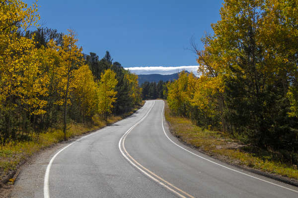
Colorado Springs Day 2 - Oct 1, 2019
On Tuesday we had a pretty easy schedule, go to the Garden of the Gods and go to the top of Pikes Peak. Luckily for us, the Garden of the Gods is an easy "hike", and by that, I mean that everything is paved and there's really no elevation change. The walk was a little over a mile and a half. The drive up to Pikes Peak was pretty fun. There were a lot of aspens on the side of the road that we stopped at on the way down from Pikes Peak. We decided not to hike to the top because neither one of us is nearly close enough in shape to hike a 14er. We did see the hiking trail and it looked brutal, so we're glad we drove instead.
Read More
| Location: | Garden of the Gods |
| Distance: | 1.65mi |
| Hiking Time: | 1 hour, 0 minute |
| Elevation Gain: | 300ft |
| Max Elevation: | 6,604ft |
View Hiking Stats

Fall Colors Hunt - Sep 30, 2019
Since Katie didn't have to work this week we decided to go on a little mini-vacation during the week up to Colorado Springs in hopes that we would find some fall colors. We packed as much of Colorado Springs as we could into the 2 days we were there including some of the touristy activities like going to the Manitou Cliff Dwellings and going to the Garden of the Gods. But mostly we picked that area for the scenic highway between Divide and Cripple Creek. There were several wonderful panoramic spots to see the fall colors, as well as some beautiful Aspen groves that we got up close to.
On Monday we went on a hike in Mueller State Park. We picked the Lost Pond hike which was short, just under 3 miles, and only 679ft of elevation gain. But since we were taking photos, it was an hour and a half long hike through the mountains. It ended up being a perfect place to shoot the aspens even though we were maybe a week too early for peak colors.
Read More
| Location: | Mueller State Park |
| Distance: | 2.92mi |
| Hiking Time: | 1 hour, 28 minutes |
| Elevation Gain: | 679ft |
| Max Elevation: | 9,839ft |
View Hiking Stats

Hanging Lake - Sep 14, 2019
With my house selling on Monday, I pushed to get everything moved and the house cleaned by Friday so I could enjoy the weekend in Glenwood. Katie was working up in Glenwood on an externship the previous week and the week after, so I figured it would be a great way for me to relax after weeks of stress from trying to get everything packed and moved. Even though it was extra stressful a few days before the weekend, the added stress was well worth the relaxing that I was able to do over the weekend knowing that everything was done and that I could start finally living normally again.
On Saturday, we decided to go hike Hanging Lake. The weather was in the upper 60's, so we figured we would be okay without jackets, but we neglected that we were hiking along a river and the breeze with the cool water next to us made it feel like upper 50's. I think if it was 5-10 degrees warmer, that would have been a perfect hike, but other than that, it was a lovely and spectacular hike. The hike was almost 5.5 miles, including the walk from where the bus dropped us off to where the trail actually started. The climb was just barely over 1,000ft in elevation gain and the whole hike took us a little over 2 hours including a 30 minute break at the top.
Read More
| Location: | Glenwood Springs |
| Distance: | 5.41mi |
| Hiking Time: | 2 hours, 6 minutes |
| Elevation Gain: | 1,007ft |
| Max Elevation: | 7,144ft |
View Hiking Stats

Lily Mountain - Aug 31, 2019
This weekend Brittany and Josh invited me to go hiking with them. It was a great idea, but a poorly executed one because it's labor day weekend. We go to the parking lot for the shuttle in Rocky Mountain National Park a little after 9 and it was just barely too late to get a parking spot. So we improvised and when to Lilly Mountain instead which is outside of the tool gate for the park and didn't have many tourists. I was surprised by how empty the hike was, but I'm not complaining!
Read More
| Location: | Rocky Mountain National Park |
| Distance: | 4.65mi |
| Hiking Time: | 2 hours, 46 minutes |
| Elevation Gain: | 1,870ft |
| Max Elevation: | 9,786ft |
View Hiking Stats

Devil's Backbone - Feb 3, 2019
The weather was great this weekend. Just looking at the temperatures, which were in the mid 50's, you wouldn't think that it's February. Since the mountains were not quite that nice, we decided to go on a quick hike at Devil's Backbone. We barely got a parking spot, but this hike started out great. Towards the half-way mark, it got pretty windy. The hike was 2.6 miles and took just under 1 hour.
Read More
| Location: | Devil's Backbone |
| Distance: | 3.59mi |
| Hiking Time: | 58 minutes |
| Elevation Gain: | 525ft |
| Max Elevation: | 6,049ft |
View Hiking Stats

Lilly Mountain - Jan 12, 2019
The weather in Rocky Mountain National Park was supposed to be calm, sunny, and in the mid 20's on Saturday, so we decided to go up into the mountains to enjoy the snow and use our snowshoes. Our Snowshoes were over a year old but had only been used once before back in March at Zimmerman Lake. Because of the Government shutdown, I did my due diligence by finding several local newspaper articles telling me that the park was open as well as calling the park to hear an automated message telling me that the park was open. So we headed up to Rocky Mountain National Park. The park was indeed open, but the roads were closed. With some recent snowfall, I guess there was no one to plow the roads, so we couldn't get to our original destination, Bear, Nymph, Dream, and Emerald Lake like we had done a few summers's ago.
With our plans spoiled, we didn't just want to go home. After all, we drove over an hour to get up here, so I started looking at the map to find some hiking trails that didn't require us to drive into the park. We headed to a trailhead that starts right next to the tallest mountain in Rocky Mountain National Park; Longs Peak. But instead of hiking South to get to Longs Peak, we headed North to go up Lilly Mountain.
Lilly Mountain has been on my list of hikes to do for a while, but only being 4 miles round trip, it's a little too easy for us to hike in mid-summer. However, being out of shape since we haven't hiked since September, this was a perfect January hike. There wasn't enough snow to use the snowshoes, but Katherine was able to use the new crampons that she got for Christmas. The hike started off easy, and after about a half-mile, we started descending. I thought it was a little weird but kept going on the path. About 3/4 of a mile into the hike, some fellow hikers told us that we weren't actually on the trail. So we tracked back until we found the correct trail and continued upward. We finally made it to a spot where we could see the summit, but the tracks in the snow became non-existent. So we made our own trail and climbed up the way that looked the best.
After 1 and a half hours, we summited. Several people followed us up the sketchy path that we made and completed their hike over the next 20 minutes that we were resting at the top. The hike ended up being 4.68 miles and took 2 and a half hours and almost 1600 feet of elevation gain. Had we stayed on the path, it would have been 4 miles round trip, and only 1200 feet of elevation gain. I guess that's what we get for hiking in the snow.
Read More
| Location: | Rocky Mountain National Park |
| Distance: | 4.68mi |
| Hiking Time: | 2 hours, 34 minutes |
| Elevation Gain: | 1,585ft |
| Max Elevation: | 9,846ft |
View Hiking Stats
2018

Arthur's Rock - Oct 28, 2018
The weather was supposed to be okay for a hike, although not nice enough to hike in Rocky Mountain National Park. We opted to go to Lory State Park while our Colorado State Parks pass was still valid. We had hiked Arthur's Rock in the past, so we knew what to expect.
The hike was 3.6 miles round trip and took a total time of 1 hour and 40 minutes. It had a total elevation gain of 1,100 feet.
Read More
| Location: | Lory State Park |
| Distance: | 3.6mi |
| Hiking Time: | 1 hour, 39 minutes |
| Elevation Gain: | 1,115ft |
| Max Elevation: | 6,719ft |
View Hiking Stats

Fern Lake - Sep 1, 2018
Not having hiked in several weeks due to emergency home renovation, we decided to do a pretty easy hike this weekend, Fern Lake. The hike seemed pretty easy on paper. There were several places we could hike to and turn around if we weren't up for going all the way to Fern Lake, and it was only supposed to be 1400 feet of elevation gain. The total hike ended up being 7.6 miles, 2,100 vertical feet, and took 3 hours and 40 minutes to complete. Since it was nearly a month since our last hike, this one was a little tough, but not too bad.
We had hiked on this trail before, just not this side of it. A few months ago when we made it to Odessa Lake, we were on the side of the trail that started at Bear Lake. We didn't realize it until a hiker asked us a question about the trail we came from and said he was on his way back from Odessa Lake. I guess the park isn't as big as we thought it was!
Read More
| Location: | Rocky Mountain National Park |
| Distance: | 7.64mi |
| Hiking Time: | 3 hours, 39 minutes |
| Elevation Gain: | 2,131ft |
| Max Elevation: | 9,648ft |
View Hiking Stats

Four 14'ers in One Day - Aug 4, 2018
Katherine, Will, and I decided to hike four 14'ers in one day. Are we crazy? Yes, definitely. But all four of them were in a row and not too difficult to get to. Democrat, Cameron, Lincoln, and Bross are the four we hiked. Technically, Cameron isn't a true 14'er because there isn't enough drop distance between the saddle between it and Lincoln, but I count it anyway because it is a peak and it is above 14,000 feet.
The hike was 7 and a quarter mile long with almost 4,000 feet in elevation gain. That's the most elevation gain Katherine and I have ever done in one hike by about 1,500 feet. We spent the night at Katherine's parent's house in Highlands ranch to get a little bit closer to the trailhead. Our morning started at 3:30 am waking up to drive to the trailhead where there were already a good 50 cars parked by 6:00 am. I was shocked at how many cars were there but you have to start a hike this early to get all 4 of them completed before the weather rolls in. We completed the hike around 12:30 and headed back home. It was a great hike that provided a lot of different scenery, but it was one of the most difficult hikes we've ever done.
Read More
| Location: | Fairplay, Colorado |
| Distance: | 7.23mi |
| Hiking Time: | 6 hours, 13 minutes |
| Elevation Gain: | 3,973ft |
| Max Elevation: | 14,303ft |
View Hiking Stats

Ypsilon Lake - Jul 29, 2018
The weather was looking pretty bad this weekend to go on a hike, which would have been 3 weekends in a row stuck at home due to bad weather. Luckily, on Saturday evening, the forecast cleared up for Sunday for us to go on a hike.
We picked Ypsilon Lake, which was a 9-mile round trip hike in the Mummy Range which had about 2600 feet of elevation gain. The hike was pretty killer compared to similar hikes we've done with similar altitude gain and distance. We made it to the lake in just under 2 hours and returned to the car 4 hours and 22 minutes after we started the hike.
The weirdest part of this hike was the people heading up when we were heading back down. The weather may have cleared up in the morning, but rain was still forecasted in the early afternoon. The clouds were rolling over the mountains and it was starting to get pretty windy. I suspect that the rain started within the next 2 hours. On a hike that took us over 4 hours, I'm sure some of those people got wet. Additionally, there were several groups of tourists attempting this hike without any water at all.
Read More
| Location: | Rocky Mountain National Park |
| Distance: | 8.86mi |
| Hiking Time: | 4 hours, 21 minutes |
| Elevation Gain: | 2,595ft |
| Max Elevation: | 10,507ft |
View Hiking Stats
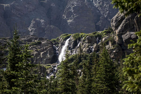
The Loch & Timberline Falls - Jul 7, 2018
It's another weekend and we went on another hike, big surprise! This time we decided to make it to The Loch, a lake that is 3 miles from the start of the Glacier Gorge Trailhead. We figured once we were there we could decide to go on to Timberline falls and then maybe make it to Sky Pond. We ended up making it to the lake and it looked oddly familiar. It turns out that we hiked to The Loch last year and thought we were at Mills Lake. Because of all the snow when we went last year, all the signs were covered and we must have taken a wrong turn. Since we had already made it to The Loch before, we had to go on, so we trecked another mile and another 600 vertical feet to Timberline Falls.
Timberline Falls is by far my favorite waterfall in Colorado that I've been to. The waterfall was visible from The Loch, as well as about a quarter-mile from the destination. It was nice being able to see the thing you're hiking to. The other thing that made the waterfall magnificent was that it was up on a giant hill in front of a massive meadow.
We hiked on, passing Glass Lake and finally arriving at Sky Pond about 3/4 of a mile from Timberline Falls. In total, the hike took us a little over 4 hours and 30 minutes, which was a lengthy 9-mile hike with a little over 2,000 feet of elevation gain. Surprisingly, this hike seemed significantly easier than the hike last week, which was just a little over 9-miles but had about 500 feet more of elevation gain. I guess more than 2,000 feet of elevation gain is killer.
Read More
| Location: | Rocky Mountain National Park |
| Distance: | 9mi |
| Hiking Time: | 4 hours, 32 minutes |
| Elevation Gain: | 2,069ft |
| Max Elevation: | 10,245ft |
View Hiking Stats

Odessa Lake and Lake Helene - Jul 1, 2018
For whatever reason, we thought it would be a great idea to go up into Rocky Mountain National Park on the weekend before the 4th of July. If that's not bad enough, we decided to start our hike in the most popular area, Bear Lake. But we did it, and it was packed in the morning. It took about 20 minutes for us to get through the entrance and buy our annual pass. We got into the park around 8 am, parked, took the shuttle to Bear Lake Trailhead, and started our hike a little after 9 am. Once we took our first turn off the path from Bear Lake, the number of people significantly decreased, and it was back to just us and nature.
Our original goal was to make it to Lake Helene with the intent on hiking down the gorge to Odessa Lake. We brought enough food that we could eat lunch at one of the lakes, and since we got to Lake Helene around 11, we thought we would hike the extra 1.2 miles down to Odessa Lake for our lunch break. We ended up getting a little lost trying to get back on the trail to head to Odessa Lake, but we ended up finding an amazing overlook of the gorge including both lakes and Notchtop Mountain, so getting lost worked out in our favor.
The hike took us a total of 4 hours, 47 minutes and we hiked a total distance of 9.48 miles with a strenuous 2524 feet of elevation gain.
Read More
| Location: | Rocky Mountain National Park |
| Distance: | 9.48mi |
| Hiking Time: | 4 hours, 47 minutes |
| Elevation Gain: | 2,524ft |
| Max Elevation: | 10,477ft |
View Hiking Stats

Chasm Falls - Jun 10, 2018
Today we hiked up Chasm Falls via Old Fall River Road. We started at the Alluvial Fan Trailhead, walked along the paved road to get to the start of Old Fall River Road, and then walked on the dirt road up to Chasm Falls.
Katie didn't enjoy the first part of the hike, where we walked along the paved road, but as soon as we got onto the vehicle prohibited dirt road, it started to feel a little more like a hike. The views of the falls were spectacular, and we were the only ones up there when we arrived, so that was great! It's a very touristy location, so I'm glad we got to go before the road was open to traffic for the tourist that want to park right next to the falls.
The hike took a little over 2 hours and was 4.8miles road trip with 515 feet of elevation gain. All of that is approximated because I forgot my GPS on this hike, but that's close enough to being accurate for me.
Read More
| Location: | Rocky Mountain National Park |
| Distance: | 4.8mi |
| Hiking Time: | 2 hours, 0 minute |
| Elevation Gain: | 515ft |
| Max Elevation: | 9,088ft |
View Hiking Stats

Gem Lake and Balanced Rock - Jun 2, 2018
We decided that it was time to drive up to Rocky Mountain National Park for our first hike of the season in the real mountains. I picked out a relatively easy, 3.4 mile round trip out-and-back hike to Gem Lake with the intent that we would go all the way to balance rock if we were up to the challenge. Balance rock is 2 miles from Gem Lake once you're there. We woke up a little late thinking that we needed to wait until late morning so it would be a little warmer, but by the time we got there (9:30), it was already in the mid 60's and we were thinking we were in for a hot hike. The temperature never got past about 70 degrees though, and there was always a constant breeze, so it was really nice!
We got to Gem lake 50 minutes into the hike. It was only 956 feet of elevation gain and 1.7 miles to get there, so we ate a quick snack, took some photos, and headed on to Balance Rock. We got to Balance rock an hour later with a total distance of 3.94 miles since the start of our hike. Balance rock is almost at the same elevation as Gem lake, but the trail dipped down some 400 feet in elevation and then back up another 400 feet. That part of the hike really wasn't that difficult. When we got to Balance Rock, we had ascended a total of 1390 feet.
The hike took us a total of 3 hours, 35 minutes. It was 7.91 miles total with 1992 feet of elevation gain.
Read More
| Location: | Rocky Mountain National Park |
| Distance: | 7.91mi |
| Hiking Time: | 3 hours, 35 minutes |
| Elevation Gain: | 1,992ft |
| Max Elevation: | 8,591ft |
View Hiking Stats

Mount Sanitas Hike - May 27, 2018
We decided to start our first real hike of the season this weekend. We're a little late to the game in starting our hiking since it's been so nice out the past several weekends. But none the less, we started off the season hiking up Mount Sanitas. We did the Mount Sanitas Loop Trail, which is a 3.1-mile round trip loop that takes you up to the top of Mount Sanitas.
Since we couldn't park in the actual parking lot for Mount Sanitas Trailhead, our hike started on the street about a quarter-mile away. The total distance was 3.54 miles, 1280 feet of elevation gain, and took us 2 hours and 9 minutes (including a 20 minute rest at the top).
Read More
| Location: | Boulder |
| Distance: | 3.54mi |
| Hiking Time: | 2 hours, 9 minutes |
| Elevation Gain: | 1,280ft |
| Max Elevation: | 6,843ft |
View Hiking Stats

Lory State Park - May 6, 2018
Katherine and I decided to go to Lory State Park and hike around a little bit. We decided to do the easy Shoreline trail hike. It was a 1.83 mile round trip hike with 300 feet of elevation gain. Hardly a hike, but it took us 47 minutes. After that, we went on the waterfall trail. The distance published for that trail is 0.1 miles, so it's really just a park and see the waterfall type "hike".
Read More
| Location: | Lory State Park |
| Distance: | 1.83mi |
| Hiking Time: | 47 minutes |
| Elevation Gain: | 300ft |
| Max Elevation: | 5,912ft |
View Hiking Stats

Snowshoeing Zimmerman Lake - Mar 3, 2018
For Christmas, I bought Katherine some snowshoes. I didn't have a pair either, so also for Christmas, I bought her a pair of snowshoes for me (lucky me). Every weekend since then we've talked about snowshoeing but have never gone until today. We picked out a spot in Rocky Mountain National Park that's only a little over an hour drive away. But before we left, I checked the Rocky Mountain National Park cameras at the entrance we usually drive into the park at and found no snow. It's the middle of winter and the Eastern side of Rocky Mountain National Park doesn't have enough snow for snowshoeing. I did find some cameras that told us to drive to the Western side of Rocky Mountain National Park (an extra hour) if we wanted to snowshoe.
Not really wanting to drive that far, I started thinking... A few years ago I went snowshoeing with Colorado State University. I started looking back through my blog and found a snowshoeing trip to Zimmerman Lake in 2012. It looked to be about the same distance West as where we would have to go in Rocky Mountain National Park, and it was just under 2 hours away, so I figured that would be our destination.
We started driving towards Poudre Canyon a little after 11 am. It was 65 degrees outside and only a few little patches of snow were lingering in the shade. We figured that there had to be snow that high in altitude (around 10,000 feet) so we kept driving. First, 1 hour passed by, then an hour and a half, and still very little snow with less than 30 minutes to our destination. We were getting concerned that we were going to go mudding and not snowshoeing! About 5 miles from the parking lot, the amount of snow on the side of the road and ground started to pick up. Maybe there's some hope after all... We got to the parking lot, got out of the car, and there was enough snow to snowshoe!
We got dressed and put on our snowshoes and started on the 2.7-mile round trip loop that takes you out to and around Zimmerman lake. We soon realized we were way overdressed. It was in the low 40's outside and we had all our winter gear on. We quickly unzipped our coats and felt the breeze cool us down (which was ironic because we decided not to go snowshoeing all the previous weekends because of the high wind gusts, and this weekends expected wind was no different).
The 867 vertical feet in elevation gain doesn't sound like much, but it was killer. Summer Noah and Katie would have laughed at our performance for this hike with how many times we had to stop and catch our breath, but we have to start somewhere for the hiking season. At least we had (what I would consider) a respectable time of an hour and a half for the entire 2.7 miles round trip.
Read More
| Location: | Poudre |
| Distance: | 2.7mi |
| Hiking Time: | 1 hour, 30 minutes |
| Elevation Gain: | 867ft |
| Max Elevation: | 10,897ft |
View Hiking Stats
2017

Horsetooth Hike in November - Nov 26, 2017
It's a little crazy, but we went on a hike at the end of November when the weather should be cold and snowy. The thing is, that it wasn't. We've had several days of wonderful weather lately, and I'm not complaining. I've been able to work outside in the garage (with the garage doors open for the extra light), go outside without a jacket, let alone a coat, and go on hikes.
Katherine and I picked Horsetooth for a few reasons, we knew the temperature on the hike would be pretty close to the temperature in the city, we knew it wouldn't be snowy (like Rocky Mountain National Park surely is), and we hadn't hiked Horsetooth in a little while.
The round trip hike was exactly 5 miles and took us 2 hours and 52 minutes, including the 30-minute long lounge we had at the summit. The hike had a total elevation gain of 1,555 feet.
Read More
| Location: | Fort Collins |
| Distance: | 5mi |
| Hiking Time: | 2 hours, 53 minutes |
| Elevation Gain: | 1,555ft |
| Max Elevation: | 7,256ft |
View Hiking Stats

Bridal Veil Falls - Aug 27, 2017
Once again, Katherine and I ventured into Rocky Mountain National Park to do some hiking. We picked a less popular hike, although it was still very rewarding with the views when we reached our destination. The hike started at the Cow Creek Trailhead. The trailhead was right next to the McGraw Ranch, which is owned by the National Parks Service. What used to be a dude ranch in the early 1900's is now a research facility.
The hike was really nice, the first half of it was hiking through a meadow with lots of wild flowers, the second part of the hike was through trees and more meadows. The trail followed along side the Cow Creek, and we were on the northern side of Lumpy Ridge.
The hike was 6.3 miles round trip and took 3 hours and 19 minutes, including about 45 minutes that we were stopped at Bridal Viel Falls. It took an hour and 15 minutes to get to the falls, and the same amount of time to hike back out to the car. Total elevation gain was 1175 feet.
Read More
| Location: | Rocky Mountain National Park |
| Distance: | 6.3mi |
| Hiking Time: | 3 hours, 19 minutes |
| Elevation Gain: | 1,175ft |
| Max Elevation: | 8,815ft |
View Hiking Stats

Mt. Sherman @ 14,036 ft. - Aug 19, 2017
We decided to do our first 14'er together. Katherine's parents wanted to do a 14'er, so we tagged along. This was my first 14'er, and Katherine has done a few other ones with her parents before. Despite Mount Sherman being the easiest 14'er in Colorado, it was treacherous. It may have only been 2.5 miles from the start to the top, but it had 2100 feet of elevation gain that just killed our legs and exhausted our lungs the whole way up. In addition, our day started at 3:30 am to make it to the trailhead by 6:30 am. Aside from that, it was a really nice hike. The hike started at the Fourmile Creek Trailhead, located just outside of Fairplay. For the first half of the hike, we hiked along the old mining roads which still had old mining equipment and buildings scattered along the road. The other half of the hike started at the saddle in between Mount Sheridan and Mount Sherman. From there, we hiked along the gusty ridge that had steep drop-offs on either side. We're lucky we didn't get blown off the ridge!
Katherine and I made it to the summit in just over 2 hours. Katherine's parents meet us at the summit about a half hour later and we all relaxed at the top together for a half hour. It took an additional 2 hours to get down from the mountain. Because of the steep grade and the extremely loose footing, you had to take extra time not to fall off the side of the ridge. This was extremely difficult on the way down.
Read More
| Location: | Fairplay, Colorado |
| Distance: | 2.5mi |
| Hiking Time: | 4 hours, 30 minutes |
| Elevation Gain: | 2,100ft |
| Max Elevation: | 14,036ft |
View Hiking Stats

Bear, Nymph, Dream, and Emerald Lake - Aug 12, 2017
Today we headed into Rocky Mountain National Park again for the 4th time this summer. We decided to do the most popular hike in all of Rocky Mountain National Park; the hike to Emerald Lake. It starts at the Bear Lake trailhead, and you pass two other lakes along the way (Nymph Lake and Dream Lake). On our way back, we stopped by Bear Lake (since it's 250 feet from the trail head). Of all the four lakes we hiked to, Nymph Lake was our favorite because of the wild Lillies floating in the water. The weather was pretty good, upper 60's, but it was pretty windy at the lakes.
The the whole hike was a little over 3.5 miles long and a little over 1,000 feet of elevation gain. The lakes were spaced out about a half-mile from each other, so it didn't take very long to get to the last lake. Total hiking time was 2 hours and 22 minutes from start to finish.
Read More
| Location: | Rocky Mountain National Park |
| Distance: | 3.5mi |
| Hiking Time: | 2 hours, 22 minutes |
| Elevation Gain: | 1,000ft |
| Max Elevation: | 10,475ft |
View Hiking Stats
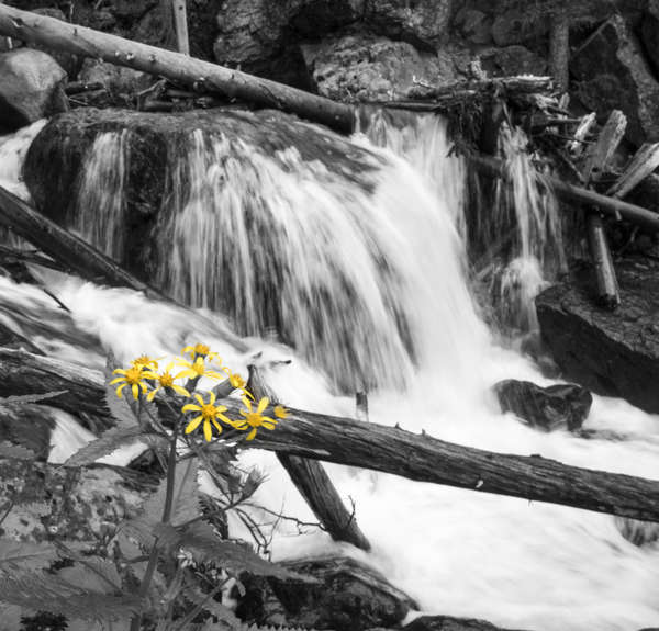
Ouzel Falls - Aug 5, 2017
Katherine and I went up into Allenspark up to the Wild Basin Trailhead in Rocky Mountain National Park. The entrance to the park was right by the venue that my sister got married at a few years ago, so that was a nice memento since just a few weeks ago was their two year anniversary. That was the first time we had gone back to Allenspark since the wedding, so it was nice to hike in an area that we typically don't go to very often.When we got to the trailhead, we got the very last parking spot and started heading to the falls. About 1/8 mile into the hike I stopped, checked my camera and realized I left my SD card in the car, so I had to go back. Good thing I remembered and good thing I caught it before we got to the first photo opportunity!
The hike took us a total of 2 hours and 46 minutes. We were actually moving for an hour and 36 minutes, so it was a pretty relaxing hike with frequent stops for photos! The round trip distance (including my 1/8 mile out and then back to the car for an SD card) was 5.73 miles, with a total elevation gain of 1070 feet.
Read More
| Location: | Allenspark |
| Distance: | 5.73mi |
| Hiking Time: | 2 hours, 46 minutes |
| Elevation Gain: | 1,070ft |
| Max Elevation: | 8,670ft |
View Hiking Stats

Coyote Ridge - Jul 8, 2017
Katherine and I made a quick hike up Coyote Ridge. We didn't want to do anything too strenuous, so this is what we came up with. The hike took us an hour and 45 minutes and was a total of 4.2 miles. The elevation gain was only 581 feet, so it wasn't that difficult of a hike.
Read More
| Location: | Fort Collins |
| Distance: | 4.2mi |
| Hiking Time: | 1 hour, 46 minutes |
| Elevation Gain: | 581ft |
| Max Elevation: | 5,853ft |
View Hiking Stats

Mount Ida @ 12,888 ft. - Jul 2, 2017
Katherine and I made it into Rocky Mountain National Park for a hike in some altitude. We have been talking about doing a 14'er sometime this summer, so we thought we would try a hike that started at a pretty high altitude with good altitude gain. Our original intent was to make it to peak 12,150, which is about a mile and a half from the summit of Mount Ida. There was only one turn off on the entire hike to go to Peak 12,150, and we missed it. We knew we missed it after the fact, so we decided to summit Mount Ida instead. The hike started at an elevation of 10,759 Ft. on the Continental Divide at Milner Pass. From there we hiked South of the Continental Divide towards the Pacific Ocean. We summited at Mount Ida 4.6 miles later at an elevation of 12,888 Ft.
The total elevation gain (there and back) was 2,496 Ft., which is much more than we have done in any other hike. We didn't spend much time at the summit because some clouds were rolling in. We wanted to make it below the tree level before any serious weather hit. Luckily, we made it all the way back to the car without getting any rain, but by the time we were half-way down the mountain, the summit was getting pounded with rain. We heard thunder a few times on the hike back, but never saw lightning. We saw several people hiking up while we were hiking down which we both thought was stupid. One person even asked us if the storm had passed the summit, in which Katherine and I both thought the person was an idiot for knowingly hiking into a storm.
Overall, it was a difficult hike that neither Katherine or I was prepared for. The 9.3-mile round trip hike took a total of 4 hours, 45 minutes. We were moving for just under 3 hours of that time.
Read More
| Location: | Rocky Mountain National Park |
| Distance: | 9.3mi |
| Hiking Time: | 4 hours, 45 minutes |
| Elevation Gain: | 2,496ft |
| Max Elevation: | 12,888ft |
View Hiking Stats

Gregory Canyon and Flagstaff Mountain - Jun 17, 2017
Katherine and I decided to drive into Boulder for a hike this weekend. Katherine just bought some new hiking boots (so she wouldn't roll her ankle) so we decided to test them out! The hike took up about 2 and a half hours and was a total round trip distance of 4 miles. On the 2 mile journey up, it was 1155 ft of elevation gain. We started down near Chautauqua Park and hiked to the realization point.
Read More
| Location: | Boulder |
| Distance: | 4mi |
| Hiking Time: | 2 hours, 30 minutes |
| Elevation Gain: | 1,155ft |
| Max Elevation: | 7,017ft |
View Hiking Stats

Alberta Falls - Jun 10, 2017
Katherine and I drove up to Rock Mountain National Park. It's only about an hour from our house, so we bought an annual membership. We hiked up to Alberta Falls and on to Mills Lake. The total round trip distance was 5.33 miles, and it was a total elevation gain of 1450ft. It took us just under 3 and a half hours, stopping frequently for photos. Our moving time was actually just over an hour of that 3 and a half hour journey.
Edit July 7, 2018
Katherine and I were looking at the hikes we haven't done and found that we wanted to go to The Loch, a lake that is the opposite direction of Mills Lake once you've hiked about 2 miles in. Turns out, on the hike for these photos, we actually ended up at The Loch Lake instead of Mills Lake like we originally thought. The reason (most likely) is due to the snow when we went in 2017 - the snow was covering some of the trail signs and we had to do some guessing. Anyway, this photo album is of Alberta Falls and The Loch Lake.
Read More
| Location: | Rocky Mountain National Park |
| Distance: | 5.33mi |
| Hiking Time: | 3 hours, 30 minutes |
| Elevation Gain: | 1,450ft |
| Max Elevation: | 10,672ft |
View Hiking Stats

Coyote Ridge - May 13, 2017
Katherine and I decided to go see what Coyote Ridge was like this Saturday. The weather was in the mid 70's and we didn't want to go far for a morning hike. Overall, it was a great hike! We didn't make it all the way to the top because Katherine's ankle is still sore from the Mallory Cave hike we did 4 weeks ago! That's okay though, it was a really nice hike and it was fun to get out of the house.
Read More
| Location: | Fort Collins |
| Distance: | 4.12mi |
| Hiking Time: | 2 hours, 0 minute |
| Elevation Gain: | 0ft |
| Max Elevation: | 0ft |
View Hiking Stats
Mallory Cave Hike - Apr 16, 2017
Katherine and I went into Boulder for a hike up at NCAR. We picked out the Mallory Caves hike. The caves were closed for the season, but it was still a great hike. The last 100 vertical feet were almost straight up (seriously, I'm surprised the city of Boulder doesn't close that part of the trail). It was a nice afternoon hike!
Read More
| Location: | Boulder |
| Distance: | 5mi |
| Hiking Time: | 2 hours, 0 minute |
| Elevation Gain: | 0ft |
| Max Elevation: | 0ft |
View Hiking Stats